Property Record
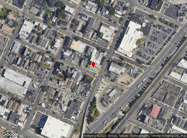
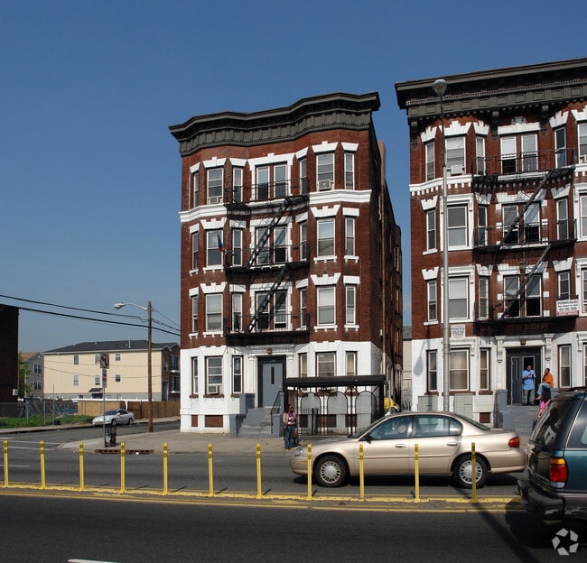
1205 Broad St, Newark, NJ 07114


NEARBY LISTINGS FOR SALE OR LEASE
Property Detail
1205 Broad St
Newark, NJ-PA
35X100
14-02806-0000-00024
Essex
Commercialnec
New Jersey
X
24
34013C0156F
0.08 AC
2023
South Broad Street
2025
Northern New Jersey
980200
DEMOGRAPHICS near 1205 Broad St
1 Mile
3 Mile
5 Mile
2024 Total Population
40,456
317,327
801,370
2029 Population
39,316
306,881
775,437
Pop Growth 2024-2029
(2.82%)
(3.29%)
(3.24%)
Average Age
36
36
38
2024 Total Households
15,850
114,797
288,325
HH Growth 2024-2029
(2.73%)
(3.33%)
(3.33%)
Median Household Inc
$35,795
$45,058
$56,007
Avg Household Size
2.40
2.60
2.60
2024 Avg HH Vehicles
1.00
1.00
1.00
Median Home Value
$312,500
$293,987
$352,976
Median Year Built
1980
1965
1959
Nearby Places
Map Layers
Map Styles
 Street
 Aerial
- Restaurants
- Banks
- Shops
- Fitness
- Groceries
PUBLIC TRANSPORTATION
COMMUTER RAIL
Newark Penn Station (Newark Penn Station-World Trade Center - Port Authority Trans-Hudson (PATH))
DRIVE
WALK
Distance
Newark Penn Station (Newark Penn Station-World Trade Center - Port Authority Trans-Hudson (PATH))
5 min
1.7 mi
Newark Airport (North Jersey Coast Line - NJ Transit Commuter Rail (NJ Transit), Northeast Corridor Line - NJ Transit Commuter Rail (NJ Transit))
DRIVE
WALK
Distance
Newark Airport (North Jersey Coast Line - NJ Transit Commuter Rail (NJ Transit), Northeast Corridor Line - NJ Transit Commuter Rail (NJ Transit))
6 min
2.2 mi
AIRPORT
Newark Liberty International
DRIVE
WALK
Distance
Newark Liberty International
6 min
3.9 mi
LaGuardia
DRIVE
WALK
Distance
LaGuardia
40 min
23.2 mi
John F Kennedy International
DRIVE
WALK
Distance
John F Kennedy International
50 min
31.4 mi
Freight Ports
Maher Terminal
DRIVE
WALK
Distance
Maher Terminal
11 min
4.5 mi
Nearby Properties
Address
Land Use
TOTAL SIZE
Lot Size
Zoning
Address
Land Use
TOTAL SIZE
Lot Size
Zoning
961.13 AC
Address
Land Use
TOTAL SIZE
Lot Size
Zoning
789.45 AC
Address
Land Use
TOTAL SIZE
Lot Size
Zoning
0.57 AC
Address
Land Use
TOTAL SIZE
Lot Size
Zoning
0.45 AC
Address
Land Use
TOTAL SIZE
Lot Size
Zoning
Address
Land Use
TOTAL SIZE
Lot Size
Zoning
0.61 AC
Address
Land Use
TOTAL SIZE
Lot Size
Zoning
31.86 AC
Address
Land Use
TOTAL SIZE
Lot Size
Zoning
Address
Land Use
TOTAL SIZE
Lot Size
Zoning
98.48 AC
Address
Land Use
TOTAL SIZE
Lot Size
Zoning
877 SF
7.25 AC
Address
Land Use
TOTAL SIZE
Lot Size
Zoning
1,136 SF
6.51 AC
Address
Land Use
TOTAL SIZE
Lot Size
Zoning
4.51 AC
Address
Land Use
TOTAL SIZE
Lot Size
Zoning
683 SF
9.59 AC
Address
Land Use
TOTAL SIZE
Lot Size
Zoning
19.03 AC
Address
Land Use
TOTAL SIZE
Lot Size
Zoning
2.01 AC
Address
Land Use
TOTAL SIZE
Lot Size
Zoning
3.42 AC
Address
Land Use
TOTAL SIZE
Lot Size
Zoning
320 SF
1.25 AC
Address
Land Use
TOTAL SIZE
Lot Size
Zoning
710 SF
39.32 AC
Address
Land Use
TOTAL SIZE
Lot Size
Zoning
9.77 AC
Address
Land Use
TOTAL SIZE
Lot Size
Zoning
877 SF
0.91 AC
Address
Land Use
TOTAL SIZE
Lot Size
Zoning
1.64 AC
Address
Land Use
TOTAL SIZE
Lot Size
Zoning
Address
Land Use
TOTAL SIZE
Lot Size
Zoning
1.63 AC
Address
Land Use
TOTAL SIZE
Lot Size
Zoning
Address
Land Use
TOTAL SIZE
Lot Size
Zoning
2.79 AC
Address
Land Use
TOTAL SIZE
Lot Size
Zoning
4.82 AC
Address
Land Use
TOTAL SIZE
Lot Size
Zoning
0.13 AC
Address
Land Use
TOTAL SIZE
Lot Size
Zoning
1,264 SF
3.20 AC
Address
Land Use
TOTAL SIZE
Lot Size
Zoning
Address
Land Use
TOTAL SIZE
Lot Size
Zoning
0.06 AC
The World's #1 Commercial Real Estate Marketplace
Connect with us
© 2025 CoStar Group
The information above has been obtained from sources believed reliable. While we do not doubt its accuracy we have not verified it and make no guarantee, warranty or representation about it. It is your responsibility to independently confirm its accuracy and completeness. Any projections, opinions, assumptions, or estimates used are for example only and do not represent the current or future performance of the property. The value of this transaction to you depends on tax and other factors which should be evaluated by your tax, financial, and legal advisors. You and your advisors should conduct a careful, independent investigation of the property to determine to your satisfaction the suitability of the property for your needs.