Property Record
1205 Fm 780, Ferris, TX 75125

Save to a Folder
{{folder.Name}}
{{folder.ListingIds.length}} Properties
{{folder.ListingIds.length}} Property
Create a New Folder
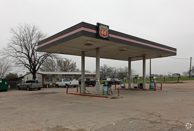
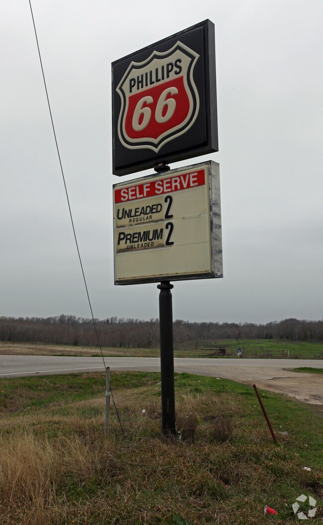
Property Detail
1205 Fm 780
Dallas-Fort Worth-Arlington, TX
LOT 18-19 BLK 1 CARRIAGE HILL ESTS #1 1.645 AC
148621
Ellis
Commercialnec
Texas
B and X Area of moderate flood hazard, usually the area between the limits of the 100-year and 500-year floods.
18-19
2024
1.65 AC
2025
Southeast Outlying
060104
Dallas/Ft Worth
8,544 SF
NEARBY LISTINGS FOR SALE OR LEASE
-
-
View all Ferris listings for sale on LoopNet.com
DEMOGRAPHICS near 1205 Fm 780
1 mile
3 mile
5 mile
2025 Total Population
875
6,195
10,669
2030 Population
1,022
7,236
12,403
Pop Growth 2025-2030
+ 16.80%
+ 16.80%
+ 16.25%
Average Age
38
38
37
2025 Total Households
292
2,059
3,489
HH Growth 2025-2030
+ 16.78%
+ 16.95%
+ 16.39%
Median Household Inc
$85,137
$75,435
$70,588
Avg Household Size
3.00
3.00
3.10
2025 Avg HH Vehicles
2.00
2.00
2.00
Median Home Value
$238,607
$230,319
$229,885
Median Year Built
1997
1991
1995
Nearby Places
Map Layers
Map Styles
 Street
 Aerial
Layers
 Traffic
 Biking
Places
Listings with unknown addresses are not visible on the map
- Restaurants
- Banks
- Shops
- Fitness
- Groceries
PUBLIC TRANSPORTATION
AIRPORT
Dallas Love Field
Drive
Walk
Distance
Dallas Love Field
39 min
27.5 mi
Freight Ports
Port of Shreveport
Drive
Walk
Distance
Port of Shreveport
219 min
203.4 mi
Nearby Properties
Address
Land Use
TOTAL SIZE
Lot Size
Zoning
Address
Land Use
TOTAL SIZE
Lot Size
Zoning
62.41 AC
Z31
Address
Land Use
TOTAL SIZE
Lot Size
Zoning
266,199 SF
33.27 AC
Address
Land Use
TOTAL SIZE
Lot Size
Zoning
89,387 SF
29.86 AC
Address
Land Use
TOTAL SIZE
Lot Size
Zoning
12,444 SF
5 AC
Address
Land Use
TOTAL SIZE
Lot Size
Zoning
116,081 SF
19.03 AC
Address
Land Use
TOTAL SIZE
Lot Size
Zoning
56,023 SF
7.52 AC
Address
Land Use
TOTAL SIZE
Lot Size
Zoning
70,799 SF
15.41 AC
Address
Land Use
TOTAL SIZE
Lot Size
Zoning
25,780 SF
100.30 AC
Z05
Address
Land Use
TOTAL SIZE
Lot Size
Zoning
22,736 SF
9.03 AC
Address
Land Use
TOTAL SIZE
Lot Size
Zoning
49,320 SF
25.10 AC
Address
Land Use
TOTAL SIZE
Lot Size
Zoning
15,000 SF
133.63 AC
Address
Land Use
TOTAL SIZE
Lot Size
Zoning
4,820.86 AC
Address
Land Use
TOTAL SIZE
Lot Size
Zoning
26,779 SF
11.29 AC
Address
Land Use
TOTAL SIZE
Lot Size
Zoning
17,175 SF
30.59 AC
Address
Land Use
TOTAL SIZE
Lot Size
Zoning
7,884 SF
1.15 AC
Address
Land Use
TOTAL SIZE
Lot Size
Zoning
1,214 SF
280.11 AC
Address
Land Use
TOTAL SIZE
Lot Size
Zoning
17,030 SF
1.08 AC
Address
Land Use
TOTAL SIZE
Lot Size
Zoning
10,430 SF
1.71 AC
Address
Land Use
TOTAL SIZE
Lot Size
Zoning
27,850 SF
0.72 AC
Address
Land Use
TOTAL SIZE
Lot Size
Zoning
9,360 SF
1.25 AC
Address
Land Use
TOTAL SIZE
Lot Size
Zoning
11,386 SF
3.23 AC
Address
Land Use
TOTAL SIZE
Lot Size
Zoning
8,125 SF
0.86 AC
Address
Land Use
TOTAL SIZE
Lot Size
Zoning
93,525 SF
5.47 AC
Address
Land Use
TOTAL SIZE
Lot Size
Zoning
51,664 SF
5.06 AC
Address
Land Use
TOTAL SIZE
Lot Size
Zoning
49.48 AC
Address
Land Use
TOTAL SIZE
Lot Size
Zoning
Address
Land Use
TOTAL SIZE
Lot Size
Zoning
2,464 SF
0.87 AC
Address
Land Use
TOTAL SIZE
Lot Size
Zoning
17,920 SF
1.06 AC
Address
Land Use
TOTAL SIZE
Lot Size
Zoning
4,256 SF
242.63 AC
The World's #1 Commercial Real Estate Marketplace
Connect with us
© 2026 CoStar Group
The information above has been obtained from sources believed reliable. While we do not doubt its accuracy we have not verified it and make no guarantee, warranty or representation about it. It is your responsibility to independently confirm its accuracy and completeness. Any projections, opinions, assumptions, or estimates used are for example only and do not represent the current or future performance of the property. The value of this transaction to you depends on tax and other factors which should be evaluated by your tax, financial, and legal advisors. You and your advisors should conduct a careful, independent investigation of the property to determine to your satisfaction the suitability of the property for your needs.