Property Record
1205 N Ankeny Blvd, Ankeny, IA 50023


NEARBY LISTINGS FOR SALE OR LEASE
Property Detail
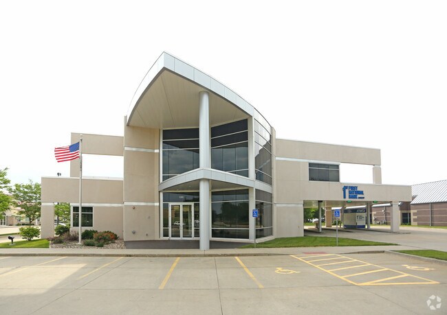
1205 N Ankeny Blvd
Des Moines-West Des Moines, IA
Highway 69 Plat 1
181-00424991004
PARCEL A BK 11499 PG 349 LOT 2 HIGHWAY 69 PLAT 1
Financialbuilding
Polk
X
Iowa
19153C0205F
2
2024
1.67 AC
2025
Ankeny
010209
Des Moines
12,799 SF
DEMOGRAPHICS near 1205 N Ankeny Blvd
1 Mile
3 Mile
5 Mile
2024 Total Population
10,837
62,824
81,786
2029 Population
11,231
66,117
85,972
Pop Growth 2024-2029
+ 3.64%
+ 5.24%
+ 5.12%
Average Age
38
37
37
2024 Total Households
4,477
24,798
31,653
HH Growth 2024-2029
+ 3.82%
+ 5.40%
+ 5.29%
Median Household Inc
$85,223
$91,005
$94,253
Avg Household Size
2.40
2.50
2.50
2024 Avg HH Vehicles
2.00
2.00
2.00
Median Home Value
$256,620
$277,326
$285,591
Median Year Built
1993
2004
2005
Nearby Places
Map Layers
Map Styles
 Street
 Aerial
- Restaurants
- Banks
- Shops
- Fitness
- Groceries
PUBLIC TRANSPORTATION
AIRPORT
Des Moines International
DRIVE
WALK
Distance
Des Moines International
32 min
18.0 mi
Freight Ports
Port Milwaukee
DRIVE
WALK
Distance
Port Milwaukee
419 min
375.7 mi
Nearby Properties
Address
Land Use
TOTAL SIZE
Lot Size
Zoning
Address
Land Use
TOTAL SIZE
Lot Size
Zoning
2,732,552 SF
443.35 AC
Address
Land Use
TOTAL SIZE
Lot Size
Zoning
519,216 SF
42.20 AC
Address
Land Use
TOTAL SIZE
Lot Size
Zoning
272,072 SF
11.70 AC
Address
Land Use
TOTAL SIZE
Lot Size
Zoning
210,696 SF
6.57 AC
Address
Land Use
TOTAL SIZE
Lot Size
Zoning
644,942 SF
60.73 AC
M-1
Address
Land Use
TOTAL SIZE
Lot Size
Zoning
100,751 SF
12.67 AC
C-2
Address
Land Use
TOTAL SIZE
Lot Size
Zoning
192,668 SF
20.73 AC
Address
Land Use
TOTAL SIZE
Lot Size
Zoning
254,801 SF
20.05 AC
Address
Land Use
TOTAL SIZE
Lot Size
Zoning
140,045 SF
9.29 AC
Address
Land Use
TOTAL SIZE
Lot Size
Zoning
48,839 SF
16.05 AC
Address
Land Use
TOTAL SIZE
Lot Size
Zoning
143,249 SF
7.19 AC
Address
Land Use
TOTAL SIZE
Lot Size
Zoning
143,012 SF
1.75 AC
Address
Land Use
TOTAL SIZE
Lot Size
Zoning
170,692 SF
6.54 AC
Address
Land Use
TOTAL SIZE
Lot Size
Zoning
96,344 SF
13.39 AC
PUD
Address
Land Use
TOTAL SIZE
Lot Size
Zoning
63,664 SF
9.02 AC
Address
Land Use
TOTAL SIZE
Lot Size
Zoning
175,424 SF
8.01 AC
Address
Land Use
TOTAL SIZE
Lot Size
Zoning
162,384 SF
11.16 AC
R-3
Address
Land Use
TOTAL SIZE
Lot Size
Zoning
211,986 SF
20.98 AC
Address
Land Use
TOTAL SIZE
Lot Size
Zoning
144,992 SF
6.03 AC
Address
Land Use
TOTAL SIZE
Lot Size
Zoning
174,602 SF
15.47 AC
Address
Land Use
TOTAL SIZE
Lot Size
Zoning
150,733 SF
18.57 AC
M-1
Address
Land Use
TOTAL SIZE
Lot Size
Zoning
51,004 SF
4.39 AC
PUD
Address
Land Use
TOTAL SIZE
Lot Size
Zoning
291,855 SF
25.66 AC
M-1
Address
Land Use
TOTAL SIZE
Lot Size
Zoning
99,775 SF
11.26 AC
C-2
Address
Land Use
TOTAL SIZE
Lot Size
Zoning
73,392 SF
6.70 AC
Address
Land Use
TOTAL SIZE
Lot Size
Zoning
142,716 SF
11.42 AC
R3A
Address
Land Use
TOTAL SIZE
Lot Size
Zoning
51,108 SF
17.81 AC
Address
Land Use
TOTAL SIZE
Lot Size
Zoning
113,394 SF
3.95 AC
Address
Land Use
TOTAL SIZE
Lot Size
Zoning
165,000 SF
16.99 AC
C2
Address
Land Use
TOTAL SIZE
Lot Size
Zoning
104,792 SF
8.25 AC
The World's #1 Commercial Real Estate Marketplace
Connect with us
© 2026 CoStar Group
The information above has been obtained from sources believed reliable. While we do not doubt its accuracy we have not verified it and make no guarantee, warranty or representation about it. It is your responsibility to independently confirm its accuracy and completeness. Any projections, opinions, assumptions, or estimates used are for example only and do not represent the current or future performance of the property. The value of this transaction to you depends on tax and other factors which should be evaluated by your tax, financial, and legal advisors. You and your advisors should conduct a careful, independent investigation of the property to determine to your satisfaction the suitability of the property for your needs.