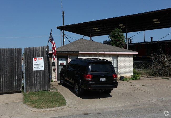
Property Record
1205 N Main St, Carrollton, TX 75006


NEARBY LISTINGS FOR SALE OR LEASE
Property Detail
1205 N Main St
Dallas-Fort Worth-Arlington, TX
New Carrollton
14081500140110000
NEW CARROLLTON BLK 14 LT 11 ACS 0.2077 AKA A W PERRY 1 LOC ON OT SH 5 VOL2002087/9021 DD05032002 CO-DC 0815001401100 11408150014
Officebuilding
Dallas
X
Texas
48113C0160K
11
2024
0.21 AC
2025
Lewisville
013717
Dallas/Ft Worth
625 SF
DEMOGRAPHICS near 1205 N Main St
1 Mile
3 Mile
5 Mile
2024 Total Population
10,162
82,866
310,652
2029 Population
10,266
84,099
330,280
Pop Growth 2024-2029
+ 1.02%
+ 1.49%
+ 6.32%
Average Age
35
38
38
2024 Total Households
3,606
30,678
126,875
HH Growth 2024-2029
+ 1.19%
+ 1.42%
+ 6.58%
Median Household Inc
$70,233
$78,687
$82,925
Avg Household Size
2.70
2.60
2.40
2024 Avg HH Vehicles
2.00
2.00
2.00
Median Home Value
$240,046
$283,888
$340,680
Median Year Built
1979
1981
1989
Nearby Places
Map Layers
Map Styles
 Street
 Aerial
- Restaurants
- Banks
- Shops
- Fitness
- Groceries
PUBLIC TRANSPORTATION
COMMUTER RAIL
Trinity Mills Station (Green Line - Dallas Area Rapid Transit (DART))
DRIVE
WALK
Distance
Trinity Mills Station (Green Line - Dallas Area Rapid Transit (DART))
5 min
2.7 mi
DRIVE
WALK
Distance
11 min
6.6 mi
AIRPORT
Dallas Love Field
DRIVE
WALK
Distance
Dallas Love Field
21 min
12.9 mi
Dallas-Fort Worth International
DRIVE
WALK
Distance
Dallas-Fort Worth International
21 min
15.6 mi
Nearby Properties
Address
Land Use
TOTAL SIZE
Lot Size
Zoning
Address
Land Use
TOTAL SIZE
Lot Size
Zoning
660,180 SF
29.95 AC
Address
Land Use
TOTAL SIZE
Lot Size
Zoning
605,278 SF
10.70 AC
Z236
Address
Land Use
TOTAL SIZE
Lot Size
Zoning
513,871 SF
3.63 AC
Z235
Address
Land Use
TOTAL SIZE
Lot Size
Zoning
242,707 SF
27.63 AC
Z343
Address
Land Use
TOTAL SIZE
Lot Size
Zoning
368,845 SF
20.96 AC
Z172
Address
Land Use
TOTAL SIZE
Lot Size
Zoning
544,650 SF
26.03 AC
Z177
Address
Land Use
TOTAL SIZE
Lot Size
Zoning
321,732 SF
4.05 AC
Z235
Address
Land Use
TOTAL SIZE
Lot Size
Zoning
345,320 SF
20.50 AC
Z172
Address
Land Use
TOTAL SIZE
Lot Size
Zoning
266,871 SF
87 SF
Address
Land Use
TOTAL SIZE
Lot Size
Zoning
725,972 SF
4 AC
Address
Land Use
TOTAL SIZE
Lot Size
Zoning
364,670 SF
13.72 AC
Z393
Address
Land Use
TOTAL SIZE
Lot Size
Zoning
283,285 SF
16.80 AC
Z172
Address
Land Use
TOTAL SIZE
Lot Size
Zoning
292,049 SF
11.44 AC
Z243
Address
Land Use
TOTAL SIZE
Lot Size
Zoning
270,915 SF
3.91 AC
Z84
Address
Land Use
TOTAL SIZE
Lot Size
Zoning
396,899 SF
3.68 AC
Z236
Address
Land Use
TOTAL SIZE
Lot Size
Zoning
330,000 SF
3.05 AC
Z236
Address
Land Use
TOTAL SIZE
Lot Size
Zoning
374,093 SF
21.54 AC
Z268
Address
Land Use
TOTAL SIZE
Lot Size
Zoning
711,360 SF
32.62 AC
Address
Land Use
TOTAL SIZE
Lot Size
Zoning
300,956 SF
8.79 AC
Z236
Address
Land Use
TOTAL SIZE
Lot Size
Zoning
350,002 SF
21.01 AC
Z172
Address
Land Use
TOTAL SIZE
Lot Size
Zoning
228,674 SF
11.81 AC
Z235
Address
Land Use
TOTAL SIZE
Lot Size
Zoning
242,280 SF
13.61 AC
Z176
Address
Land Use
TOTAL SIZE
Lot Size
Zoning
227,032 SF
11 AC
Z243
Address
Land Use
TOTAL SIZE
Lot Size
Zoning
231,628 SF
12.21 AC
RMR2
Address
Land Use
TOTAL SIZE
Lot Size
Zoning
399,880 SF
25.21 AC
Z236
Address
Land Use
TOTAL SIZE
Lot Size
Zoning
218,630 SF
10.42 AC
Z393
Address
Land Use
TOTAL SIZE
Lot Size
Zoning
219,057 SF
12.63 AC
2B
Address
Land Use
TOTAL SIZE
Lot Size
Zoning
205,902 SF
10 AC
Z177
Address
Land Use
TOTAL SIZE
Lot Size
Zoning
223,391 SF
10.90 AC
RMR2
Address
Land Use
TOTAL SIZE
Lot Size
Zoning
214,033 SF
10.39 AC
RMR2
The World's #1 Commercial Real Estate Marketplace
Connect with us
© 2026 CoStar Group
The information above has been obtained from sources believed reliable. While we do not doubt its accuracy we have not verified it and make no guarantee, warranty or representation about it. It is your responsibility to independently confirm its accuracy and completeness. Any projections, opinions, assumptions, or estimates used are for example only and do not represent the current or future performance of the property. The value of this transaction to you depends on tax and other factors which should be evaluated by your tax, financial, and legal advisors. You and your advisors should conduct a careful, independent investigation of the property to determine to your satisfaction the suitability of the property for your needs.