Property Record
1205 Sulphur Spring Rd, Ballwin, MO 63021
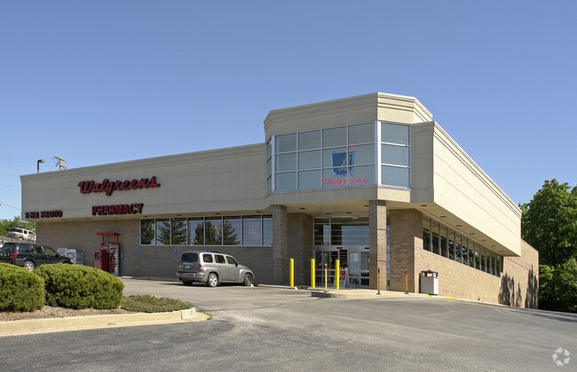

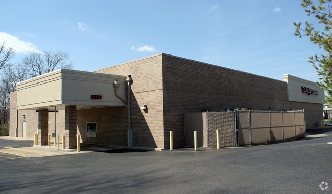
Property Detail
1205 Sulphur Spring Rd
24R-31-0803
LOC N OF TREETOP VILLAGE PLAT 2 12 8 88
Storebuilding
Saint Louis
NU
Missouri
B and X Area of moderate flood hazard, usually the area between the limits of the 100-year and 500-year floods.
2.35 AC
2024
Southwest County
2025
St. Louis
217932
St. Louis, MO-IL
13,841 SF
NEARBY LISTINGS FOR SALE OR LEASE
DEMOGRAPHICS near 1205 Sulphur Spring Rd
1 mile
3 mile
5 mile
2024 Total Population
11,919
68,321
141,635
2029 Population
11,689
67,241
139,358
Pop Growth 2024-2029
(1.93%)
(1.58%)
(1.61%)
Average Age
41
41
42
2024 Total Households
4,705
27,708
55,415
HH Growth 2024-2029
(1.87%)
(1.60%)
(1.64%)
Median Household Inc
$117,245
$108,757
$121,240
Avg Household Size
2.50
2.40
2.50
2024 Avg HH Vehicles
2.00
2.00
2.00
Median Home Value
$312,313
$330,423
$384,648
Median Year Built
1982
1979
1979
Nearby Places
Map Layers
Map Styles
 Street
 Aerial
Transit
 Traffic
 Biking
Places
Listings with unknown addresses are not visible on the map
- Restaurants
- Banks
- Shops
- Fitness
- Groceries
PUBLIC TRANSPORTATION
COMMUTER RAIL
Drive
Walk
Distance
17 min
7.7 mi
AIRPORT
St Louis Lambert International
Drive
Walk
Distance
St Louis Lambert International
37 min
24.6 mi
Nearby Properties
Address
Land Use
TOTAL SIZE
Lot Size
Zoning
Address
Land Use
TOTAL SIZE
Lot Size
Zoning
96.62 AC
R3
Address
Land Use
TOTAL SIZE
Lot Size
Zoning
633,127 SF
51.20 AC
NU
Address
Land Use
TOTAL SIZE
Lot Size
Zoning
284,400 SF
10.72 AC
55RSING
Address
Land Use
TOTAL SIZE
Lot Size
Zoning
403,166 SF
23.17 AC
R4
Address
Land Use
TOTAL SIZE
Lot Size
Zoning
68,441 SF
26.01 AC
58PDC
Address
Land Use
TOTAL SIZE
Lot Size
Zoning
19.25 AC
55INSTU
Address
Land Use
TOTAL SIZE
Lot Size
Zoning
117.18 AC
FPPS
Address
Land Use
TOTAL SIZE
Lot Size
Zoning
223,598 SF
13.95 AC
93C-1
Address
Land Use
TOTAL SIZE
Lot Size
Zoning
206,018 SF
18.78 AC
R1
Address
Land Use
TOTAL SIZE
Lot Size
Zoning
137,873 SF
10.99 AC
PCD
Address
Land Use
TOTAL SIZE
Lot Size
Zoning
153,489 SF
13.01 AC
93C-1
Address
Land Use
TOTAL SIZE
Lot Size
Zoning
246,426 SF
8.87 AC
94R-6
Address
Land Use
TOTAL SIZE
Lot Size
Zoning
212,328 SF
17.98 AC
94R-1
Address
Land Use
TOTAL SIZE
Lot Size
Zoning
1,782 SF
120.27 AC
NU
Address
Land Use
TOTAL SIZE
Lot Size
Zoning
141,806 SF
7.65 AC
C-8
Address
Land Use
TOTAL SIZE
Lot Size
Zoning
220,288 SF
11.09 AC
93R-4
Address
Land Use
TOTAL SIZE
Lot Size
Zoning
191,316 SF
7.61 AC
R4
Address
Land Use
TOTAL SIZE
Lot Size
Zoning
181,170 SF
9.74 AC
94R-6
Address
Land Use
TOTAL SIZE
Lot Size
Zoning
181,790 SF
16.64 AC
R4
Address
Land Use
TOTAL SIZE
Lot Size
Zoning
177,250 SF
23.87 AC
M1
Address
Land Use
TOTAL SIZE
Lot Size
Zoning
177,900 SF
23.46 AC
FPM3
Address
Land Use
TOTAL SIZE
Lot Size
Zoning
158,700 SF
14.25 AC
R6A
Address
Land Use
TOTAL SIZE
Lot Size
Zoning
151,222 SF
11.50 AC
FPR6A
Address
Land Use
TOTAL SIZE
Lot Size
Zoning
74,614 SF
8.05 AC
93C-1
Address
Land Use
TOTAL SIZE
Lot Size
Zoning
27.05 AC
R1
Address
Land Use
TOTAL SIZE
Lot Size
Zoning
5,641 SF
9.41 AC
94R-1
Address
Land Use
TOTAL SIZE
Lot Size
Zoning
131,718 SF
15.23 AC
C
Address
Land Use
TOTAL SIZE
Lot Size
Zoning
161,562 SF
9.39 AC
R3
Address
Land Use
TOTAL SIZE
Lot Size
Zoning
106,446 SF
4.49 AC
58PDC
Address
Land Use
TOTAL SIZE
Lot Size
Zoning
6,720 SF
6.01 AC
NU
The World's #1 Commercial Real Estate Marketplace
Connect with us
© 2026 CoStar Group
The information above has been obtained from sources believed reliable. While we do not doubt its accuracy we have not verified it and make no guarantee, warranty or representation about it. It is your responsibility to independently confirm its accuracy and completeness. Any projections, opinions, assumptions, or estimates used are for example only and do not represent the current or future performance of the property. The value of this transaction to you depends on tax and other factors which should be evaluated by your tax, financial, and legal advisors. You and your advisors should conduct a careful, independent investigation of the property to determine to your satisfaction the suitability of the property for your needs.