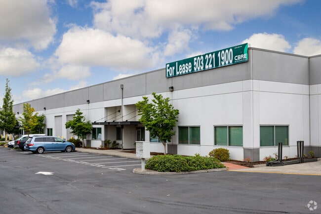
Property Record
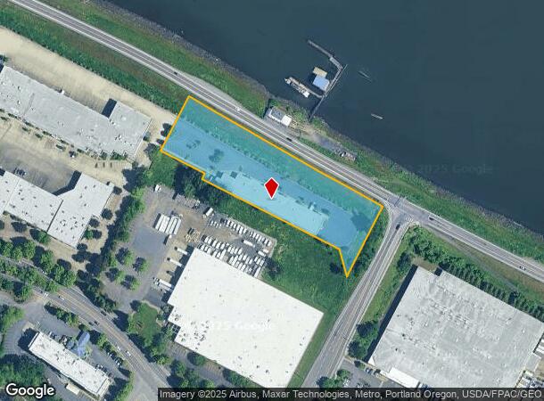
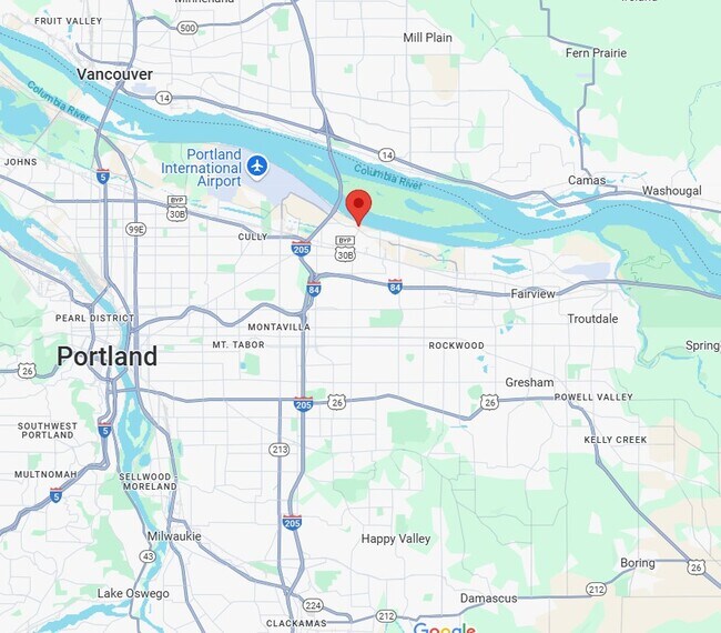
12055 Ne Glenn Widing Dr, Portland, OR 97220

NEARBY LISTINGS FOR SALE OR LEASE
Property Detail
12055 Ne Glenn Widing Dr
Portland-Vancouver-Hillsboro, OR-WA
Partition 1993-47
R605980
SECTION 14 1N 2E, TL 1001 3.00 ACRES
Industrialgeneral
Multnomah
ARE
Oregon
53011C0508D
2
2025
3 AC
2025
Airport Way
007300
Portland
19,568 SF
DEMOGRAPHICS near 12055 Ne Glenn Widing Dr
1 Mile
3 Mile
5 Mile
2024 Total Population
2,077
64,631
304,446
2029 Population
2,020
64,524
306,649
Pop Growth 2024-2029
(2.74%)
(0.17%)
+ 0.72%
Average Age
39
43
41
2024 Total Households
724
25,694
117,231
HH Growth 2024-2029
(3.31%)
(0.19%)
+ 0.64%
Median Household Inc
$46,136
$75,816
$73,004
Avg Household Size
2.30
2.40
2.50
2024 Avg HH Vehicles
1.00
2.00
2.00
Median Home Value
$397,691
$435,103
$441,199
Median Year Built
1975
1975
1975
Nearby Places
Map Layers
Map Styles
 Street
 Aerial
- Restaurants
- Banks
- Shops
- Fitness
- Groceries
PUBLIC TRANSPORTATION
AIRPORT
Portland International
DRIVE
WALK
Distance
Portland International
9 min
3.5 mi
Freight Ports
Port of Portland
DRIVE
WALK
Distance
Port of Portland
22 min
13.5 mi
SALE & LEASE HISTORY
LISTING DATE
SALE/LEASE

Sep 11, 2019
For Lease
May 09, 2017
For Lease
Jan 30, 2025
For Lease
Nearby Properties
Address
Land Use
TOTAL SIZE
Lot Size
Zoning
Address
Land Use
TOTAL SIZE
Lot Size
Zoning
273,811 SF
6.39 AC
NULL
Address
Land Use
TOTAL SIZE
Lot Size
Zoning
236,035 SF
13.01 AC
R7
Address
Land Use
TOTAL SIZE
Lot Size
Zoning
197,027 SF
28.54 AC
R7H
Address
Land Use
TOTAL SIZE
Lot Size
Zoning
817,845 SF
22.54 AC
IG2
Address
Land Use
TOTAL SIZE
Lot Size
Zoning
296,039 SF
11.70 AC
R5
Address
Land Use
TOTAL SIZE
Lot Size
Zoning
23.95 AC
IG2
Address
Land Use
TOTAL SIZE
Lot Size
Zoning
356,805 SF
27.10 AC
EG2
Address
Land Use
TOTAL SIZE
Lot Size
Zoning
339,894 SF
27.82 AC
R-22
Address
Land Use
TOTAL SIZE
Lot Size
Zoning
140,000 SF
14.53 AC
R7
Address
Land Use
TOTAL SIZE
Lot Size
Zoning
126.40 AC
IG2
Address
Land Use
TOTAL SIZE
Lot Size
Zoning
105.72 AC
IG2
Address
Land Use
TOTAL SIZE
Lot Size
Zoning
285,765 SF
14.41 AC
R-22
Address
Land Use
TOTAL SIZE
Lot Size
Zoning
199,197 SF
10.60 AC
R-22
Address
Land Use
TOTAL SIZE
Lot Size
Zoning
273,844 SF
13.09 AC
R-22
Address
Land Use
TOTAL SIZE
Lot Size
Zoning
47.70 AC
IG2
Address
Land Use
TOTAL SIZE
Lot Size
Zoning
257,560 SF
NULL
Address
Land Use
TOTAL SIZE
Lot Size
Zoning
60,788 SF
10.21 AC
GI
Address
Land Use
TOTAL SIZE
Lot Size
Zoning
175,840 SF
12.30 AC
R-18
Address
Land Use
TOTAL SIZE
Lot Size
Zoning
184,000 SF
18.88 AC
EG2
Address
Land Use
TOTAL SIZE
Lot Size
Zoning
58,843 SF
4.53 AC
EG2
Address
Land Use
TOTAL SIZE
Lot Size
Zoning
53.15 AC
IG2
Address
Land Use
TOTAL SIZE
Lot Size
Zoning
174,240 SF
11.25 AC
R-22
Address
Land Use
TOTAL SIZE
Lot Size
Zoning
118,040 SF
10.29 AC
EG2
Address
Land Use
TOTAL SIZE
Lot Size
Zoning
489,695 SF
23.76 AC
IG2P
Address
Land Use
TOTAL SIZE
Lot Size
Zoning
316,197 SF
11.49 AC
R-30
Address
Land Use
TOTAL SIZE
Lot Size
Zoning
1,566 SF
51.74 AC
IG2
Address
Land Use
TOTAL SIZE
Lot Size
Zoning
1,698,294 SF
21.36 AC
IG2HX
Address
Land Use
TOTAL SIZE
Lot Size
Zoning
175,276 SF
13.05 AC
IG2
Address
Land Use
TOTAL SIZE
Lot Size
Zoning
492,161 SF
28.13 AC
IG2
Address
Land Use
TOTAL SIZE
Lot Size
Zoning
The World's #1 Commercial Real Estate Marketplace
Connect with us
© 2026 CoStar Group
The information above has been obtained from sources believed reliable. While we do not doubt its accuracy we have not verified it and make no guarantee, warranty or representation about it. It is your responsibility to independently confirm its accuracy and completeness. Any projections, opinions, assumptions, or estimates used are for example only and do not represent the current or future performance of the property. The value of this transaction to you depends on tax and other factors which should be evaluated by your tax, financial, and legal advisors. You and your advisors should conduct a careful, independent investigation of the property to determine to your satisfaction the suitability of the property for your needs.