Property Record
1208 W Cumberland St, Dunn, NC 28334
This Property Is For Sale
NEARBY LISTINGS FOR SALE OR LEASE
Property Detail
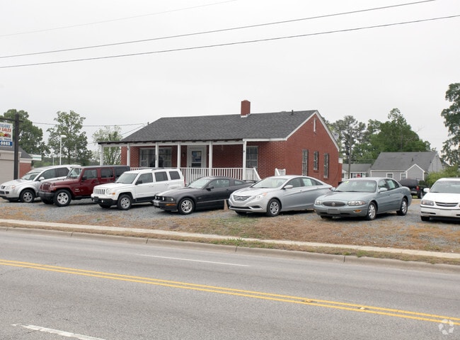
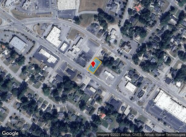
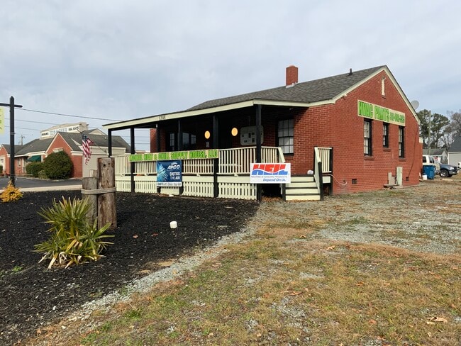
1208 W Cumberland St
Dunn, NC
L G Wilson Property
02151609080008
70X150 1 LOT PARKER REALTY
Realpropertynec
Harnett
X
North Carolina
3720150600J
1
2025
0.26 AC
2025
North Carolina Southeast Area
070300
Other Market Areas
1,274 SF
DEMOGRAPHICS near 1208 W Cumberland St
1 Mile
3 Mile
5 Mile
2024 Total Population
4,911
14,773
22,327
2029 Population
5,453
16,297
24,480
Pop Growth 2024-2029
+ 11.04%
+ 10.32%
+ 9.64%
Average Age
43
43
43
2024 Total Households
2,120
6,265
9,246
HH Growth 2024-2029
+ 11.32%
+ 10.60%
+ 9.94%
Median Household Inc
$43,992
$44,001
$46,189
Avg Household Size
2.30
2.30
2.40
2024 Avg HH Vehicles
2.00
2.00
2.00
Median Home Value
$171,375
$150,361
$150,714
Median Year Built
1975
1975
1976
Nearby Places
Map Layers
Map Styles
 Street
 Aerial
- Restaurants
- Banks
- Shops
- Fitness
- Groceries
PUBLIC TRANSPORTATION
AIRPORT
Fayetteville Regional/Grannis Field
DRIVE
WALK
Distance
Fayetteville Regional/Grannis Field
41 min
30.5 mi
Freight Ports
Port of Wilmington
DRIVE
WALK
Distance
Port of Wilmington
127 min
104.9 mi
Nearby Properties
Address
Land Use
TOTAL SIZE
Lot Size
Zoning
Address
Land Use
TOTAL SIZE
Lot Size
Zoning
1,444,066 SF
116.27 AC
I100
Address
Land Use
TOTAL SIZE
Lot Size
Zoning
1,336,065 SF
115.65 AC
IND
Address
Land Use
TOTAL SIZE
Lot Size
Zoning
73.86 AC
Address
Land Use
TOTAL SIZE
Lot Size
Zoning
15.37 AC
R10
Address
Land Use
TOTAL SIZE
Lot Size
Zoning
50,165 SF
3.65 AC
C3
Address
Land Use
TOTAL SIZE
Lot Size
Zoning
67,844 SF
2.64 AC
C3
Address
Land Use
TOTAL SIZE
Lot Size
Zoning
40 AC
R20
Address
Land Use
TOTAL SIZE
Lot Size
Zoning
81,250 SF
12.60 AC
I10
Address
Land Use
TOTAL SIZE
Lot Size
Zoning
90,000 SF
61.34 AC
I100
Address
Land Use
TOTAL SIZE
Lot Size
Zoning
94,411 SF
14.50 AC
R10
Address
Land Use
TOTAL SIZE
Lot Size
Zoning
14,466 SF
1.64 AC
Address
Land Use
TOTAL SIZE
Lot Size
Zoning
52,334 SF
8.72 AC
R10
Address
Land Use
TOTAL SIZE
Lot Size
Zoning
44,726 SF
34.92 AC
I10
Address
Land Use
TOTAL SIZE
Lot Size
Zoning
26,334 SF
3.45 AC
C3
Address
Land Use
TOTAL SIZE
Lot Size
Zoning
43,834 SF
3.07 AC
R10
Address
Land Use
TOTAL SIZE
Lot Size
Zoning
50,991 SF
12 AC
I10
Address
Land Use
TOTAL SIZE
Lot Size
Zoning
30,959 SF
2.14 AC
C3
Address
Land Use
TOTAL SIZE
Lot Size
Zoning
60,864 SF
6.33 AC
C2
Address
Land Use
TOTAL SIZE
Lot Size
Zoning
8,760 SF
2.58 AC
CB
Address
Land Use
TOTAL SIZE
Lot Size
Zoning
9,095 SF
3.12 AC
OI
Address
Land Use
TOTAL SIZE
Lot Size
Zoning
9,375 SF
13.40 AC
C3
Address
Land Use
TOTAL SIZE
Lot Size
Zoning
37,716 SF
3.70 AC
C3
Address
Land Use
TOTAL SIZE
Lot Size
Zoning
43,785 SF
2.94 AC
Address
Land Use
TOTAL SIZE
Lot Size
Zoning
44,556 SF
2.76 AC
C2
Address
Land Use
TOTAL SIZE
Lot Size
Zoning
5,832 SF
0.63 AC
C3
Address
Land Use
TOTAL SIZE
Lot Size
Zoning
5,362 SF
1.24 AC
C2
Address
Land Use
TOTAL SIZE
Lot Size
Zoning
17,555 SF
12.85 AC
R10
Address
Land Use
TOTAL SIZE
Lot Size
Zoning
40,806 SF
5.50 AC
RM
Address
Land Use
TOTAL SIZE
Lot Size
Zoning
34,307 SF
1.59 AC
OI
Address
Land Use
TOTAL SIZE
Lot Size
Zoning
143,622 SF
8 AC
I10
The World's #1 Commercial Real Estate Marketplace
Connect with us
© 2025 CoStar Group
The information above has been obtained from sources believed reliable. While we do not doubt its accuracy we have not verified it and make no guarantee, warranty or representation about it. It is your responsibility to independently confirm its accuracy and completeness. Any projections, opinions, assumptions, or estimates used are for example only and do not represent the current or future performance of the property. The value of this transaction to you depends on tax and other factors which should be evaluated by your tax, financial, and legal advisors. You and your advisors should conduct a careful, independent investigation of the property to determine to your satisfaction the suitability of the property for your needs.