Property Record
1207 E Forrest St, Athens, AL 35613
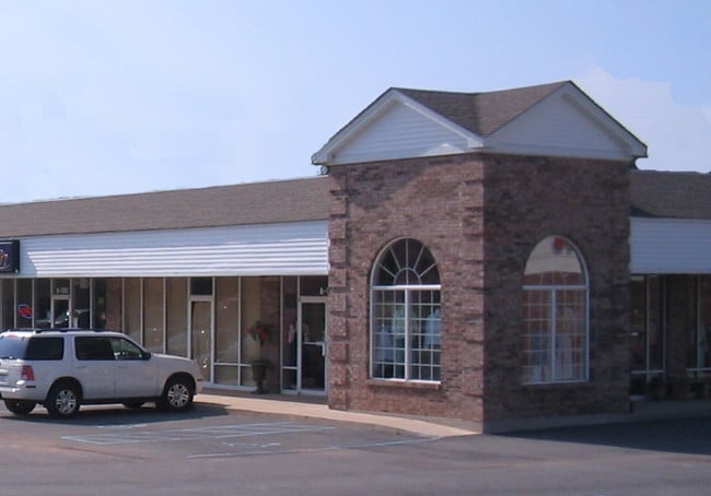

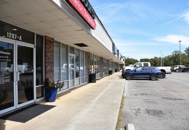
Property Detail
1207 E Forrest St
10-02-09-1-001-024.000
COM SE COR OF NE/4 TH W 1210N 20 TO POB CONT N 130 W 70 N30 W 300 S 140 E 300 TO POB INSEC 9 3 4N ADD DEED REF
Stripcommercialcenter
Limestone
B and X Area of moderate flood hazard, usually the area between the limits of the 100-year and 500-year floods.
Alabama
2025
0.97 AC
2025
Athens
020900
Huntsville
13,332 SF
Huntsville, AL
NEARBY LISTINGS FOR SALE OR LEASE
DEMOGRAPHICS near 1207 E Forrest St
1 mile
3 mile
5 mile
2025 Total Population
3,650
25,002
38,931
2030 Population
4,075
27,951
43,648
Pop Growth 2025-2030
+ 11.64%
+ 11.80%
+ 12.12%
Average Age
41
41
41
2025 Total Households
1,601
10,314
15,778
HH Growth 2025-2030
+ 11.93%
+ 12.07%
+ 12.37%
Median Household Inc
$65,094
$65,430
$74,712
Avg Household Size
2.20
2.30
2.40
2025 Avg HH Vehicles
2.00
2.00
2.00
Median Home Value
$351,381
$273,759
$278,438
Median Year Built
1979
1983
1988
Nearby Places
Map Layers
Map Styles
 Street
 Aerial
Transit
 Traffic
 Biking
Places
Listings with unknown addresses are not visible on the map
- Restaurants
- Banks
- Shops
- Fitness
- Groceries
PUBLIC TRANSPORTATION
AIRPORT
Huntsville International-Carl T Jones Field
Drive
Walk
Distance
Huntsville International-Carl T Jones Field
31 min
23.8 mi
Freight Ports
Port of Mobile
Drive
Walk
Distance
Port of Mobile
380 min
348.6 mi
SALE & LEASE HISTORY
LISTING DATE
SALE/LEASE

Oct 16, 2023
For Lease
Nearby Properties
Address
Land Use
TOTAL SIZE
Lot Size
Zoning
Address
Land Use
TOTAL SIZE
Lot Size
Zoning
395,826 SF
42 AC
Address
Land Use
TOTAL SIZE
Lot Size
Zoning
111,960 SF
13.96 AC
Address
Land Use
TOTAL SIZE
Lot Size
Zoning
899,329 SF
32 AC
Address
Land Use
TOTAL SIZE
Lot Size
Zoning
31,812 SF
54.94 AC
Address
Land Use
TOTAL SIZE
Lot Size
Zoning
222,182 SF
7.15 AC
Address
Land Use
TOTAL SIZE
Lot Size
Zoning
Address
Land Use
TOTAL SIZE
Lot Size
Zoning
209,125 SF
51.01 AC
Address
Land Use
TOTAL SIZE
Lot Size
Zoning
194,291 SF
21.52 AC
Address
Land Use
TOTAL SIZE
Lot Size
Zoning
79,713 SF
9.37 AC
Address
Land Use
TOTAL SIZE
Lot Size
Zoning
1,698 SF
18.22 AC
Address
Land Use
TOTAL SIZE
Lot Size
Zoning
11,620 SF
7.40 AC
Address
Land Use
TOTAL SIZE
Lot Size
Zoning
210,570 SF
9 AC
Address
Land Use
TOTAL SIZE
Lot Size
Zoning
134,312 SF
17.38 AC
Address
Land Use
TOTAL SIZE
Lot Size
Zoning
117,586 SF
34.35 AC
Address
Land Use
TOTAL SIZE
Lot Size
Zoning
6,310 SF
13.68 AC
Address
Land Use
TOTAL SIZE
Lot Size
Zoning
36,460 SF
6.65 AC
Address
Land Use
TOTAL SIZE
Lot Size
Zoning
67,241 SF
2.80 AC
Address
Land Use
TOTAL SIZE
Lot Size
Zoning
11 AC
Address
Land Use
TOTAL SIZE
Lot Size
Zoning
2,119 SF
17.54 AC
Address
Land Use
TOTAL SIZE
Lot Size
Zoning
60,612 SF
3.74 AC
Address
Land Use
TOTAL SIZE
Lot Size
Zoning
3.03 AC
Address
Land Use
TOTAL SIZE
Lot Size
Zoning
7.60 AC
Address
Land Use
TOTAL SIZE
Lot Size
Zoning
42,868 SF
11.54 AC
Address
Land Use
TOTAL SIZE
Lot Size
Zoning
70,749 SF
8.01 AC
Address
Land Use
TOTAL SIZE
Lot Size
Zoning
241,870 SF
7.50 AC
Address
Land Use
TOTAL SIZE
Lot Size
Zoning
11,476 SF
10 AC
Address
Land Use
TOTAL SIZE
Lot Size
Zoning
45,156 SF
2.28 AC
Address
Land Use
TOTAL SIZE
Lot Size
Zoning
11,540 SF
8.50 AC
Address
Land Use
TOTAL SIZE
Lot Size
Zoning
8,943 SF
50.58 AC
Address
Land Use
TOTAL SIZE
Lot Size
Zoning
36,990 SF
7.72 AC
The World's #1 Commercial Real Estate Marketplace
Connect with us
© 2026 CoStar Group
The information above has been obtained from sources believed reliable. While we do not doubt its accuracy we have not verified it and make no guarantee, warranty or representation about it. It is your responsibility to independently confirm its accuracy and completeness. Any projections, opinions, assumptions, or estimates used are for example only and do not represent the current or future performance of the property. The value of this transaction to you depends on tax and other factors which should be evaluated by your tax, financial, and legal advisors. You and your advisors should conduct a careful, independent investigation of the property to determine to your satisfaction the suitability of the property for your needs.