Property Record
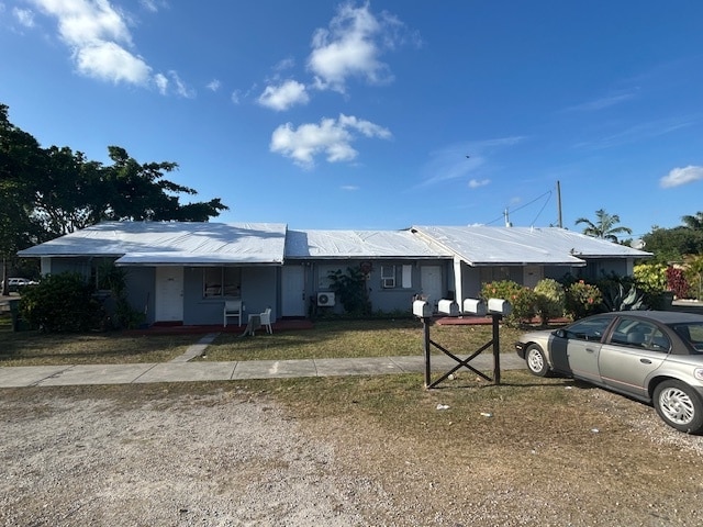
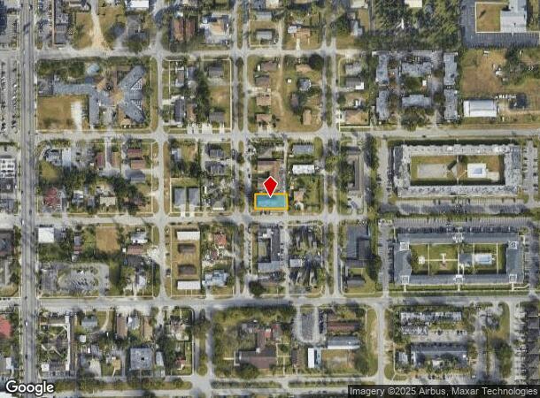
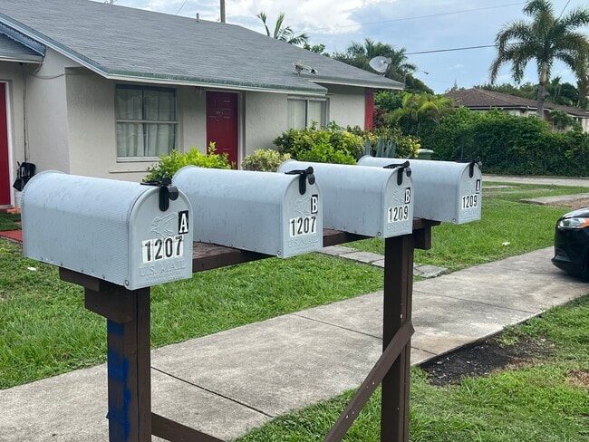
1207 Ne 1St Ave, Homestead, FL 33030
This Property Is For Sale
NEARBY LISTINGS FOR SALE OR LEASE
Property Detail
1207 Ne 1St Ave
Miami-Miami Beach-Kendall, FL
Diamond Park Re Sub
10-7907-029-0040
DIAMOND PARK RE SUB PB 9-164 LOT 4 BLK 5 LOT SIZE 67.900 X 130 OR 14333-1489 1189 1
Multifamilydwelling
Miami/Dade
X
Florida
12086C0726L
4
2024
0.20 AC
2025
Outer Homestead/South Dade
011104
South Florida
2,484 SF
DEMOGRAPHICS near 1207 Ne 1St Ave
1 Mile
3 Mile
5 Mile
2024 Total Population
16,832
102,748
166,135
2029 Population
16,627
102,353
165,254
Pop Growth 2024-2029
(1.22%)
(0.38%)
(0.53%)
Average Age
36
37
36
2024 Total Households
4,750
30,923
49,690
HH Growth 2024-2029
(1.85%)
(0.86%)
(1.03%)
Median Household Inc
$43,827
$51,522
$54,813
Avg Household Size
3.20
3.20
3.20
2024 Avg HH Vehicles
2.00
2.00
2.00
Median Home Value
$273,842
$314,152
$315,401
Median Year Built
1975
1993
1999
Nearby Places
- Restaurants
- Banks
- Shops
- Fitness
- Groceries
PUBLIC TRANSPORTATION
AIRPORT
Miami International
DRIVE
WALK
Distance
Miami International
47 min
31.2 mi
Freight Ports
Port of Miami
DRIVE
WALK
Distance
Port of Miami
56 min
38.1 mi
Nearby Properties
Address
Land Use
TOTAL SIZE
Lot Size
Zoning
Address
Land Use
TOTAL SIZE
Lot Size
Zoning
487,531 SF
60 AC
9300
Address
Land Use
TOTAL SIZE
Lot Size
Zoning
289,905 SF
29.74 AC
6500
Address
Land Use
TOTAL SIZE
Lot Size
Zoning
321,122 SF
7.31 AC
3161
Address
Land Use
TOTAL SIZE
Lot Size
Zoning
149,022 SF
34.85 AC
9300
Address
Land Use
TOTAL SIZE
Lot Size
Zoning
228,908 SF
65.07 AC
3050
Address
Land Use
TOTAL SIZE
Lot Size
Zoning
216,282 SF
20.04 AC
6300
Address
Land Use
TOTAL SIZE
Lot Size
Zoning
183,244 SF
4 AC
6500
Address
Land Use
TOTAL SIZE
Lot Size
Zoning
122,719 SF
18.62 AC
9000
Address
Land Use
TOTAL SIZE
Lot Size
Zoning
304,629 SF
36.34 AC
0100
Address
Land Use
TOTAL SIZE
Lot Size
Zoning
252,526 SF
29.86 AC
6000
Address
Land Use
TOTAL SIZE
Lot Size
Zoning
169,474 SF
5.76 AC
6300
Address
Land Use
TOTAL SIZE
Lot Size
Zoning
278,375 SF
20.15 AC
7000
Address
Land Use
TOTAL SIZE
Lot Size
Zoning
208,951 SF
20 AC
6300
Address
Land Use
TOTAL SIZE
Lot Size
Zoning
409,347 SF
33.88 AC
3000
Address
Land Use
TOTAL SIZE
Lot Size
Zoning
322,425 SF
16.40 AC
5700
Address
Land Use
TOTAL SIZE
Lot Size
Zoning
119,534 SF
8.55 AC
6200
Address
Land Use
TOTAL SIZE
Lot Size
Zoning
203,528 SF
3.73 AC
6000
Address
Land Use
TOTAL SIZE
Lot Size
Zoning
234,124 SF
23.35 AC
6000
Address
Land Use
TOTAL SIZE
Lot Size
Zoning
374,632 SF
23.28 AC
3000
Address
Land Use
TOTAL SIZE
Lot Size
Zoning
159,298 SF
4.93 AC
5300
Address
Land Use
TOTAL SIZE
Lot Size
Zoning
185,907 SF
57.94 AC
3100
Address
Land Use
TOTAL SIZE
Lot Size
Zoning
24.37 AC
6600
Address
Land Use
TOTAL SIZE
Lot Size
Zoning
96,971 SF
3.08 AC
6500
Address
Land Use
TOTAL SIZE
Lot Size
Zoning
165,761 SF
6.72 AC
6300
Address
Land Use
TOTAL SIZE
Lot Size
Zoning
431,236 SF
2.74 AC
9450
Address
Land Use
TOTAL SIZE
Lot Size
Zoning
84,500 SF
2.90 AC
7000
Address
Land Use
TOTAL SIZE
Lot Size
Zoning
177,485 SF
14.71 AC
6300
Address
Land Use
TOTAL SIZE
Lot Size
Zoning
122,076 SF
4.87 AC
9300
Address
Land Use
TOTAL SIZE
Lot Size
Zoning
122,450 SF
17.80 AC
9000
The World's #1 Commercial Real Estate Marketplace
Connect with us
© 2025 CoStar Group
The information above has been obtained from sources believed reliable. While we do not doubt its accuracy we have not verified it and make no guarantee, warranty or representation about it. It is your responsibility to independently confirm its accuracy and completeness. Any projections, opinions, assumptions, or estimates used are for example only and do not represent the current or future performance of the property. The value of this transaction to you depends on tax and other factors which should be evaluated by your tax, financial, and legal advisors. You and your advisors should conduct a careful, independent investigation of the property to determine to your satisfaction the suitability of the property for your needs.