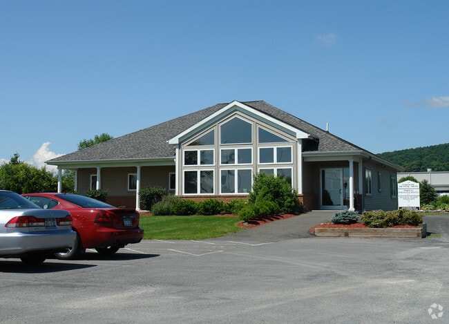
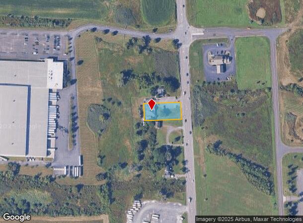
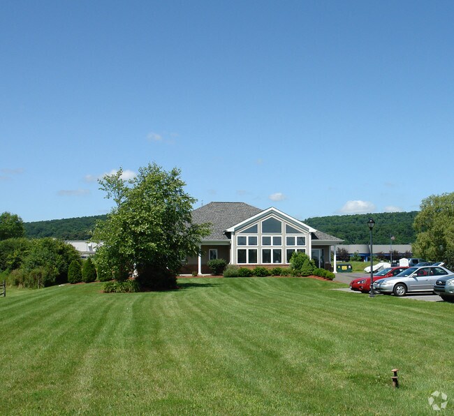
Property Record
12077 State Route 9W, West Coxsackie, NY 12192
NEARBY LISTINGS FOR SALE OR LEASE
-
-
View all West Coxsackie listings for sale on LoopNet.com
Property Detail
12077 State Route 9W
Professionalbldglegalinsurancerealestateetc
Greene
X
New York
36039C0277F
17.220
2025
0.50 AC
2024
Greene County
080600
Albany/Schenectady/Troy
2,523 SF
192889-040-004-0001-017-220-0000
DEMOGRAPHICS near 12077 State Route 9W
1 Mile
3 Mile
5 Mile
2024 Total Population
839
4,972
9,515
2029 Population
839
5,016
9,595
Pop Growth 2024-2029
0.00%
+ 0.88%
+ 0.84%
Average Age
45
43
44
2024 Total Households
400
2,196
4,102
HH Growth 2024-2029
(0.25%)
+ 0.64%
+ 0.68%
Median Household Inc
$45,961
$65,560
$73,622
Avg Household Size
2.10
2.20
2.30
2024 Avg HH Vehicles
2.00
2.00
2.00
Median Home Value
$162,903
$207,885
$215,860
Median Year Built
1972
1966
1972
Nearby Places
- Restaurants
- Banks
- Shops
- Fitness
- Groceries
PUBLIC TRANSPORTATION
AIRPORT
Albany International
DRIVE
WALK
Distance
Albany International
46 min
33.1 mi
Freight Ports
Albany, NY Port
DRIVE
WALK
Distance
Albany, NY Port
27 min
19.9 mi
Nearby Properties
Address
Land Use
TOTAL SIZE
Lot Size
Zoning
Address
Land Use
TOTAL SIZE
Lot Size
Zoning
146.47 AC
01 - NOT Z
Address
Land Use
TOTAL SIZE
Lot Size
Zoning
464,152 SF
84.16 AC
07 - MIXED
Address
Land Use
TOTAL SIZE
Lot Size
Zoning
333,660 SF
30.70 AC
04 - FARM
Address
Land Use
TOTAL SIZE
Lot Size
Zoning
218,036 SF
19.60 AC
07 - MIXED
Address
Land Use
TOTAL SIZE
Lot Size
Zoning
114,420 SF
61.50 AC
06 - INDUS
Address
Land Use
TOTAL SIZE
Lot Size
Zoning
257,860 SF
49 AC
05 - COMME
Address
Land Use
TOTAL SIZE
Lot Size
Zoning
230,900 SF
16.06 AC
05 - COMME
Address
Land Use
TOTAL SIZE
Lot Size
Zoning
3.22 AC
03 - MULTI
Address
Land Use
TOTAL SIZE
Lot Size
Zoning
4.01 AC
01 - NOT Z
Address
Land Use
TOTAL SIZE
Lot Size
Zoning
67.80 AC
05 - COMME
Address
Land Use
TOTAL SIZE
Lot Size
Zoning
150,004 SF
20 AC
9
Address
Land Use
TOTAL SIZE
Lot Size
Zoning
Address
Land Use
TOTAL SIZE
Lot Size
Zoning
36,513 SF
2.24 AC
01 - NOT Z
Address
Land Use
TOTAL SIZE
Lot Size
Zoning
6,000 SF
6.45 AC
05 - COMME
Address
Land Use
TOTAL SIZE
Lot Size
Zoning
86,144 SF
24.70 AC
01 - NOT Z
Address
Land Use
TOTAL SIZE
Lot Size
Zoning
14,758 SF
8 AC
04 - FARM
Address
Land Use
TOTAL SIZE
Lot Size
Zoning
Address
Land Use
TOTAL SIZE
Lot Size
Zoning
9,396 SF
14.83 AC
07 - MIXED
Address
Land Use
TOTAL SIZE
Lot Size
Zoning
37,179 SF
3.30 AC
04 - FARM
Address
Land Use
TOTAL SIZE
Lot Size
Zoning
Address
Land Use
TOTAL SIZE
Lot Size
Zoning
30,720 SF
8.25 AC
01 - NOT Z
Address
Land Use
TOTAL SIZE
Lot Size
Zoning
21,172 SF
2.86 AC
03 - MULTI
Address
Land Use
TOTAL SIZE
Lot Size
Zoning
Address
Land Use
TOTAL SIZE
Lot Size
Zoning
6,300 SF
34.18 AC
01 - NOT Z
Address
Land Use
TOTAL SIZE
Lot Size
Zoning
13.30 AC
05 - COMME
Address
Land Use
TOTAL SIZE
Lot Size
Zoning
4,456 SF
31.99 AC
10
Address
Land Use
TOTAL SIZE
Lot Size
Zoning
11.70 AC
01 - NOT Z
Address
Land Use
TOTAL SIZE
Lot Size
Zoning
11,000 SF
13.20 AC
01 - NOT Z
Address
Land Use
TOTAL SIZE
Lot Size
Zoning
146.47 AC
01 - NOT Z
Address
Land Use
TOTAL SIZE
Lot Size
Zoning
301.80 AC
05 - COMME
The World's #1 Commercial Real Estate Marketplace
Connect with us
© 2025 CoStar Group
The information above has been obtained from sources believed reliable. While we do not doubt its accuracy we have not verified it and make no guarantee, warranty or representation about it. It is your responsibility to independently confirm its accuracy and completeness. Any projections, opinions, assumptions, or estimates used are for example only and do not represent the current or future performance of the property. The value of this transaction to you depends on tax and other factors which should be evaluated by your tax, financial, and legal advisors. You and your advisors should conduct a careful, independent investigation of the property to determine to your satisfaction the suitability of the property for your needs.