Property Record
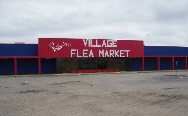
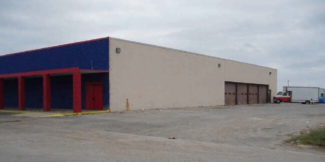
1208 Highway 44, Robstown, TX 78380


Property Detail
1208 Highway 44
Corpus Christi, TX
WAL-MART - RBST, BLOCK 0, LOT 2-R
200054124
NUECES
Commercialnec
Texas
AE The base floodplain where base flood elevations are provided. AE Zones are now used on new format FIRMs instead of A1-A30 Zones.
2-r
2024
4.57 AC
2025
Northwest
005804
Corpus Christi
46,210 SF
NEARBY LISTINGS FOR SALE OR LEASE
DEMOGRAPHICS near 1208 Highway 44
1 mile
3 mile
5 mile
2025 Total Population
2,149
12,451
17,514
2030 Population
2,114
12,563
17,684
Pop Growth 2025-2030
(1.63%)
+ 0.90%
+ 0.97%
Average Age
38
39
39
2025 Total Households
708
4,083
5,720
HH Growth 2025-2030
(1.84%)
+ 0.73%
+ 0.79%
Median Household Inc
$37,818
$40,777
$55,249
Avg Household Size
3.00
3.00
3.00
2025 Avg HH Vehicles
2.00
2.00
2.00
Median Home Value
$78,062
$83,463
$125,209
Median Year Built
1962
1970
1975
Nearby Places
Map Layers
Map Styles
 Street
 Aerial
Layers
 Traffic
 Biking
Places
Listings with unknown addresses are not visible on the map
- Restaurants
- Banks
- Shops
- Fitness
- Groceries
PUBLIC TRANSPORTATION
AIRPORT
Corpus Christi International
Drive
Walk
Distance
Corpus Christi International
14 min
10.3 mi
Freight Ports
Port of Corpus Christi
Drive
Walk
Distance
Port of Corpus Christi
22 min
18.0 mi
Nearby Properties
Address
Land Use
TOTAL SIZE
Lot Size
Zoning
Address
Land Use
TOTAL SIZE
Lot Size
Zoning
265,451 SF
54.68 AC
Address
Land Use
TOTAL SIZE
Lot Size
Zoning
71,004 SF
38.48 AC
Address
Land Use
TOTAL SIZE
Lot Size
Zoning
133,580 SF
50.28 AC
Address
Land Use
TOTAL SIZE
Lot Size
Zoning
177,230 SF
13.31 AC
Address
Land Use
TOTAL SIZE
Lot Size
Zoning
109,882 SF
10.31 AC
Address
Land Use
TOTAL SIZE
Lot Size
Zoning
50,207 SF
10.30 AC
Address
Land Use
TOTAL SIZE
Lot Size
Zoning
50,688 SF
11.34 AC
Address
Land Use
TOTAL SIZE
Lot Size
Zoning
356,824 SF
41.01 AC
Address
Land Use
TOTAL SIZE
Lot Size
Zoning
58,400 SF
14.64 AC
Address
Land Use
TOTAL SIZE
Lot Size
Zoning
13,000 SF
5.93 AC
Address
Land Use
TOTAL SIZE
Lot Size
Zoning
14,885 SF
11.77 AC
Address
Land Use
TOTAL SIZE
Lot Size
Zoning
20,375 SF
9.12 AC
Address
Land Use
TOTAL SIZE
Lot Size
Zoning
2,812 SF
56 AC
Address
Land Use
TOTAL SIZE
Lot Size
Zoning
14,150 SF
9.92 AC
Address
Land Use
TOTAL SIZE
Lot Size
Zoning
54,437 SF
10.44 AC
B-2
Address
Land Use
TOTAL SIZE
Lot Size
Zoning
17,334 SF
1.28 AC
Address
Land Use
TOTAL SIZE
Lot Size
Zoning
26,000 SF
2.81 AC
Address
Land Use
TOTAL SIZE
Lot Size
Zoning
21,632 SF
3.06 AC
Address
Land Use
TOTAL SIZE
Lot Size
Zoning
21,016 SF
12.72 AC
Address
Land Use
TOTAL SIZE
Lot Size
Zoning
31,660 SF
7 AC
Address
Land Use
TOTAL SIZE
Lot Size
Zoning
15,555 SF
8.28 AC
Address
Land Use
TOTAL SIZE
Lot Size
Zoning
19,501 SF
2.01 AC
Address
Land Use
TOTAL SIZE
Lot Size
Zoning
37,745 SF
21.06 AC
OCL
Address
Land Use
TOTAL SIZE
Lot Size
Zoning
28,222 SF
1.13 AC
Address
Land Use
TOTAL SIZE
Lot Size
Zoning
68,513 SF
23.59 AC
I
Address
Land Use
TOTAL SIZE
Lot Size
Zoning
21,609 SF
1.70 AC
R-3
Address
Land Use
TOTAL SIZE
Lot Size
Zoning
36,480 SF
3.97 AC
Address
Land Use
TOTAL SIZE
Lot Size
Zoning
12,862 SF
6.70 AC
Address
Land Use
TOTAL SIZE
Lot Size
Zoning
8,160 SF
1.91 AC
Address
Land Use
TOTAL SIZE
Lot Size
Zoning
13,476 SF
1.08 AC
B-2
The World's #1 Commercial Real Estate Marketplace
Connect with us
© 2026 CoStar Group
The information above has been obtained from sources believed reliable. While we do not doubt its accuracy we have not verified it and make no guarantee, warranty or representation about it. It is your responsibility to independently confirm its accuracy and completeness. Any projections, opinions, assumptions, or estimates used are for example only and do not represent the current or future performance of the property. The value of this transaction to you depends on tax and other factors which should be evaluated by your tax, financial, and legal advisors. You and your advisors should conduct a careful, independent investigation of the property to determine to your satisfaction the suitability of the property for your needs.