Property Record
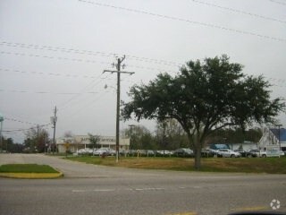
1208 Stanton Rd, Daphne, AL 36526


NEARBY LISTINGS FOR SALE OR LEASE
Property Detail
1208 Stanton Rd
43-04-20-3-000-007.000
249'(S) X 197'(S) IRR COM AT THE SE COR OF SW1/4 OF SEC 20 R UN TH N 2488', TH W 855'(S) FOR POB TH RUN S 197'(S), TH W 2 68'
Autorepair
Baldwin
X
Alabama
01097C0725L
1.21 AC
2024
Baldwin County
2024
Mobile
010710
Daphne-Fairhope-Foley, AL
2,230 SF
DEMOGRAPHICS near 1208 Stanton Rd
1 Mile
3 Mile
5 Mile
2024 Total Population
4,199
19,420
42,801
2029 Population
4,723
22,289
49,037
Pop Growth 2024-2029
+ 12.48%
+ 14.77%
+ 14.57%
Average Age
42
40
40
2024 Total Households
1,715
7,477
16,545
HH Growth 2024-2029
+ 11.95%
+ 14.15%
+ 14.08%
Median Household Inc
$55,086
$77,968
$79,622
Avg Household Size
2.30
2.50
2.50
2024 Avg HH Vehicles
2.00
2.00
2.00
Median Home Value
$383,476
$321,540
$292,926
Median Year Built
1986
1997
1996
Nearby Places
Map Layers
Map Styles
 Street
 Aerial
- Restaurants
- Banks
- Shops
- Fitness
- Groceries
PUBLIC TRANSPORTATION
AIRPORT
Mobile International
DRIVE
WALK
Distance
Mobile International
26 min
17.6 mi
Mobile Regional
DRIVE
WALK
Distance
Mobile Regional
49 min
31.2 mi
SALE & LEASE HISTORY
LISTING DATE
SALE/LEASE

Nov 04, 2016
For Lease
Nearby Properties
Address
Land Use
TOTAL SIZE
Lot Size
Zoning
Address
Land Use
TOTAL SIZE
Lot Size
Zoning
6,375 SF
21 AC
Address
Land Use
TOTAL SIZE
Lot Size
Zoning
23,907 SF
21 AC
Address
Land Use
TOTAL SIZE
Lot Size
Zoning
4,160 SF
19 AC
Address
Land Use
TOTAL SIZE
Lot Size
Zoning
17,428 SF
17 AC
Address
Land Use
TOTAL SIZE
Lot Size
Zoning
2,342 SF
13 AC
Address
Land Use
TOTAL SIZE
Lot Size
Zoning
3,310 SF
10 AC
Address
Land Use
TOTAL SIZE
Lot Size
Zoning
2,744 SF
15 AC
Address
Land Use
TOTAL SIZE
Lot Size
Zoning
7,020 SF
21 AC
Address
Land Use
TOTAL SIZE
Lot Size
Zoning
203,028 SF
29 AC
Address
Land Use
TOTAL SIZE
Lot Size
Zoning
9,917 SF
9.60 AC
Address
Land Use
TOTAL SIZE
Lot Size
Zoning
64,725 SF
8.70 AC
Address
Land Use
TOTAL SIZE
Lot Size
Zoning
20,664 SF
7.10 AC
Address
Land Use
TOTAL SIZE
Lot Size
Zoning
126,247 SF
13 AC
Address
Land Use
TOTAL SIZE
Lot Size
Zoning
8,548 SF
9.70 AC
Address
Land Use
TOTAL SIZE
Lot Size
Zoning
57,311 SF
15 AC
Address
Land Use
TOTAL SIZE
Lot Size
Zoning
22,158 SF
15 AC
Address
Land Use
TOTAL SIZE
Lot Size
Zoning
Address
Land Use
TOTAL SIZE
Lot Size
Zoning
47,923 SF
12 AC
Address
Land Use
TOTAL SIZE
Lot Size
Zoning
Address
Land Use
TOTAL SIZE
Lot Size
Zoning
85,018 SF
8.60 AC
Address
Land Use
TOTAL SIZE
Lot Size
Zoning
20,073 SF
5.60 AC
Address
Land Use
TOTAL SIZE
Lot Size
Zoning
6,025 SF
6 AC
Address
Land Use
TOTAL SIZE
Lot Size
Zoning
37,066 SF
3.60 AC
Address
Land Use
TOTAL SIZE
Lot Size
Zoning
30,862 SF
4.68 AC
Address
Land Use
TOTAL SIZE
Lot Size
Zoning
24,015 SF
3.11 AC
Address
Land Use
TOTAL SIZE
Lot Size
Zoning
3,526 SF
5.70 AC
Address
Land Use
TOTAL SIZE
Lot Size
Zoning
12,390 SF
0.41 AC
Address
Land Use
TOTAL SIZE
Lot Size
Zoning
1,751 SF
5.90 AC
Address
Land Use
TOTAL SIZE
Lot Size
Zoning
23,704 SF
3.58 AC
Address
Land Use
TOTAL SIZE
Lot Size
Zoning
53,388 SF
7.20 AC
The World's #1 Commercial Real Estate Marketplace
Connect with us
© 2025 CoStar Group
The information above has been obtained from sources believed reliable. While we do not doubt its accuracy we have not verified it and make no guarantee, warranty or representation about it. It is your responsibility to independently confirm its accuracy and completeness. Any projections, opinions, assumptions, or estimates used are for example only and do not represent the current or future performance of the property. The value of this transaction to you depends on tax and other factors which should be evaluated by your tax, financial, and legal advisors. You and your advisors should conduct a careful, independent investigation of the property to determine to your satisfaction the suitability of the property for your needs.