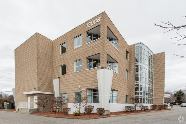
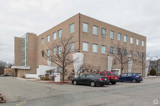
Property Record
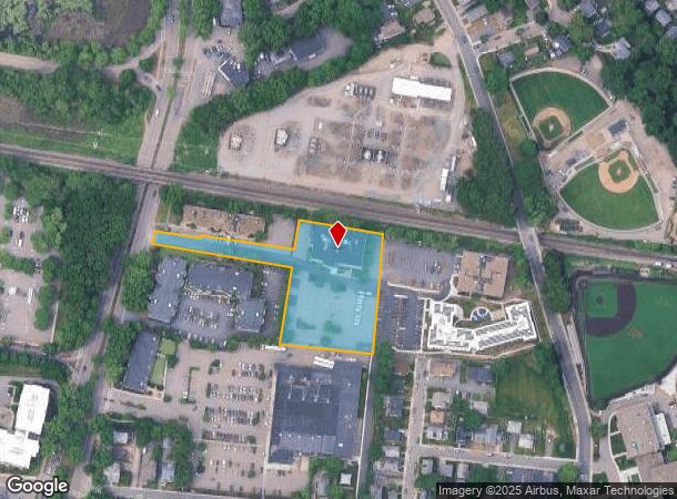
1208B Vfw Pky, West Roxbury, MA 02132
Current Lease Availabilities
NEARBY LISTINGS FOR SALE OR LEASE
Property Detail
1208B Vfw Pky
Daycare
Suffolk
X
Massachusetts
25021C0043F
2.06 AC
2025
South Suffolk County
2025
Boston
130402
Boston-Cambridge-Newton, MA-NH
37,680 SF
WROX-000000-000020-009180-000010
DEMOGRAPHICS near 1208B Vfw Pky
1 Mile
3 Mile
5 Mile
2024 Total Population
13,443
120,201
410,828
2029 Population
12,886
115,670
396,855
Pop Growth 2024-2029
(4.14%)
(3.77%)
(3.40%)
Average Age
45
42
40
2024 Total Households
5,621
46,652
158,126
HH Growth 2024-2029
(4.64%)
(4.18%)
(3.83%)
Median Household Inc
$125,561
$113,185
$103,288
Avg Household Size
2.30
2.50
2.50
2024 Avg HH Vehicles
2.00
2.00
1.00
Median Home Value
$691,256
$744,877
$798,053
Median Year Built
1949
1952
1951
Nearby Places
- Restaurants
- Banks
- Shops
- Fitness
- Groceries
PUBLIC TRANSPORTATION
COMMUTER RAIL
West Roxbury (Needham Line - Massachusetts Bay Transportation Authority Commuter Rail (Purple Line))
DRIVE
WALK
Distance
West Roxbury (Needham Line - Massachusetts Bay Transportation Authority Commuter Rail (Purple Line))
6 min
17 min
0.9 mi
Highland (Needham Line - Massachusetts Bay Transportation Authority Commuter Rail (Purple Line))
DRIVE
WALK
Distance
Highland (Needham Line - Massachusetts Bay Transportation Authority Commuter Rail (Purple Line))
7 min
2.3 mi
AIRPORT
General Edward Lawrence Logan International
DRIVE
WALK
Distance
General Edward Lawrence Logan International
33 min
13.7 mi
Freight Ports
Port of Boston
DRIVE
WALK
Distance
Port of Boston
1 min
8.7 mi
Nearby Properties
Address
Land Use
TOTAL SIZE
Lot Size
Zoning
Address
Land Use
TOTAL SIZE
Lot Size
Zoning
30,845 SF
50.36 AC
SR1
Address
Land Use
TOTAL SIZE
Lot Size
Zoning
412,208 SF
7.93 AC
I
Address
Land Use
TOTAL SIZE
Lot Size
Zoning
228,483 SF
7.57 AC
BU1
Address
Land Use
TOTAL SIZE
Lot Size
Zoning
317,049 SF
11.22 AC
M05
Address
Land Use
TOTAL SIZE
Lot Size
Zoning
1,050 SF
8.77 AC
BU4
Address
Land Use
TOTAL SIZE
Lot Size
Zoning
203,252 SF
236.88 AC
S40
Address
Land Use
TOTAL SIZE
Lot Size
Zoning
45,000 SF
14.30 AC
E
Address
Land Use
TOTAL SIZE
Lot Size
Zoning
355,941 SF
4.60 AC
A
Address
Land Use
TOTAL SIZE
Lot Size
Zoning
4.74 AC
NEBC
Address
Land Use
TOTAL SIZE
Lot Size
Zoning
241,737 SF
4.67 AC
BU1
Address
Land Use
TOTAL SIZE
Lot Size
Zoning
25,744 SF
35.80 AC
S40
Address
Land Use
TOTAL SIZE
Lot Size
Zoning
179.13 AC
E
Address
Land Use
TOTAL SIZE
Lot Size
Zoning
5,119 SF
119.98 AC
S15
Address
Land Use
TOTAL SIZE
Lot Size
Zoning
286,928 SF
2.89 AC
BU1
Address
Land Use
TOTAL SIZE
Lot Size
Zoning
151,232 SF
8.27 AC
PUB
Address
Land Use
TOTAL SIZE
Lot Size
Zoning
220,500 SF
1.96 AC
NEBC
Address
Land Use
TOTAL SIZE
Lot Size
Zoning
208,500 SF
13.98 AC
I
Address
Land Use
TOTAL SIZE
Lot Size
Zoning
59.94 AC
PUB
Address
Land Use
TOTAL SIZE
Lot Size
Zoning
34.93 AC
LM
Address
Land Use
TOTAL SIZE
Lot Size
Zoning
Address
Land Use
TOTAL SIZE
Lot Size
Zoning
21,830 SF
158.48 AC
E
Address
Land Use
TOTAL SIZE
Lot Size
Zoning
2,781 SF
60.98 AC
S40
Address
Land Use
TOTAL SIZE
Lot Size
Zoning
264,014 SF
10.64 AC
NEBC
Address
Land Use
TOTAL SIZE
Lot Size
Zoning
3.18 AC
M05
Address
Land Use
TOTAL SIZE
Lot Size
Zoning
14.64 AC
S15
Address
Land Use
TOTAL SIZE
Lot Size
Zoning
26,569 SF
45.93 AC
RC
Address
Land Use
TOTAL SIZE
Lot Size
Zoning
332,100 SF
4.63 AC
M05
Address
Land Use
TOTAL SIZE
Lot Size
Zoning
8.18 AC
B
Address
Land Use
TOTAL SIZE
Lot Size
Zoning
22.95 AC
E
Address
Land Use
TOTAL SIZE
Lot Size
Zoning
408,199 SF
23.35 AC
NEBC
The World's #1 Commercial Real Estate Marketplace
Connect with us
© 2025 CoStar Group
The information above has been obtained from sources believed reliable. While we do not doubt its accuracy we have not verified it and make no guarantee, warranty or representation about it. It is your responsibility to independently confirm its accuracy and completeness. Any projections, opinions, assumptions, or estimates used are for example only and do not represent the current or future performance of the property. The value of this transaction to you depends on tax and other factors which should be evaluated by your tax, financial, and legal advisors. You and your advisors should conduct a careful, independent investigation of the property to determine to your satisfaction the suitability of the property for your needs.