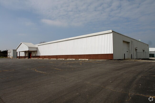
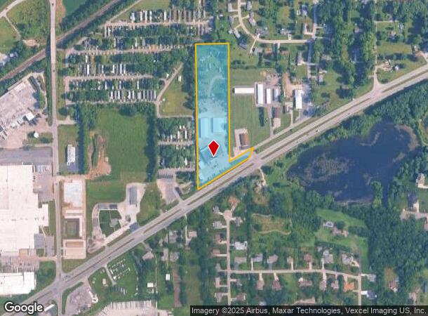
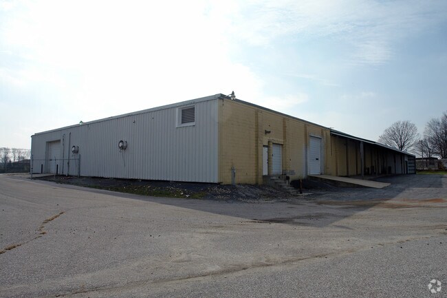
Property Record
1209 E State Road 2, La Porte, IN 46350
NEARBY LISTINGS FOR SALE OR LEASE
Property Detail
1209 E State Road 2
46-07-29-126-001.000-052
W Sd
Warehouse
32-07-29-126-001 IN NE 1/4 NW 1/4 N OF US 2 S29 T37 R2 7.301 AC
X
La Porte
18091C0170D
Indiana
2023
7.30 AC
2024
South Bend/Elkhart
041800
Other Market Areas
39,272 SF
Michigan City-La Porte, IN
DEMOGRAPHICS near 1209 E State Road 2
1 Mile
3 Mile
5 Mile
2024 Total Population
1,206
13,860
31,507
2029 Population
1,201
13,744
31,085
Pop Growth 2024-2029
(0.41%)
(0.84%)
(1.34%)
Average Age
40
39
40
2024 Total Households
435
5,385
12,433
HH Growth 2024-2029
(0.69%)
(1.00%)
(1.53%)
Median Household Inc
$83,393
$57,473
$61,476
Avg Household Size
2.60
2.40
2.40
2024 Avg HH Vehicles
2.00
2.00
2.00
Median Home Value
$220,100
$156,143
$169,124
Median Year Built
1990
1954
1960
Nearby Places
Map Layers
Map Styles
 Street
 Aerial
- Restaurants
- Banks
- Shops
- Fitness
- Groceries
PUBLIC TRANSPORTATION
COMMUTER RAIL
Hudson Lake (LaPorte County) Station (South Shore Line - Northern Indiana Commuter Transportation District (South Shore Line))
DRIVE
WALK
Distance
Hudson Lake (LaPorte County) Station (South Shore Line - Northern Indiana Commuter Transportation District (South Shore Line))
15 min
9.2 mi
AIRPORT
South Bend International
DRIVE
WALK
Distance
South Bend International
40 min
22.8 mi
Nearby Properties
Address
Land Use
TOTAL SIZE
Lot Size
Zoning
Address
Land Use
TOTAL SIZE
Lot Size
Zoning
225,592 SF
3.72 AC
Address
Land Use
TOTAL SIZE
Lot Size
Zoning
482,301 SF
49.97 AC
Address
Land Use
TOTAL SIZE
Lot Size
Zoning
511,980 SF
45.42 AC
Address
Land Use
TOTAL SIZE
Lot Size
Zoning
294,600 SF
22.86 AC
Address
Land Use
TOTAL SIZE
Lot Size
Zoning
289,954 SF
15.78 AC
Address
Land Use
TOTAL SIZE
Lot Size
Zoning
47,659 SF
22.32 AC
Address
Land Use
TOTAL SIZE
Lot Size
Zoning
603,796 SF
18.96 AC
Address
Land Use
TOTAL SIZE
Lot Size
Zoning
18,620 SF
6.87 AC
Address
Land Use
TOTAL SIZE
Lot Size
Zoning
194,458 SF
17.50 AC
Address
Land Use
TOTAL SIZE
Lot Size
Zoning
50,562 SF
11.99 AC
Address
Land Use
TOTAL SIZE
Lot Size
Zoning
28,154 SF
2.68 AC
Address
Land Use
TOTAL SIZE
Lot Size
Zoning
84,600 SF
52.13 AC
Address
Land Use
TOTAL SIZE
Lot Size
Zoning
52,830 SF
0.32 AC
Address
Land Use
TOTAL SIZE
Lot Size
Zoning
130,620 SF
12.68 AC
Address
Land Use
TOTAL SIZE
Lot Size
Zoning
414,159 SF
54.34 AC
Address
Land Use
TOTAL SIZE
Lot Size
Zoning
7,217 SF
0.40 AC
LBCCN
Address
Land Use
TOTAL SIZE
Lot Size
Zoning
39,424 SF
1.28 AC
Address
Land Use
TOTAL SIZE
Lot Size
Zoning
45,375 SF
4.67 AC
Address
Land Use
TOTAL SIZE
Lot Size
Zoning
10,506 SF
2.23 AC
Address
Land Use
TOTAL SIZE
Lot Size
Zoning
50,266 SF
10 AC
Address
Land Use
TOTAL SIZE
Lot Size
Zoning
11,404 SF
9.30 AC
Address
Land Use
TOTAL SIZE
Lot Size
Zoning
27,437 SF
3 AC
Address
Land Use
TOTAL SIZE
Lot Size
Zoning
13,150 SF
4.69 AC
Address
Land Use
TOTAL SIZE
Lot Size
Zoning
37,070 SF
Address
Land Use
TOTAL SIZE
Lot Size
Zoning
143,610 SF
7.50 AC
Address
Land Use
TOTAL SIZE
Lot Size
Zoning
28,672 SF
0.80 AC
Address
Land Use
TOTAL SIZE
Lot Size
Zoning
173,101 SF
7.61 AC
Address
Land Use
TOTAL SIZE
Lot Size
Zoning
124,550 SF
7.41 AC
Address
Land Use
TOTAL SIZE
Lot Size
Zoning
134,366 SF
6.02 AC
Address
Land Use
TOTAL SIZE
Lot Size
Zoning
14,585 SF
1.16 AC
The World's #1 Commercial Real Estate Marketplace
Connect with us
© 2025 CoStar Group
The information above has been obtained from sources believed reliable. While we do not doubt its accuracy we have not verified it and make no guarantee, warranty or representation about it. It is your responsibility to independently confirm its accuracy and completeness. Any projections, opinions, assumptions, or estimates used are for example only and do not represent the current or future performance of the property. The value of this transaction to you depends on tax and other factors which should be evaluated by your tax, financial, and legal advisors. You and your advisors should conduct a careful, independent investigation of the property to determine to your satisfaction the suitability of the property for your needs.