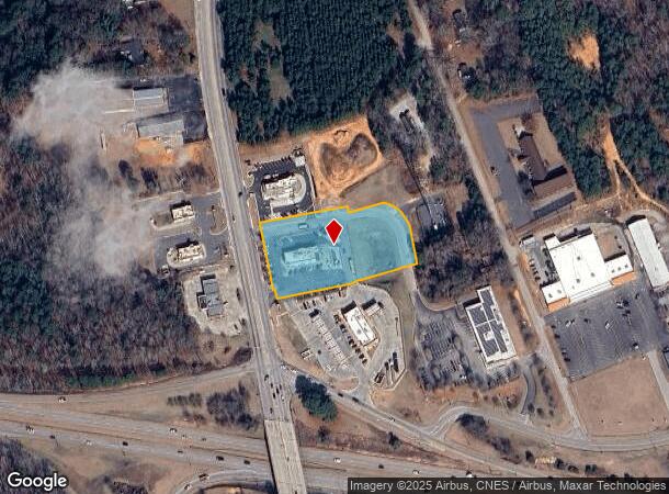
Property Record
1209 N Main St, Lancaster, SC 29720

NEARBY LISTINGS FOR SALE OR LEASE
-
-
View all Lancaster listings for lease on LoopNet.com
Property Detail
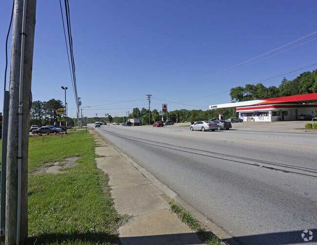
1209 N Main St
0062M-0D-013.00
Wyatt Fraser Estate Lands
Commercialnec
BOJANGLES
X
Lancaster
45057C0232E
South Carolina
2024
2.10 AC
2024
Lancaster County
011002
Charlotte
3,603 SF
Charlotte-Concord-Gastonia, NC-SC
DEMOGRAPHICS near 1209 N Main St
1 mile
3 mile
5 mile
2024 Total Population
2,887
18,963
30,964
2029 Population
3,499
22,982
37,444
Pop Growth 2024-2029
+ 21.20%
+ 21.19%
+ 20.93%
Average Age
43
41
41
2024 Total Households
1,213
7,763
12,542
HH Growth 2024-2029
+ 21.19%
+ 21.18%
+ 20.94%
Median Household Inc
$45,312
$45,266
$49,764
Avg Household Size
2.30
2.40
2.40
2024 Avg HH Vehicles
2.00
2.00
2.00
Median Home Value
$223,387
$172,899
$161,386
Median Year Built
1979
1975
1978
Nearby Places
Map Layers
Map Styles
 Street
 Aerial
Transit
 Traffic
 Biking
Places
Listings with unknown addresses are not visible on the map
- Restaurants
- Banks
- Shops
- Fitness
- Groceries
SALE & LEASE HISTORY
LISTING DATE
SALE/LEASE

Sep 24, 2016
For Sale
May 24, 2018
For Lease
May 10, 2017
For Sale
Nearby Properties
Address
Land Use
TOTAL SIZE
Lot Size
Zoning
Address
Land Use
TOTAL SIZE
Lot Size
Zoning
214,483 SF
20.62 AC
CITY
Address
Land Use
TOTAL SIZE
Lot Size
Zoning
11,456 SF
395 AC
CITY
Address
Land Use
TOTAL SIZE
Lot Size
Zoning
131,000 SF
26.88 AC
CITY
Address
Land Use
TOTAL SIZE
Lot Size
Zoning
38,652 SF
83.76 AC
CITY
Address
Land Use
TOTAL SIZE
Lot Size
Zoning
145,281 SF
19 AC
CITY
Address
Land Use
TOTAL SIZE
Lot Size
Zoning
53,564 SF
42.71 AC
INS
Address
Land Use
TOTAL SIZE
Lot Size
Zoning
55,998 SF
398 AC
CITY
Address
Land Use
TOTAL SIZE
Lot Size
Zoning
87,300 SF
25.77 AC
HI
Address
Land Use
TOTAL SIZE
Lot Size
Zoning
114,000 SF
21.53 AC
HI
Address
Land Use
TOTAL SIZE
Lot Size
Zoning
17,802 SF
5.24 AC
INS
Address
Land Use
TOTAL SIZE
Lot Size
Zoning
109,766 SF
19.99 AC
HI
Address
Land Use
TOTAL SIZE
Lot Size
Zoning
69,482 SF
63.14 AC
CITY
Address
Land Use
TOTAL SIZE
Lot Size
Zoning
29,710 SF
10.25 AC
GB
Address
Land Use
TOTAL SIZE
Lot Size
Zoning
17,000 SF
1.30 AC
INS
Address
Land Use
TOTAL SIZE
Lot Size
Zoning
49,240 SF
12.60 AC
CITY
Address
Land Use
TOTAL SIZE
Lot Size
Zoning
329,748 SF
20 AC
CITY
Address
Land Use
TOTAL SIZE
Lot Size
Zoning
4,550 SF
34.40 AC
CITY
Address
Land Use
TOTAL SIZE
Lot Size
Zoning
19,198 SF
11.61 AC
INS
Address
Land Use
TOTAL SIZE
Lot Size
Zoning
50,637 SF
2.42 AC
CITY
Address
Land Use
TOTAL SIZE
Lot Size
Zoning
1,288 SF
69.59 AC
INS
Address
Land Use
TOTAL SIZE
Lot Size
Zoning
9,491 SF
412 AC
CITY
Address
Land Use
TOTAL SIZE
Lot Size
Zoning
20,023 SF
9.79 AC
INS
Address
Land Use
TOTAL SIZE
Lot Size
Zoning
90,765 SF
16.75 AC
CITY
Address
Land Use
TOTAL SIZE
Lot Size
Zoning
21,299 SF
390 AC
CITY
Address
Land Use
TOTAL SIZE
Lot Size
Zoning
61,875 SF
5.74 AC
CITY
Address
Land Use
TOTAL SIZE
Lot Size
Zoning
9,502 SF
393 AC
CITY
Address
Land Use
TOTAL SIZE
Lot Size
Zoning
16,877 SF
381 AC
CITY
Address
Land Use
TOTAL SIZE
Lot Size
Zoning
71.28 AC
CITY
Address
Land Use
TOTAL SIZE
Lot Size
Zoning
20,368 SF
18.68 AC
GB
Address
Land Use
TOTAL SIZE
Lot Size
Zoning
15,659 SF
8.69 AC
CITY
The World's #1 Commercial Real Estate Marketplace
Connect with us
© 2026 CoStar Group
The information above has been obtained from sources believed reliable. While we do not doubt its accuracy we have not verified it and make no guarantee, warranty or representation about it. It is your responsibility to independently confirm its accuracy and completeness. Any projections, opinions, assumptions, or estimates used are for example only and do not represent the current or future performance of the property. The value of this transaction to you depends on tax and other factors which should be evaluated by your tax, financial, and legal advisors. You and your advisors should conduct a careful, independent investigation of the property to determine to your satisfaction the suitability of the property for your needs.