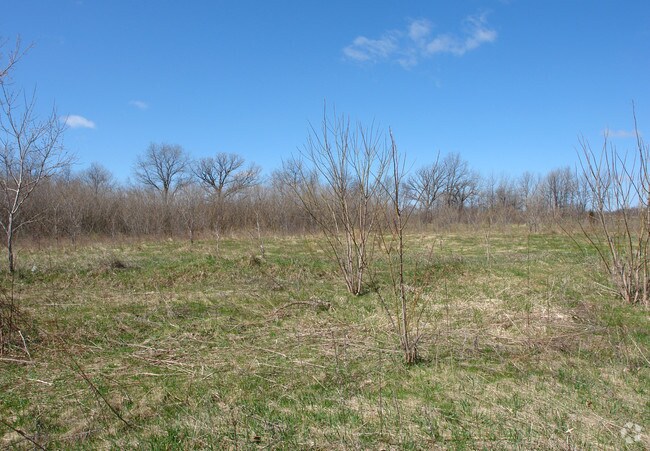
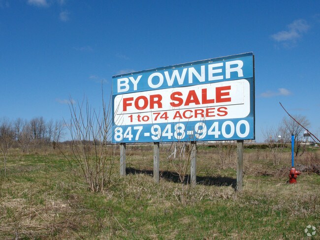
Property Record
120Th Ave, Bristol, WI 53104
NEARBY LISTINGS FOR SALE OR LEASE
-
-
-
-
-
-
-
No Photo
-
View all Bristol listings for sale on LoopNet.com
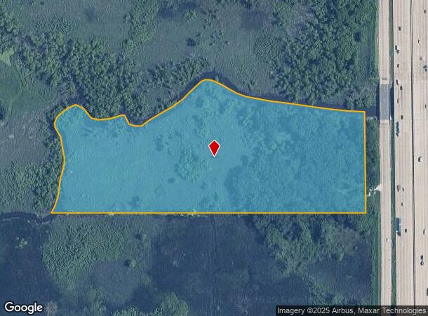
Property Detail
120Th Ave
Kenosha, WI
272-B-1 PT SE 1/4 SEC 12 T 1 R 21 BEG INT S LN 1/4 & W LN HY I-94 (315.5 FT W OF SE COR 1/4 N 419 FT TO CT DES PLAINES RIVER
37-4-121-124-0420
Kenosha
Taxexempt
Wisconsin
AE
420
55059C0187D
12 AC
2024
Kenosha East
2024
Chicago
002700
DEMOGRAPHICS near 120Th Ave
1 Mile
3 Mile
5 Mile
2024 Total Population
1,322
16,742
39,834
2029 Population
1,351
16,827
39,818
Pop Growth 2024-2029
+ 2.19%
+ 0.51%
(0.04%)
Average Age
43
39
40
2024 Total Households
545
6,394
15,454
HH Growth 2024-2029
+ 2.20%
+ 0.53%
(0.08%)
Median Household Inc
$83,080
$93,044
$84,544
Avg Household Size
2.30
2.60
2.50
2024 Avg HH Vehicles
2.00
2.00
2.00
Median Home Value
$291,010
$296,868
$277,912
Median Year Built
1992
2000
1991
Nearby Places
Map Layers
Map Styles
 Street
 Aerial
- Restaurants
- Banks
- Shops
- Fitness
- Groceries
PUBLIC TRANSPORTATION
COMMUTER RAIL
Kenosha Station (Union Pacific North Line - Northeast Illinois Regional Commuter Railroad (Metra))
DRIVE
WALK
Distance
Kenosha Station (Union Pacific North Line - Northeast Illinois Regional Commuter Railroad (Metra))
17 min
9.0 mi
AIRPORT
General Mitchell International
DRIVE
WALK
Distance
General Mitchell International
36 min
29.4 mi
Freight Ports
Port Milwaukee
DRIVE
WALK
Distance
Port Milwaukee
41 min
33.3 mi
Nearby Properties
Address
Land Use
TOTAL SIZE
Lot Size
Zoning
Address
Land Use
TOTAL SIZE
Lot Size
Zoning
1,083,094 SF
230.85 AC
Address
Land Use
TOTAL SIZE
Lot Size
Zoning
159,194 SF
136.60 AC
Address
Land Use
TOTAL SIZE
Lot Size
Zoning
75,755 SF
19.27 AC
Address
Land Use
TOTAL SIZE
Lot Size
Zoning
51,119 SF
63.71 AC
Address
Land Use
TOTAL SIZE
Lot Size
Zoning
12.53 AC
Address
Land Use
TOTAL SIZE
Lot Size
Zoning
176,386 SF
58.38 AC
Address
Land Use
TOTAL SIZE
Lot Size
Zoning
108,727 SF
67.52 AC
Address
Land Use
TOTAL SIZE
Lot Size
Zoning
12,876 SF
30.13 AC
Address
Land Use
TOTAL SIZE
Lot Size
Zoning
38,201 SF
16 AC
Address
Land Use
TOTAL SIZE
Lot Size
Zoning
424,072 SF
29.14 AC
Address
Land Use
TOTAL SIZE
Lot Size
Zoning
16.01 AC
Address
Land Use
TOTAL SIZE
Lot Size
Zoning
12,794 SF
16.75 AC
Address
Land Use
TOTAL SIZE
Lot Size
Zoning
77,776 SF
36.16 AC
Address
Land Use
TOTAL SIZE
Lot Size
Zoning
27.77 AC
Address
Land Use
TOTAL SIZE
Lot Size
Zoning
418,036 SF
25.33 AC
Address
Land Use
TOTAL SIZE
Lot Size
Zoning
47.82 AC
Address
Land Use
TOTAL SIZE
Lot Size
Zoning
447,200 SF
23.50 AC
Address
Land Use
TOTAL SIZE
Lot Size
Zoning
396,508 SF
21.72 AC
Address
Land Use
TOTAL SIZE
Lot Size
Zoning
626,520 SF
35.19 AC
M2
Address
Land Use
TOTAL SIZE
Lot Size
Zoning
13.10 AC
Address
Land Use
TOTAL SIZE
Lot Size
Zoning
20.33 AC
M2
Address
Land Use
TOTAL SIZE
Lot Size
Zoning
31,809 SF
11.36 AC
BASE
Address
Land Use
TOTAL SIZE
Lot Size
Zoning
50,145 SF
12.76 AC
Address
Land Use
TOTAL SIZE
Lot Size
Zoning
4,643 SF
60 AC
Address
Land Use
TOTAL SIZE
Lot Size
Zoning
21.62 AC
Address
Land Use
TOTAL SIZE
Lot Size
Zoning
314,505 SF
19.30 AC
Address
Land Use
TOTAL SIZE
Lot Size
Zoning
55,140 SF
21 AC
FW
Address
Land Use
TOTAL SIZE
Lot Size
Zoning
48,284 SF
4.99 AC
Address
Land Use
TOTAL SIZE
Lot Size
Zoning
31.07 AC
Address
Land Use
TOTAL SIZE
Lot Size
Zoning
2,963 SF
13.16 AC
The World's #1 Commercial Real Estate Marketplace
Connect with us
© 2026 CoStar Group
The information above has been obtained from sources believed reliable. While we do not doubt its accuracy we have not verified it and make no guarantee, warranty or representation about it. It is your responsibility to independently confirm its accuracy and completeness. Any projections, opinions, assumptions, or estimates used are for example only and do not represent the current or future performance of the property. The value of this transaction to you depends on tax and other factors which should be evaluated by your tax, financial, and legal advisors. You and your advisors should conduct a careful, independent investigation of the property to determine to your satisfaction the suitability of the property for your needs.