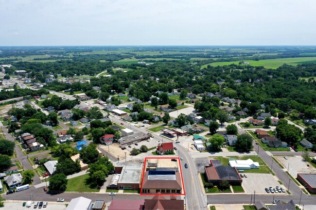
Property Record
121 E 9Th St, Trenton, MO 64683


Property Detail
121 E 9Th St
110420010500500
COM AT SE COR OF BLK 49 OF THE ORIGINAL TOWN OF TRENTON TH NELY 102 ALONG MONROE ST TH NWLY PARALLEL WITH 9TH ST 205 T SEE DE
Taxexempt
Grundy
0
Missouri
2025
0.48 AC
960300
Missouri North Area
7,425 SF
Other Market Areas
NEARBY LISTINGS FOR SALE OR LEASE
DEMOGRAPHICS near 121 E 9Th St
1 mile
3 mile
5 mile
2025 Total Population
4,135
5,880
6,458
2030 Population
4,185
5,887
6,461
Pop Growth 2025-2030
+ 1.21%
+ 0.12%
+ 0.05%
Average Age
41
42
42
2025 Total Households
1,766
2,509
2,734
HH Growth 2025-2030
+ 1.19%
+ 0.16%
+ 0.07%
Median Household Inc
$47,241
$50,521
$51,571
Avg Household Size
2.20
2.20
2.20
2025 Avg HH Vehicles
2.00
2.00
2.00
Median Home Value
$90,172
$99,935
$103,772
Median Year Built
1962
1964
1964
Nearby Places
Map Layers
Map Styles
 Street
 Aerial
Transit
 Traffic
 Biking
Places
Listings with unknown addresses are not visible on the map
- Restaurants
- Banks
- Shops
- Fitness
- Groceries
SALE & LEASE HISTORY
LISTING DATE
SALE/LEASE

Apr 13, 2020
For Sale
Nearby Properties
Address
Land Use
TOTAL SIZE
Lot Size
Zoning
Address
Land Use
TOTAL SIZE
Lot Size
Zoning
163,344 SF
21.68 AC
Address
Land Use
TOTAL SIZE
Lot Size
Zoning
39,504 SF
5.24 AC
Address
Land Use
TOTAL SIZE
Lot Size
Zoning
72,000 SF
35.40 AC
Address
Land Use
TOTAL SIZE
Lot Size
Zoning
16,200 SF
5.65 AC
Address
Land Use
TOTAL SIZE
Lot Size
Zoning
36,000 SF
9 AC
Address
Land Use
TOTAL SIZE
Lot Size
Zoning
2,488 SF
6.35 AC
Address
Land Use
TOTAL SIZE
Lot Size
Zoning
24,192 SF
2.32 AC
Address
Land Use
TOTAL SIZE
Lot Size
Zoning
2,201 SF
4.41 AC
Address
Land Use
TOTAL SIZE
Lot Size
Zoning
9,230 SF
3.03 AC
Address
Land Use
TOTAL SIZE
Lot Size
Zoning
15,779 SF
1.85 AC
Address
Land Use
TOTAL SIZE
Lot Size
Zoning
6,120 SF
0.46 AC
Address
Land Use
TOTAL SIZE
Lot Size
Zoning
6,595 SF
1.91 AC
Address
Land Use
TOTAL SIZE
Lot Size
Zoning
29,636 SF
28.20 AC
Address
Land Use
TOTAL SIZE
Lot Size
Zoning
4,027 SF
0.32 AC
Address
Land Use
TOTAL SIZE
Lot Size
Zoning
24,547 SF
2.83 AC
Address
Land Use
TOTAL SIZE
Lot Size
Zoning
2,808 SF
0.41 AC
Address
Land Use
TOTAL SIZE
Lot Size
Zoning
7,465 SF
1.25 AC
Address
Land Use
TOTAL SIZE
Lot Size
Zoning
17,250 SF
5.28 AC
Address
Land Use
TOTAL SIZE
Lot Size
Zoning
42,918 SF
1.07 AC
Address
Land Use
TOTAL SIZE
Lot Size
Zoning
11,670 SF
1.60 AC
Address
Land Use
TOTAL SIZE
Lot Size
Zoning
3,000 SF
8.90 AC
Address
Land Use
TOTAL SIZE
Lot Size
Zoning
12,700 SF
3.37 AC
Address
Land Use
TOTAL SIZE
Lot Size
Zoning
2,732 SF
0.83 AC
Address
Land Use
TOTAL SIZE
Lot Size
Zoning
6,202 SF
0.28 AC
Address
Land Use
TOTAL SIZE
Lot Size
Zoning
10,448 SF
65.03 AC
Address
Land Use
TOTAL SIZE
Lot Size
Zoning
20,320 SF
2 AC
Address
Land Use
TOTAL SIZE
Lot Size
Zoning
30,574 SF
1.26 AC
Address
Land Use
TOTAL SIZE
Lot Size
Zoning
200 SF
6 AC
Address
Land Use
TOTAL SIZE
Lot Size
Zoning
1,834 SF
2.62 AC
The World's #1 Commercial Real Estate Marketplace
Connect with us
© 2026 CoStar Group
The information above has been obtained from sources believed reliable. While we do not doubt its accuracy we have not verified it and make no guarantee, warranty or representation about it. It is your responsibility to independently confirm its accuracy and completeness. Any projections, opinions, assumptions, or estimates used are for example only and do not represent the current or future performance of the property. The value of this transaction to you depends on tax and other factors which should be evaluated by your tax, financial, and legal advisors. You and your advisors should conduct a careful, independent investigation of the property to determine to your satisfaction the suitability of the property for your needs.