Property Record
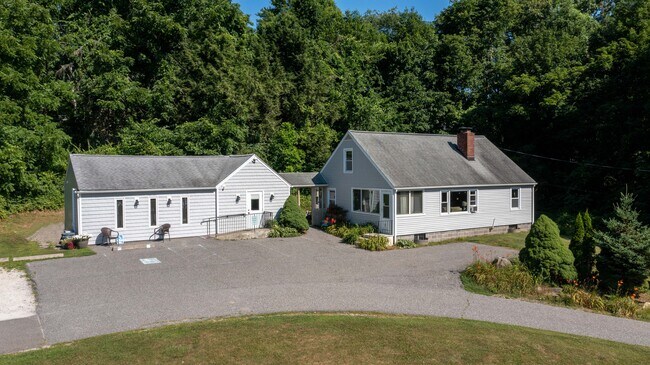
121 Litchfield Rd, New Milford, CT 06776


NEARBY LISTINGS FOR SALE OR LEASE
Property Detail
121 Litchfield Rd
Torrington, CT
Litchfield
NMIL-000057-000000-000102
Connecticut
Commercialofficeresidentialmixeduse
102
2025
1.20 AC
2025
New Milford/SW Litchfield
253100
Hartford
DEMOGRAPHICS near 121 Litchfield Rd
1 mile
3 mile
5 mile
2024 Total Population
2,061
13,833
25,120
2029 Population
2,051
13,778
25,091
Pop Growth 2024-2029
(0.49%)
(0.40%)
(0.12%)
Average Age
43
43
43
2024 Total Households
805
5,415
9,913
HH Growth 2024-2029
(0.62%)
(0.44%)
(0.12%)
Median Household Inc
$98,504
$87,085
$94,576
Avg Household Size
2.50
2.50
2.50
2024 Avg HH Vehicles
2.00
2.00
2.00
Median Home Value
$347,004
$351,754
$365,430
Median Year Built
1972
1974
1974
Nearby Places
Map Layers
Map Styles
 Street
 Aerial
Transit
 Traffic
 Biking
Places
Listings with unknown addresses are not visible on the map
- Restaurants
- Banks
- Shops
- Fitness
- Groceries
PUBLIC TRANSPORTATION
AIRPORT
Tweed/New Haven
Drive
Walk
Distance
Tweed/New Haven
75 min
47.6 mi
Freight Ports
Port of New Haven
Drive
Walk
Distance
Port of New Haven
69 min
45.4 mi
SALE & LEASE HISTORY
LISTING DATE
SALE/LEASE

Oct 24, 2022
For Sale
Nearby Properties
Address
Land Use
TOTAL SIZE
Lot Size
Zoning
Address
Land Use
TOTAL SIZE
Lot Size
Zoning
6.13 AC
R8
Address
Land Use
TOTAL SIZE
Lot Size
Zoning
1,643 SF
69.12 AC
R40
Address
Land Use
TOTAL SIZE
Lot Size
Zoning
41.87 AC
R40/B1
Address
Land Use
TOTAL SIZE
Lot Size
Zoning
153,713 SF
53.82 AC
R40
Address
Land Use
TOTAL SIZE
Lot Size
Zoning
79,524 SF
38.54 AC
R40
Address
Land Use
TOTAL SIZE
Lot Size
Zoning
7.61 AC
BI
Address
Land Use
TOTAL SIZE
Lot Size
Zoning
51,277 SF
12.31 AC
R40
Address
Land Use
TOTAL SIZE
Lot Size
Zoning
3,620 SF
39.39 AC
R-1
Address
Land Use
TOTAL SIZE
Lot Size
Zoning
2,800 SF
64.14 AC
R-1
Address
Land Use
TOTAL SIZE
Lot Size
Zoning
54.80 AC
R-1
Address
Land Use
TOTAL SIZE
Lot Size
Zoning
22,345 SF
0.76 AC
VC
Address
Land Use
TOTAL SIZE
Lot Size
Zoning
4.46 AC
RM
Address
Land Use
TOTAL SIZE
Lot Size
Zoning
6,932 SF
15.23 AC
R-1
Address
Land Use
TOTAL SIZE
Lot Size
Zoning
9,000 SF
342.45 AC
I/R40
Address
Land Use
TOTAL SIZE
Lot Size
Zoning
6,351 SF
14.91 AC
R-1
Address
Land Use
TOTAL SIZE
Lot Size
Zoning
43,828 SF
1.29 AC
R8
Address
Land Use
TOTAL SIZE
Lot Size
Zoning
7,803 SF
13.39 AC
R-1
Address
Land Use
TOTAL SIZE
Lot Size
Zoning
6.90 AC
B1
Address
Land Use
TOTAL SIZE
Lot Size
Zoning
10.04 AC
I
Address
Land Use
TOTAL SIZE
Lot Size
Zoning
12,916 SF
1.86 AC
B1
Address
Land Use
TOTAL SIZE
Lot Size
Zoning
14 AC
B1
Address
Land Use
TOTAL SIZE
Lot Size
Zoning
14.04 AC
R40
Address
Land Use
TOTAL SIZE
Lot Size
Zoning
45,942 SF
3.17 AC
B1
Address
Land Use
TOTAL SIZE
Lot Size
Zoning
1,446 SF
5.22 AC
I
Address
Land Use
TOTAL SIZE
Lot Size
Zoning
42,324 SF
3.10 AC
MR
Address
Land Use
TOTAL SIZE
Lot Size
Zoning
31,044 SF
4.63 AC
R20
Address
Land Use
TOTAL SIZE
Lot Size
Zoning
26.32 AC
R40
Address
Land Use
TOTAL SIZE
Lot Size
Zoning
12.97 AC
R-1
Address
Land Use
TOTAL SIZE
Lot Size
Zoning
5,992 SF
15.80 AC
R-1
Address
Land Use
TOTAL SIZE
Lot Size
Zoning
4,802 SF
7.01 AC
R-1
The World's #1 Commercial Real Estate Marketplace
Connect with us
© 2026 CoStar Group
The information above has been obtained from sources believed reliable. While we do not doubt its accuracy we have not verified it and make no guarantee, warranty or representation about it. It is your responsibility to independently confirm its accuracy and completeness. Any projections, opinions, assumptions, or estimates used are for example only and do not represent the current or future performance of the property. The value of this transaction to you depends on tax and other factors which should be evaluated by your tax, financial, and legal advisors. You and your advisors should conduct a careful, independent investigation of the property to determine to your satisfaction the suitability of the property for your needs.