Property Record
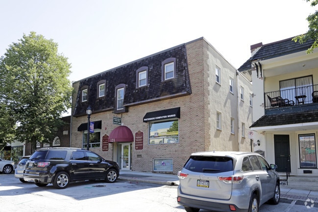
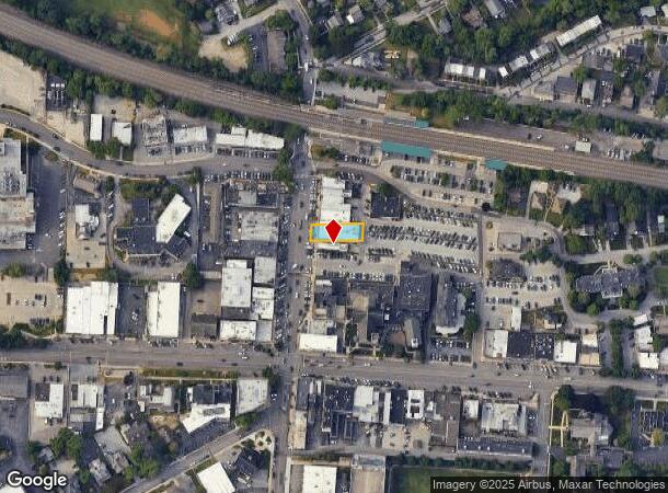
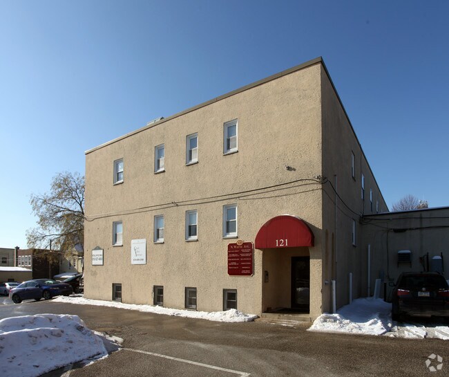
121 N Wayne Ave, Wayne, PA 19087
Property Detail
121 N Wayne Ave
36-01-00592-00
Jeanette Parks
Restaurantbuilding
3 STY OFF BLDG 49.59 X 140
X
Delaware
42029C0170G
Pennsylvania
2024
0.15 AC
2025
Upper Main Line
409803
Philadelphia
16,122 SF
Philadelphia-Camden-Wilmington, PA-NJ-DE-MD
NEARBY LISTINGS FOR SALE OR LEASE
DEMOGRAPHICS near 121 N Wayne Ave
1 mile
3 mile
5 mile
2024 Total Population
11,578
60,330
167,628
2029 Population
11,724
61,717
171,045
Pop Growth 2024-2029
+ 1.26%
+ 2.30%
+ 2.04%
Average Age
37
39
40
2024 Total Households
3,833
21,110
64,702
HH Growth 2024-2029
+ 1.62%
+ 2.85%
+ 2.32%
Median Household Inc
$144,224
$139,528
$124,621
Avg Household Size
2.50
2.50
2.40
2024 Avg HH Vehicles
2.00
2.00
2.00
Median Home Value
$811,715
$732,454
$585,997
Median Year Built
1960
1966
1968
Nearby Places
Map Layers
Map Styles
 Street
 Aerial
Transit
 Traffic
 Biking
Places
Listings with unknown addresses are not visible on the map
- Restaurants
- Banks
- Shops
- Fitness
- Groceries
PUBLIC TRANSPORTATION
COMMUTER RAIL
Wayne (R5 - Southeastern Pennsylvania Transportation Authority Regional Rail (SEPTA Regional Rail))
Drive
Walk
Distance
Wayne (R5 - Southeastern Pennsylvania Transportation Authority Regional Rail (SEPTA Regional Rail))
0 min
1 min
0.1 mi
St. Davids (R5 - Southeastern Pennsylvania Transportation Authority Regional Rail (SEPTA Regional Rail))
Drive
Walk
Distance
St. Davids (R5 - Southeastern Pennsylvania Transportation Authority Regional Rail (SEPTA Regional Rail))
3 min
17 min
0.9 mi
AIRPORT
Philadelphia International
Drive
Walk
Distance
Philadelphia International
33 min
20.7 mi
Freight Ports
South Jersey Port
Drive
Walk
Distance
South Jersey Port
36 min
22.3 mi
SALE & LEASE HISTORY
LISTING DATE
SALE/LEASE

Sep 25, 2016
For Lease
Sep 11, 2017
For Lease
Oct 06, 2020
For Lease
Nearby Properties
Address
Land Use
TOTAL SIZE
Lot Size
Zoning
Address
Land Use
TOTAL SIZE
Lot Size
Zoning
2,373,472 SF
96.77 AC
SC
Address
Land Use
TOTAL SIZE
Lot Size
Zoning
703,572 SF
159 AC
Address
Land Use
TOTAL SIZE
Lot Size
Zoning
10.50 AC
Address
Land Use
TOTAL SIZE
Lot Size
Zoning
222,980 SF
57.68 AC
Address
Land Use
TOTAL SIZE
Lot Size
Zoning
398,844 SF
21.89 AC
Address
Land Use
TOTAL SIZE
Lot Size
Zoning
45,871 SF
112 AC
Address
Land Use
TOTAL SIZE
Lot Size
Zoning
628,694 SF
6.89 AC
AG
Address
Land Use
TOTAL SIZE
Lot Size
Zoning
649,339 SF
3.69 AC
AG
Address
Land Use
TOTAL SIZE
Lot Size
Zoning
254,781 SF
14.62 AC
Address
Land Use
TOTAL SIZE
Lot Size
Zoning
325,016 SF
1.62 AC
P
Address
Land Use
TOTAL SIZE
Lot Size
Zoning
137,282 SF
14.33 AC
Address
Land Use
TOTAL SIZE
Lot Size
Zoning
546,664 SF
2.83 AC
AG
Address
Land Use
TOTAL SIZE
Lot Size
Zoning
92,337 SF
7.30 AC
Address
Land Use
TOTAL SIZE
Lot Size
Zoning
872,232 SF
51.99 AC
G
Address
Land Use
TOTAL SIZE
Lot Size
Zoning
583,559 SF
AG
Address
Land Use
TOTAL SIZE
Lot Size
Zoning
214,714 SF
22.23 AC
R1
Address
Land Use
TOTAL SIZE
Lot Size
Zoning
260,938 SF
9.81 AC
SM1
Address
Land Use
TOTAL SIZE
Lot Size
Zoning
311,353 SF
7.41 AC
SM1
Address
Land Use
TOTAL SIZE
Lot Size
Zoning
414,642 SF
3.70 AC
AG
Address
Land Use
TOTAL SIZE
Lot Size
Zoning
322,236 SF
50.80 AC
Address
Land Use
TOTAL SIZE
Lot Size
Zoning
322,736 SF
22 AC
LI
Address
Land Use
TOTAL SIZE
Lot Size
Zoning
30,787 SF
30.50 AC
Address
Land Use
TOTAL SIZE
Lot Size
Zoning
114,121 SF
16.80 AC
LI
Address
Land Use
TOTAL SIZE
Lot Size
Zoning
29,364 SF
21.90 AC
Address
Land Use
TOTAL SIZE
Lot Size
Zoning
193,290 SF
8.34 AC
Address
Land Use
TOTAL SIZE
Lot Size
Zoning
6,210 SF
17.16 AC
Address
Land Use
TOTAL SIZE
Lot Size
Zoning
33,000 SF
1 AC
Address
Land Use
TOTAL SIZE
Lot Size
Zoning
799,754 SF
27.10 AC
R4
Address
Land Use
TOTAL SIZE
Lot Size
Zoning
159,248 SF
23.13 AC
Address
Land Use
TOTAL SIZE
Lot Size
Zoning
123,862 SF
12.97 AC
AG
The World's #1 Commercial Real Estate Marketplace
Connect with us
© 2026 CoStar Group
The information above has been obtained from sources believed reliable. While we do not doubt its accuracy we have not verified it and make no guarantee, warranty or representation about it. It is your responsibility to independently confirm its accuracy and completeness. Any projections, opinions, assumptions, or estimates used are for example only and do not represent the current or future performance of the property. The value of this transaction to you depends on tax and other factors which should be evaluated by your tax, financial, and legal advisors. You and your advisors should conduct a careful, independent investigation of the property to determine to your satisfaction the suitability of the property for your needs.