Property Record
121 Northshore Cir, Slidell, LA 70458
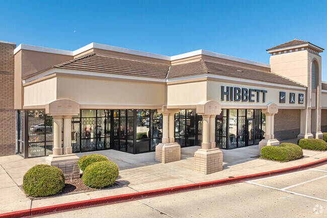

Property Detail
121 Northshore Cir
Slidell-Mandeville-Covington, LA
SEC 37 38 8 14 NORTHSHORE LT1A 1B
91613
ST TAMMANY
Commercialnec
Louisiana
2025
1b
2025
0.88 AC
040900
Slidell
144,638 SF
New Orleans/Metairie/Kenner
NEARBY LISTINGS FOR SALE OR LEASE
DEMOGRAPHICS near 121 Northshore Cir
1 mile
3 mile
5 mile
2025 Total Population
1,714
21,667
58,257
2030 Population
1,773
22,373
60,006
Pop Growth 2025-2030
+ 3.44%
+ 3.26%
+ 3.00%
Average Age
40
40
41
2025 Total Households
666
8,288
22,539
HH Growth 2025-2030
+ 3.45%
+ 3.33%
+ 3.07%
Median Household Inc
$70,644
$66,411
$66,124
Avg Household Size
2.50
2.50
2.50
2025 Avg HH Vehicles
2.00
2.00
2.00
Median Home Value
$193,249
$199,148
$211,610
Median Year Built
1991
1988
1984
Nearby Places
Map Layers
Map Styles
 Street
 Aerial
Layers
 Traffic
 Biking
Places
Listings with unknown addresses are not visible on the map
- Restaurants
- Banks
- Shops
- Fitness
- Groceries
PUBLIC TRANSPORTATION
COMMUTER RAIL
Slidell Amtrak Station (Crescent - Amtrak)
Drive
Walk
Distance
Slidell Amtrak Station (Crescent - Amtrak)
6 min
3.8 mi
Freight Ports
Port of New Orleans
Drive
Walk
Distance
Port of New Orleans
54 min
38.9 mi
Nearby Properties
Address
Land Use
TOTAL SIZE
Lot Size
Zoning
Address
Land Use
TOTAL SIZE
Lot Size
Zoning
192,685 SF
Address
Land Use
TOTAL SIZE
Lot Size
Zoning
208,769 SF
1 AC
Address
Land Use
TOTAL SIZE
Lot Size
Zoning
157,561 SF
10.06 AC
Address
Land Use
TOTAL SIZE
Lot Size
Zoning
137,402 SF
76.02 AC
Address
Land Use
TOTAL SIZE
Lot Size
Zoning
137,402 SF
52.77 AC
Address
Land Use
TOTAL SIZE
Lot Size
Zoning
67,517 SF
0.89 AC
Address
Land Use
TOTAL SIZE
Lot Size
Zoning
63,135 SF
12.49 AC
Address
Land Use
TOTAL SIZE
Lot Size
Zoning
1,940 SF
1.77 AC
Address
Land Use
TOTAL SIZE
Lot Size
Zoning
54,188 SF
1.50 AC
Address
Land Use
TOTAL SIZE
Lot Size
Zoning
131,548 SF
1 AC
Address
Land Use
TOTAL SIZE
Lot Size
Zoning
137,759 SF
1 AC
Address
Land Use
TOTAL SIZE
Lot Size
Zoning
108,003 SF
2.59 AC
Address
Land Use
TOTAL SIZE
Lot Size
Zoning
184,551 SF
20 AC
Address
Land Use
TOTAL SIZE
Lot Size
Zoning
116,077 SF
9.14 AC
Address
Land Use
TOTAL SIZE
Lot Size
Zoning
115,776 SF
7.50 AC
Address
Land Use
TOTAL SIZE
Lot Size
Zoning
66,130 SF
3 AC
Address
Land Use
TOTAL SIZE
Lot Size
Zoning
182,734 SF
38.95 AC
Address
Land Use
TOTAL SIZE
Lot Size
Zoning
78,962 SF
4.89 AC
Address
Land Use
TOTAL SIZE
Lot Size
Zoning
1,729 SF
1.22 AC
Address
Land Use
TOTAL SIZE
Lot Size
Zoning
26,634 SF
1.06 AC
Address
Land Use
TOTAL SIZE
Lot Size
Zoning
125,178 SF
12.38 AC
Address
Land Use
TOTAL SIZE
Lot Size
Zoning
68,284 SF
7.20 AC
Address
Land Use
TOTAL SIZE
Lot Size
Zoning
30,002 SF
3.41 AC
Address
Land Use
TOTAL SIZE
Lot Size
Zoning
97,161 SF
11.53 AC
Address
Land Use
TOTAL SIZE
Lot Size
Zoning
76,594 SF
7.50 AC
Address
Land Use
TOTAL SIZE
Lot Size
Zoning
34,159 SF
1.34 AC
Address
Land Use
TOTAL SIZE
Lot Size
Zoning
32,375 SF
27.60 AC
Address
Land Use
TOTAL SIZE
Lot Size
Zoning
51,986 SF
10.56 AC
Address
Land Use
TOTAL SIZE
Lot Size
Zoning
41,989 SF
3.48 AC
The World's #1 Commercial Real Estate Marketplace
Connect with us
© 2026 CoStar Group
The information above has been obtained from sources believed reliable. While we do not doubt its accuracy we have not verified it and make no guarantee, warranty or representation about it. It is your responsibility to independently confirm its accuracy and completeness. Any projections, opinions, assumptions, or estimates used are for example only and do not represent the current or future performance of the property. The value of this transaction to you depends on tax and other factors which should be evaluated by your tax, financial, and legal advisors. You and your advisors should conduct a careful, independent investigation of the property to determine to your satisfaction the suitability of the property for your needs.