Property Record
121 Plain St, Hopedale, MA 01747


Property Detail
121 Plain St
HOPE-000022-000032-000017
WORCESTER
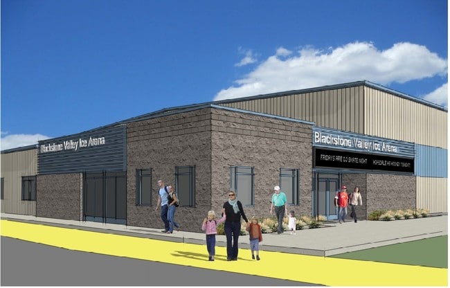
Skatingrink
Massachusetts
LI
17
AE The base floodplain where base flood elevations are provided. AE Zones are now used on new format FIRMs instead of A1-A30 Zones.
7.66 AC
2025
Outlying Worcester
2025
Boston
745100
Worcester, MA
32,152 SF
NEARBY LISTINGS FOR SALE OR LEASE
DEMOGRAPHICS near 121 Plain St
1 mile
3 mile
5 mile
2025 Total Population
1,917
31,115
72,807
2030 Population
1,973
31,873
74,765
Pop Growth 2025-2030
+ 2.92%
+ 2.44%
+ 2.69%
Average Age
41
41
42
2025 Total Households
658
11,909
27,314
HH Growth 2025-2030
+ 3.04%
+ 2.56%
+ 2.78%
Median Household Inc
$150,909
$98,091
$114,708
Avg Household Size
2.90
2.60
2.60
2025 Avg HH Vehicles
2.00
2.00
2.00
Median Home Value
$668,903
$480,166
$511,102
Median Year Built
1986
1970
1976
Nearby Places
Map Layers
Map Styles
 Street
 Aerial
Layers
 Traffic
 Biking
Places
Listings with unknown addresses are not visible on the map
- Restaurants
- Banks
- Shops
- Fitness
- Groceries
PUBLIC TRANSPORTATION
COMMUTER RAIL
Forge Park/Route 495 (Franklin Line - Massachusetts Bay Transportation Authority Commuter Rail (Purple Line))
Drive
Walk
Distance
Forge Park/Route 495 (Franklin Line - Massachusetts Bay Transportation Authority Commuter Rail (Purple Line))
11 min
5.7 mi
Franklin (Franklin Line - Massachusetts Bay Transportation Authority Commuter Rail (Purple Line))
Drive
Walk
Distance
Franklin (Franklin Line - Massachusetts Bay Transportation Authority Commuter Rail (Purple Line))
14 min
7.4 mi
AIRPORT
Worcester Regional
Drive
Walk
Distance
Worcester Regional
48 min
28.1 mi
Rhode Island Tf Green International
Drive
Walk
Distance
Rhode Island Tf Green International
49 min
31.6 mi
General Edward Lawrence Logan International
Drive
Walk
Distance
General Edward Lawrence Logan International
63 min
44.9 mi
Freight Ports
Port of Boston
Drive
Walk
Distance
Port of Boston
61 min
43.2 mi
Nearby Properties
Address
Land Use
TOTAL SIZE
Lot Size
Zoning
Address
Land Use
TOTAL SIZE
Lot Size
Zoning
322,615 SF
17.33 AC
SUBN
Address
Land Use
TOTAL SIZE
Lot Size
Zoning
204,879 SF
12.44 AC
OR
Address
Land Use
TOTAL SIZE
Lot Size
Zoning
616,875 SF
141 AC
LI
Address
Land Use
TOTAL SIZE
Lot Size
Zoning
183,839 SF
39.29 AC
IND
Address
Land Use
TOTAL SIZE
Lot Size
Zoning
231,817 SF
35.01 AC
IND
Address
Land Use
TOTAL SIZE
Lot Size
Zoning
24.81 AC
IB
Address
Land Use
TOTAL SIZE
Lot Size
Zoning
238,975 SF
33.82 AC
IND
Address
Land Use
TOTAL SIZE
Lot Size
Zoning
75,140 SF
39.40 AC
Address
Land Use
TOTAL SIZE
Lot Size
Zoning
27.32 AC
IB
Address
Land Use
TOTAL SIZE
Lot Size
Zoning
347,012 SF
29.23 AC
IB
Address
Land Use
TOTAL SIZE
Lot Size
Zoning
96,433 SF
5.40 AC
RB
Address
Land Use
TOTAL SIZE
Lot Size
Zoning
120,327 SF
28.75 AC
BUS2
Address
Land Use
TOTAL SIZE
Lot Size
Zoning
16.50 AC
RA
Address
Land Use
TOTAL SIZE
Lot Size
Zoning
7.36 AC
RA
Address
Land Use
TOTAL SIZE
Lot Size
Zoning
19.14 AC
IB
Address
Land Use
TOTAL SIZE
Lot Size
Zoning
113,044 SF
71.52 AC
B
Address
Land Use
TOTAL SIZE
Lot Size
Zoning
165,132 SF
24.49 AC
IN3
Address
Land Use
TOTAL SIZE
Lot Size
Zoning
106.49 AC
IB
Address
Land Use
TOTAL SIZE
Lot Size
Zoning
272,941 SF
34.05 AC
IB
Address
Land Use
TOTAL SIZE
Lot Size
Zoning
66,430 SF
10.19 AC
T
Address
Land Use
TOTAL SIZE
Lot Size
Zoning
11 AC
IB
Address
Land Use
TOTAL SIZE
Lot Size
Zoning
111,100 SF
17.98 AC
IND
Address
Land Use
TOTAL SIZE
Lot Size
Zoning
7.80 AC
IB
Address
Land Use
TOTAL SIZE
Lot Size
Zoning
115,908 SF
58.86 AC
IND
Address
Land Use
TOTAL SIZE
Lot Size
Zoning
167,299 SF
9.07 AC
IB
Address
Land Use
TOTAL SIZE
Lot Size
Zoning
7.47 AC
CC
Address
Land Use
TOTAL SIZE
Lot Size
Zoning
128,693 SF
28.30 AC
Address
Land Use
TOTAL SIZE
Lot Size
Zoning
5.28 AC
IB
Address
Land Use
TOTAL SIZE
Lot Size
Zoning
115,225 SF
10.79 AC
M
Address
Land Use
TOTAL SIZE
Lot Size
Zoning
62,920 SF
7.20 AC
RA
The World's #1 Commercial Real Estate Marketplace
Connect with us
© 2026 CoStar Group
The information above has been obtained from sources believed reliable. While we do not doubt its accuracy we have not verified it and make no guarantee, warranty or representation about it. It is your responsibility to independently confirm its accuracy and completeness. Any projections, opinions, assumptions, or estimates used are for example only and do not represent the current or future performance of the property. The value of this transaction to you depends on tax and other factors which should be evaluated by your tax, financial, and legal advisors. You and your advisors should conduct a careful, independent investigation of the property to determine to your satisfaction the suitability of the property for your needs.