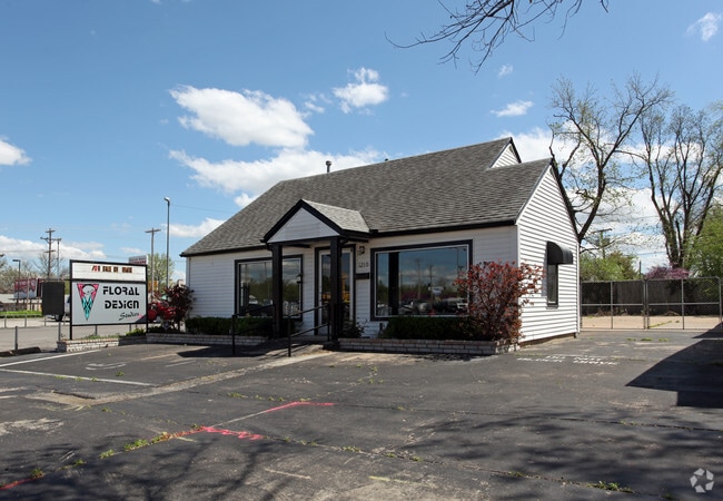
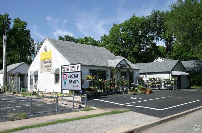
Property Record
1210 E 41St St, Tulsa, OK 74105
NEARBY LISTINGS FOR SALE OR LEASE
Property Detail
1210 E 41St St
Tulsa, OK
Alta Dena Place
01650-92-25-00740
E48 OF LTS 1 & 2 BLK 4
Officebuilding
Tulsa
X
Oklahoma
40143C0351L
1
0
0.13 AC
2025
MidTown Tulsa
005001
Tulsa
873 SF
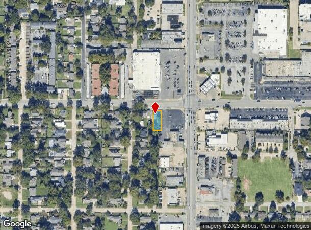
DEMOGRAPHICS near 1210 E 41St St
1 Mile
3 Mile
5 Mile
2024 Total Population
9,226
76,529
198,386
2029 Population
9,571
79,474
206,236
Pop Growth 2024-2029
+ 3.74%
+ 3.85%
+ 3.96%
Average Age
41
41
39
2024 Total Households
4,840
37,538
89,365
HH Growth 2024-2029
+ 3.74%
+ 3.94%
+ 4.07%
Median Household Inc
$70,522
$56,457
$53,075
Avg Household Size
1.90
2.00
2.10
2024 Avg HH Vehicles
2.00
2.00
2.00
Median Home Value
$262,557
$261,556
$191,741
Median Year Built
1957
1962
1966
Nearby Places
Map Layers
Map Styles
 Street
 Aerial
- Restaurants
- Banks
- Shops
- Fitness
- Groceries
PUBLIC TRANSPORTATION
AIRPORT
Tulsa International
DRIVE
WALK
Distance
Tulsa International
22 min
12.5 mi
Freight Ports
Tulsa Port Of Catoosa
DRIVE
WALK
Distance
Tulsa Port Of Catoosa
29 min
21.1 mi
Nearby Properties
Address
Land Use
TOTAL SIZE
Lot Size
Zoning
Address
Land Use
TOTAL SIZE
Lot Size
Zoning
1,303,210 SF
7.94 AC
OH
Address
Land Use
TOTAL SIZE
Lot Size
Zoning
431,569 SF
39.02 AC
RM2
Address
Land Use
TOTAL SIZE
Lot Size
Zoning
247,806 SF
8.40 AC
RS3
Address
Land Use
TOTAL SIZE
Lot Size
Zoning
49,992 SF
33.23 AC
AG
Address
Land Use
TOTAL SIZE
Lot Size
Zoning
110,922 SF
1.59 AC
RM2
Address
Land Use
TOTAL SIZE
Lot Size
Zoning
114,791 SF
23.40 AC
RE
Address
Land Use
TOTAL SIZE
Lot Size
Zoning
238,884 SF
38.79 AC
RS2
Address
Land Use
TOTAL SIZE
Lot Size
Zoning
310,629 SF
19.19 AC
OM
Address
Land Use
TOTAL SIZE
Lot Size
Zoning
290,963 SF
10.77 AC
RM1
Address
Land Use
TOTAL SIZE
Lot Size
Zoning
303 SF
33.64 AC
RS2
Address
Land Use
TOTAL SIZE
Lot Size
Zoning
266,675 SF
12.31 AC
RM1
Address
Land Use
TOTAL SIZE
Lot Size
Zoning
147,881 SF
35.20 AC
RS2
Address
Land Use
TOTAL SIZE
Lot Size
Zoning
1,264,325 SF
10.72 AC
CH
Address
Land Use
TOTAL SIZE
Lot Size
Zoning
137,215 SF
5.08 AC
RM3
Address
Land Use
TOTAL SIZE
Lot Size
Zoning
88,702 SF
8.27 AC
IM
Address
Land Use
TOTAL SIZE
Lot Size
Zoning
21,693 SF
4.24 AC
Address
Land Use
TOTAL SIZE
Lot Size
Zoning
62,000 SF
7.20 AC
OM
Address
Land Use
TOTAL SIZE
Lot Size
Zoning
149,830 SF
0.83 AC
CBD
Address
Land Use
TOTAL SIZE
Lot Size
Zoning
106,743 SF
4.34 AC
MX1U55
Address
Land Use
TOTAL SIZE
Lot Size
Zoning
89,640 SF
5.47 AC
MX1U55
Address
Land Use
TOTAL SIZE
Lot Size
Zoning
100,857 SF
4.04 AC
MX1U55
Address
Land Use
TOTAL SIZE
Lot Size
Zoning
105,620 SF
2.55 AC
RM2
Address
Land Use
TOTAL SIZE
Lot Size
Zoning
132,105 SF
9.32 AC
RS3
Address
Land Use
TOTAL SIZE
Lot Size
Zoning
62,968 SF
2.32 AC
NCU
Address
Land Use
TOTAL SIZE
Lot Size
Zoning
28,953 SF
10.32 AC
RS2
Address
Land Use
TOTAL SIZE
Lot Size
Zoning
78,442 SF
31.24 AC
IM
Address
Land Use
TOTAL SIZE
Lot Size
Zoning
495,226 SF
27.47 AC
CH
Address
Land Use
TOTAL SIZE
Lot Size
Zoning
53,220 SF
4.93 AC
CH
Address
Land Use
TOTAL SIZE
Lot Size
Zoning
589,648 SF
2.84 AC
RM3
Address
Land Use
TOTAL SIZE
Lot Size
Zoning
11,349 SF
0.61 AC
RM2
The World's #1 Commercial Real Estate Marketplace
Connect with us
© 2026 CoStar Group
The information above has been obtained from sources believed reliable. While we do not doubt its accuracy we have not verified it and make no guarantee, warranty or representation about it. It is your responsibility to independently confirm its accuracy and completeness. Any projections, opinions, assumptions, or estimates used are for example only and do not represent the current or future performance of the property. The value of this transaction to you depends on tax and other factors which should be evaluated by your tax, financial, and legal advisors. You and your advisors should conduct a careful, independent investigation of the property to determine to your satisfaction the suitability of the property for your needs.