Property Record
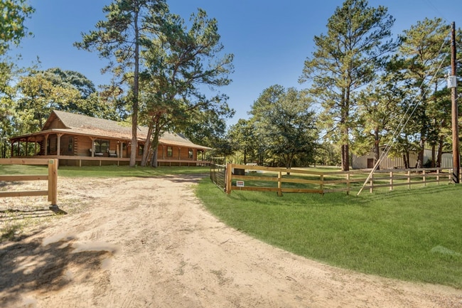
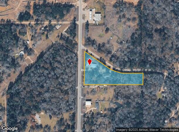
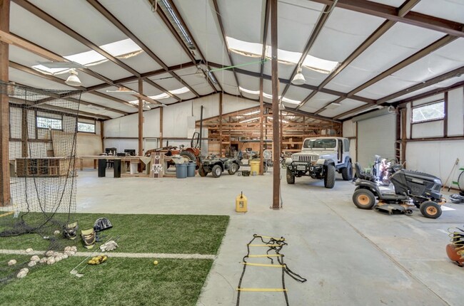
1210 Fm 1486 Rd, Magnolia, TX 77354
NEARBY LISTINGS FOR SALE OR LEASE
Property Detail
1210 Fm 1486 Rd
0396-01-01300
Niles John W
Commercialnec
A0396 - NILES JOHN W, TRACT 10-B, RES A, RES B, ACRES 3.086
X
Montgomery
48339C0475G
Texas
2024
3.09 AC
2025
Northwest Hwy 6
690300
Houston
8,444 SF
Houston-The Woodlands-Sugar Land, TX
DEMOGRAPHICS near 1210 Fm 1486 Rd
1 Mile
3 Mile
5 Mile
2024 Total Population
863
10,305
31,651
2029 Population
1,275
15,193
46,290
Pop Growth 2024-2029
+ 47.74%
+ 47.43%
+ 46.25%
Average Age
40
38
39
2024 Total Households
297
3,468
10,627
HH Growth 2024-2029
+ 48.82%
+ 48.62%
+ 47.37%
Median Household Inc
$78,571
$88,296
$91,635
Avg Household Size
2.90
2.90
2.90
2024 Avg HH Vehicles
2.00
2.00
2.00
Median Home Value
$308,511
$361,929
$381,755
Median Year Built
1997
2010
2007
Nearby Places
Map Layers
Map Styles
 Street
 Aerial
- Restaurants
- Banks
- Shops
- Fitness
- Groceries
PUBLIC TRANSPORTATION
AIRPORT
George Bush Intcntl/Houston
DRIVE
WALK
Distance
George Bush Intcntl/Houston
52 min
42.9 mi
Freight Ports
Port of Houston
DRIVE
WALK
Distance
Port of Houston
72 min
53.6 mi
SALE & LEASE HISTORY
LISTING DATE
SALE/LEASE

Jun 23, 2025
For Sale
Nearby Properties
Address
Land Use
TOTAL SIZE
Lot Size
Zoning
Address
Land Use
TOTAL SIZE
Lot Size
Zoning
415,414 SF
78.38 AC
2
Address
Land Use
TOTAL SIZE
Lot Size
Zoning
182,399 SF
33.46 AC
2
Address
Land Use
TOTAL SIZE
Lot Size
Zoning
99,363 SF
13.76 AC
2
Address
Land Use
TOTAL SIZE
Lot Size
Zoning
65,975 SF
4.83 AC
Address
Land Use
TOTAL SIZE
Lot Size
Zoning
69,902 SF
14.82 AC
2
Address
Land Use
TOTAL SIZE
Lot Size
Zoning
28,308 SF
17.40 AC
Address
Land Use
TOTAL SIZE
Lot Size
Zoning
51,482 SF
17.16 AC
2
Address
Land Use
TOTAL SIZE
Lot Size
Zoning
28,102 SF
3.15 AC
Address
Land Use
TOTAL SIZE
Lot Size
Zoning
14,820 SF
1.87 AC
2
Address
Land Use
TOTAL SIZE
Lot Size
Zoning
97,804 SF
9.46 AC
2
Address
Land Use
TOTAL SIZE
Lot Size
Zoning
59,976 SF
3.68 AC
Address
Land Use
TOTAL SIZE
Lot Size
Zoning
29,692 SF
19.28 AC
Address
Land Use
TOTAL SIZE
Lot Size
Zoning
20,301 SF
13.34 AC
2
Address
Land Use
TOTAL SIZE
Lot Size
Zoning
21,186 SF
11.62 AC
2
Address
Land Use
TOTAL SIZE
Lot Size
Zoning
72,180 SF
8.83 AC
2
Address
Land Use
TOTAL SIZE
Lot Size
Zoning
18,862 SF
20.45 AC
2
Address
Land Use
TOTAL SIZE
Lot Size
Zoning
18,900 SF
5 AC
2
Address
Land Use
TOTAL SIZE
Lot Size
Zoning
34,780 SF
11.35 AC
2
Address
Land Use
TOTAL SIZE
Lot Size
Zoning
45,676 SF
7.49 AC
Address
Land Use
TOTAL SIZE
Lot Size
Zoning
62,020 SF
5.28 AC
Address
Land Use
TOTAL SIZE
Lot Size
Zoning
8.23 AC
2
Address
Land Use
TOTAL SIZE
Lot Size
Zoning
14,287 SF
16.08 AC
Address
Land Use
TOTAL SIZE
Lot Size
Zoning
32,098 SF
7.61 AC
2
Address
Land Use
TOTAL SIZE
Lot Size
Zoning
16,928 SF
12.50 AC
Address
Land Use
TOTAL SIZE
Lot Size
Zoning
40,525 SF
5.21 AC
2
Address
Land Use
TOTAL SIZE
Lot Size
Zoning
16,656 SF
6.83 AC
2
Address
Land Use
TOTAL SIZE
Lot Size
Zoning
7,920 SF
1.95 AC
2
Address
Land Use
TOTAL SIZE
Lot Size
Zoning
23,900 SF
2.40 AC
Address
Land Use
TOTAL SIZE
Lot Size
Zoning
14,200 SF
1.50 AC
2
The World's #1 Commercial Real Estate Marketplace
Connect with us
© 2026 CoStar Group
The information above has been obtained from sources believed reliable. While we do not doubt its accuracy we have not verified it and make no guarantee, warranty or representation about it. It is your responsibility to independently confirm its accuracy and completeness. Any projections, opinions, assumptions, or estimates used are for example only and do not represent the current or future performance of the property. The value of this transaction to you depends on tax and other factors which should be evaluated by your tax, financial, and legal advisors. You and your advisors should conduct a careful, independent investigation of the property to determine to your satisfaction the suitability of the property for your needs.