Property Record
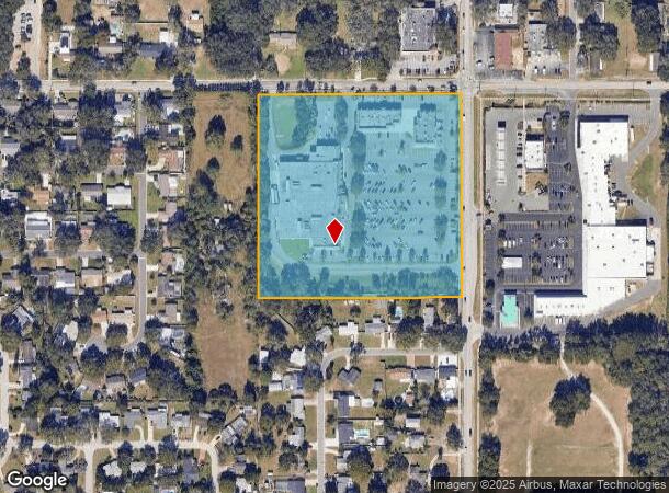
1210 Kingsway Rd, Brandon, FL 33510


NEARBY LISTINGS FOR SALE OR LEASE
Property Detail
1210 Kingsway Rd
Tampa-St. Petersburg-Clearwater, FL
Unplatted
U-14-29-20-ZZZ-000002-47160.0
NE 1/4 OF NE 1/4 OF SW 1/4 LESS R/W
Regionalshoppingcenterormallwithanchorstore
Hillsborough
X
Florida
12057C0385H
47160
2024
9.42 AC
2024
East Tampa
012303
Tampa/St Petersburg
69,036 SF
DEMOGRAPHICS near 1210 Kingsway Rd
1 Mile
3 Mile
5 Mile
2024 Total Population
12,003
87,597
187,427
2029 Population
12,969
95,393
204,294
Pop Growth 2024-2029
+ 8.05%
+ 8.90%
+ 9.00%
Average Age
41
40
39
2024 Total Households
4,292
32,468
70,793
HH Growth 2024-2029
+ 8.25%
+ 9.20%
+ 9.40%
Median Household Inc
$72,391
$66,211
$68,047
Avg Household Size
2.70
2.60
2.60
2024 Avg HH Vehicles
2.00
2.00
2.00
Median Home Value
$253,829
$261,671
$272,385
Median Year Built
1978
1987
1992
Nearby Places
Map Layers
Map Styles
 Street
 Aerial
- Restaurants
- Banks
- Shops
- Fitness
- Groceries
PUBLIC TRANSPORTATION
AIRPORT
Tampa International
DRIVE
WALK
Distance
Tampa International
34 min
21.2 mi
St Pete-Clearwater International
DRIVE
WALK
Distance
St Pete-Clearwater International
51 min
30.4 mi
Freight Ports
Port of Tampa Bay
DRIVE
WALK
Distance
Port of Tampa Bay
25 min
14.0 mi
Nearby Properties
Address
Land Use
TOTAL SIZE
Lot Size
Zoning
Address
Land Use
TOTAL SIZE
Lot Size
Zoning
868,482 SF
60.83 AC
PD
Address
Land Use
TOTAL SIZE
Lot Size
Zoning
606,551 SF
18.23 AC
PD
Address
Land Use
TOTAL SIZE
Lot Size
Zoning
501,085 SF
41.18 AC
PD
Address
Land Use
TOTAL SIZE
Lot Size
Zoning
398,440 SF
48.63 AC
IPD-1
Address
Land Use
TOTAL SIZE
Lot Size
Zoning
358,987 SF
49.16 AC
PD
Address
Land Use
TOTAL SIZE
Lot Size
Zoning
402,388 SF
34.49 AC
PD
Address
Land Use
TOTAL SIZE
Lot Size
Zoning
283,777 SF
36.66 AC
PD
Address
Land Use
TOTAL SIZE
Lot Size
Zoning
219,902 SF
16.65 AC
PD
Address
Land Use
TOTAL SIZE
Lot Size
Zoning
208,719 SF
16.59 AC
PD
Address
Land Use
TOTAL SIZE
Lot Size
Zoning
172,136 SF
21.94 AC
PD
Address
Land Use
TOTAL SIZE
Lot Size
Zoning
143,487 SF
8.85 AC
RMC-9
Address
Land Use
TOTAL SIZE
Lot Size
Zoning
123,646 SF
16.10 AC
RSC-6
Address
Land Use
TOTAL SIZE
Lot Size
Zoning
134,594 SF
13.22 AC
PD
Address
Land Use
TOTAL SIZE
Lot Size
Zoning
307,520 SF
23.22 AC
IPD-1
Address
Land Use
TOTAL SIZE
Lot Size
Zoning
325,781 SF
18.88 AC
PD
Address
Land Use
TOTAL SIZE
Lot Size
Zoning
302,054 SF
68.34 AC
RSC-6
Address
Land Use
TOTAL SIZE
Lot Size
Zoning
156,266 SF
9.27 AC
PD
Address
Land Use
TOTAL SIZE
Lot Size
Zoning
361,657 SF
24.15 AC
PD
Address
Land Use
TOTAL SIZE
Lot Size
Zoning
209,392 SF
27.16 AC
PD
Address
Land Use
TOTAL SIZE
Lot Size
Zoning
397,513 SF
22.91 AC
PD
Address
Land Use
TOTAL SIZE
Lot Size
Zoning
107,525 SF
2.84 AC
PD
Address
Land Use
TOTAL SIZE
Lot Size
Zoning
92,715 SF
20.10 AC
PD
Address
Land Use
TOTAL SIZE
Lot Size
Zoning
116,149 SF
8.14 AC
RMC-9
Address
Land Use
TOTAL SIZE
Lot Size
Zoning
85,972 SF
10.49 AC
PD
Address
Land Use
TOTAL SIZE
Lot Size
Zoning
147,527 SF
9.25 AC
PD
Address
Land Use
TOTAL SIZE
Lot Size
Zoning
106,224 SF
4.48 AC
PD
Address
Land Use
TOTAL SIZE
Lot Size
Zoning
58,988 SF
4.40 AC
PD
Address
Land Use
TOTAL SIZE
Lot Size
Zoning
216,537 SF
31.18 AC
PD
Address
Land Use
TOTAL SIZE
Lot Size
Zoning
7,064 SF
58.34 AC
PD
Address
Land Use
TOTAL SIZE
Lot Size
Zoning
113,930 SF
19.85 AC
ASC-1
The World's #1 Commercial Real Estate Marketplace
Connect with us
© 2026 CoStar Group
The information above has been obtained from sources believed reliable. While we do not doubt its accuracy we have not verified it and make no guarantee, warranty or representation about it. It is your responsibility to independently confirm its accuracy and completeness. Any projections, opinions, assumptions, or estimates used are for example only and do not represent the current or future performance of the property. The value of this transaction to you depends on tax and other factors which should be evaluated by your tax, financial, and legal advisors. You and your advisors should conduct a careful, independent investigation of the property to determine to your satisfaction the suitability of the property for your needs.