Property Record
1210 Us Highway 2 W, Kalispell, MT 59901
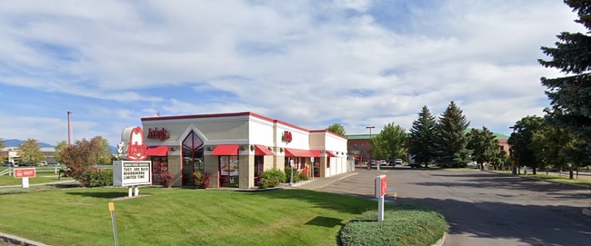

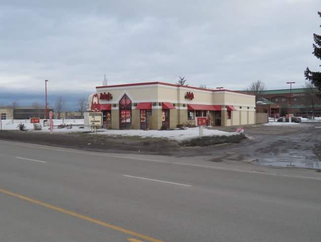
Property Detail
1210 Us Highway 2 W
Kalispell, MT
SUBDIVISION 228, S12, T28 N, R22 W, LOT 001, SUBDIVISION 228 LOT 1
07-3965-12-4-04-07-0000
Flathead
Restaurantdrivein
Montana
AE The base floodplain where base flood elevations are provided. AE Zones are now used on new format FIRMs instead of A1-A30 Zones.
1
2025
0.80 AC
2025
Glacier Country
000901
Other Market Areas
3,007 SF
NEARBY LISTINGS FOR SALE OR LEASE
DEMOGRAPHICS near 1210 Us Highway 2 W
1 mile
3 mile
5 mile
2025 Total Population
9,182
36,806
49,030
2030 Population
9,839
39,288
52,239
Pop Growth 2025-2030
+ 7.16%
+ 6.74%
+ 6.54%
Average Age
40
40
40
2025 Total Households
4,166
15,048
19,739
HH Growth 2025-2030
+ 7.15%
+ 6.75%
+ 6.54%
Median Household Inc
$53,224
$69,724
$72,359
Avg Household Size
2.10
2.40
2.40
2025 Avg HH Vehicles
2.00
2.00
2.00
Median Home Value
$402,436
$457,424
$468,775
Median Year Built
1979
1988
1989
Nearby Places
Map Layers
Map Styles
 Street
 Aerial
Transit
 Traffic
 Biking
Places
Listings with unknown addresses are not visible on the map
- Restaurants
- Banks
- Shops
- Fitness
- Groceries
PUBLIC TRANSPORTATION
AIRPORT
Glacier Park International
Drive
Walk
Distance
Glacier Park International
17 min
9.8 mi
SALE & LEASE HISTORY
LISTING DATE
SALE/LEASE

Oct 04, 2024
For Sale
May 17, 2024
For Sale
Nearby Properties
Address
Land Use
TOTAL SIZE
Lot Size
Zoning
Address
Land Use
TOTAL SIZE
Lot Size
Zoning
800,000 SF
9.86 AC
5
Address
Land Use
TOTAL SIZE
Lot Size
Zoning
85,209 SF
3.32 AC
Address
Land Use
TOTAL SIZE
Lot Size
Zoning
321,200 SF
7.77 AC
Address
Land Use
TOTAL SIZE
Lot Size
Zoning
242,665 SF
7.13 AC
Address
Land Use
TOTAL SIZE
Lot Size
Zoning
3,460 SF
9.15 AC
Address
Land Use
TOTAL SIZE
Lot Size
Zoning
57,624 SF
3.73 AC
Address
Land Use
TOTAL SIZE
Lot Size
Zoning
58,248 SF
11.94 AC
5
Address
Land Use
TOTAL SIZE
Lot Size
Zoning
105,300 SF
2.56 AC
Address
Land Use
TOTAL SIZE
Lot Size
Zoning
117,819 SF
3.70 AC
Address
Land Use
TOTAL SIZE
Lot Size
Zoning
188,028 SF
17.70 AC
Address
Land Use
TOTAL SIZE
Lot Size
Zoning
33,084 SF
5.42 AC
Address
Land Use
TOTAL SIZE
Lot Size
Zoning
97,968 SF
6.31 AC
Address
Land Use
TOTAL SIZE
Lot Size
Zoning
79,844 SF
3.21 AC
Address
Land Use
TOTAL SIZE
Lot Size
Zoning
140,812 SF
22.11 AC
Address
Land Use
TOTAL SIZE
Lot Size
Zoning
84,996 SF
3.18 AC
Address
Land Use
TOTAL SIZE
Lot Size
Zoning
45,000 SF
6.79 AC
Address
Land Use
TOTAL SIZE
Lot Size
Zoning
231,514 SF
22.45 AC
6
Address
Land Use
TOTAL SIZE
Lot Size
Zoning
62,420 SF
1.73 AC
Address
Land Use
TOTAL SIZE
Lot Size
Zoning
35,198 SF
5.86 AC
Address
Land Use
TOTAL SIZE
Lot Size
Zoning
115,524 SF
13.03 AC
Address
Land Use
TOTAL SIZE
Lot Size
Zoning
125,344 SF
10.06 AC
Address
Land Use
TOTAL SIZE
Lot Size
Zoning
139,724 SF
0.08 AC
Address
Land Use
TOTAL SIZE
Lot Size
Zoning
134,456 SF
0.04 AC
Address
Land Use
TOTAL SIZE
Lot Size
Zoning
25,848 SF
2.61 AC
Address
Land Use
TOTAL SIZE
Lot Size
Zoning
83,823 SF
4.78 AC
Address
Land Use
TOTAL SIZE
Lot Size
Zoning
31,230 SF
0.64 AC
Address
Land Use
TOTAL SIZE
Lot Size
Zoning
59,195 SF
5 AC
Address
Land Use
TOTAL SIZE
Lot Size
Zoning
32,769 SF
Address
Land Use
TOTAL SIZE
Lot Size
Zoning
78,433 SF
7.64 AC
The World's #1 Commercial Real Estate Marketplace
Connect with us
© 2026 CoStar Group
The information above has been obtained from sources believed reliable. While we do not doubt its accuracy we have not verified it and make no guarantee, warranty or representation about it. It is your responsibility to independently confirm its accuracy and completeness. Any projections, opinions, assumptions, or estimates used are for example only and do not represent the current or future performance of the property. The value of this transaction to you depends on tax and other factors which should be evaluated by your tax, financial, and legal advisors. You and your advisors should conduct a careful, independent investigation of the property to determine to your satisfaction the suitability of the property for your needs.