Property Record
1210 Winder Hwy, Dacula, GA 30019

Property Detail
1210 Winder Hwy
5-210-318
L1 WINDER HWY
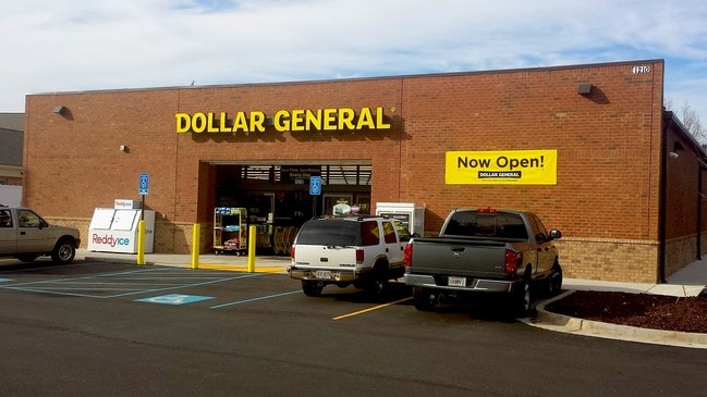
Storebuilding
Gwinnett
C2
Georgia
B and X Area of moderate flood hazard, usually the area between the limits of the 100-year and 500-year floods.
1
2025
1.81 AC
2025
Lawrenceville/Dacula
050583
Atlanta
9,352 SF
Atlanta-Sandy Springs-Roswell, GA
NEARBY LISTINGS FOR SALE OR LEASE
DEMOGRAPHICS near 1210 Winder Hwy
1 mile
3 mile
5 mile
2025 Total Population
6,328
58,299
170,128
2030 Population
6,648
61,423
178,519
Pop Growth 2025-2030
+ 5.06%
+ 5.36%
+ 4.93%
Average Age
34
36
37
2025 Total Households
1,690
17,367
53,106
HH Growth 2025-2030
+ 5.44%
+ 5.53%
+ 5.05%
Median Household Inc
$79,905
$89,225
$91,266
Avg Household Size
3.10
3.20
3.10
2025 Avg HH Vehicles
2.00
2.00
2.00
Median Home Value
$335,714
$384,466
$398,959
Median Year Built
2005
2002
1999
Nearby Places
Map Layers
Map Styles
 Street
 Aerial
Transit
 Traffic
 Biking
Places
Listings with unknown addresses are not visible on the map
- Restaurants
- Banks
- Shops
- Fitness
- Groceries
SALE & LEASE HISTORY
LISTING DATE
SALE/LEASE

May 04, 2017
For Sale
Nearby Properties
Address
Land Use
TOTAL SIZE
Lot Size
Zoning
Address
Land Use
TOTAL SIZE
Lot Size
Zoning
2,260,742 SF
285.40 AC
M1
Address
Land Use
TOTAL SIZE
Lot Size
Zoning
1,071,116 SF
69.77 AC
OI
Address
Land Use
TOTAL SIZE
Lot Size
Zoning
493,520 SF
12.67 AC
BG2
Address
Land Use
TOTAL SIZE
Lot Size
Zoning
321,476 SF
38.63 AC
RMM
Address
Land Use
TOTAL SIZE
Lot Size
Zoning
16,062 SF
89.78 AC
BG
Address
Land Use
TOTAL SIZE
Lot Size
Zoning
190,485 SF
103.66 AC
RA200
Address
Land Use
TOTAL SIZE
Lot Size
Zoning
439,272 SF
18 AC
RM24
Address
Land Use
TOTAL SIZE
Lot Size
Zoning
240,509 SF
19.18 AC
RM
Address
Land Use
TOTAL SIZE
Lot Size
Zoning
231,373 SF
3.82 AC
OI
Address
Land Use
TOTAL SIZE
Lot Size
Zoning
571,230 SF
64.70 AC
LM
Address
Land Use
TOTAL SIZE
Lot Size
Zoning
240,800 SF
28.74 AC
M1
Address
Land Use
TOTAL SIZE
Lot Size
Zoning
250,960 SF
17.55 AC
OI
Address
Land Use
TOTAL SIZE
Lot Size
Zoning
176,034 SF
92.85 AC
RA200
Address
Land Use
TOTAL SIZE
Lot Size
Zoning
101,343 SF
44.33 AC
R1400
Address
Land Use
TOTAL SIZE
Lot Size
Zoning
204,895 SF
26.89 AC
R1200
Address
Land Use
TOTAL SIZE
Lot Size
Zoning
212,571 SF
31.30 AC
RA200
Address
Land Use
TOTAL SIZE
Lot Size
Zoning
149,440 SF
28.41 AC
M1
Address
Land Use
TOTAL SIZE
Lot Size
Zoning
178,635 SF
28.77 AC
R1200
Address
Land Use
TOTAL SIZE
Lot Size
Zoning
163,978 SF
14.31 AC
RM12
Address
Land Use
TOTAL SIZE
Lot Size
Zoning
140,809 SF
8.97 AC
RM13
Address
Land Use
TOTAL SIZE
Lot Size
Zoning
125,700 SF
33.85 AC
C2
Address
Land Use
TOTAL SIZE
Lot Size
Zoning
310,027 SF
18.54 AC
M1
Address
Land Use
TOTAL SIZE
Lot Size
Zoning
393,811 SF
66.81 AC
M1
Address
Land Use
TOTAL SIZE
Lot Size
Zoning
164,957 SF
11.55 AC
RM
Address
Land Use
TOTAL SIZE
Lot Size
Zoning
164,850 SF
14.45 AC
M1
Address
Land Use
TOTAL SIZE
Lot Size
Zoning
327,884 SF
19 AC
M1
Address
Land Use
TOTAL SIZE
Lot Size
Zoning
179,065 SF
24 AC
M1
Address
Land Use
TOTAL SIZE
Lot Size
Zoning
229,868 SF
19.17 AC
RM
Address
Land Use
TOTAL SIZE
Lot Size
Zoning
76,342 SF
1.25 AC
BCG
Address
Land Use
TOTAL SIZE
Lot Size
Zoning
248,992 SF
17.54 AC
M1
The World's #1 Commercial Real Estate Marketplace
Connect with us
© 2026 CoStar Group
The information above has been obtained from sources believed reliable. While we do not doubt its accuracy we have not verified it and make no guarantee, warranty or representation about it. It is your responsibility to independently confirm its accuracy and completeness. Any projections, opinions, assumptions, or estimates used are for example only and do not represent the current or future performance of the property. The value of this transaction to you depends on tax and other factors which should be evaluated by your tax, financial, and legal advisors. You and your advisors should conduct a careful, independent investigation of the property to determine to your satisfaction the suitability of the property for your needs.