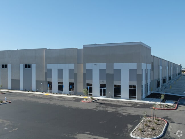
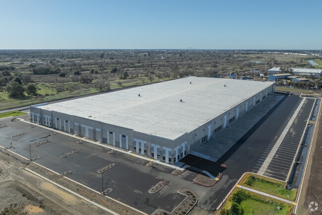
Property Record
12100 Atlanta Cir, Rancho Cordova, CA 95742

NEARBY LISTINGS FOR SALE OR LEASE
Property Detail
12100 Atlanta Cir
072-4050-033
Sacramento
Warehouse
California
2024
Sunrise
2025
Sacramento
008706
Sacramento-Roseville-Folsom, CA
DEMOGRAPHICS near 12100 Atlanta Cir
1 Mile
3 Mile
5 Mile
2024 Total Population
2,712
36,090
171,351
2029 Population
2,708
36,256
172,665
Pop Growth 2024-2029
(0.15%)
+ 0.46%
+ 0.77%
Average Age
45
46
42
2024 Total Households
1,250
15,261
67,391
HH Growth 2024-2029
(0.08%)
+ 0.45%
+ 0.74%
Median Household Inc
$117,316
$109,037
$95,678
Avg Household Size
2.00
2.30
2.50
2024 Avg HH Vehicles
2.00
2.00
2.00
Median Home Value
$684,291
$649,244
$556,642
Median Year Built
1988
1982
1980
Nearby Places
Map Layers
Map Styles
 Street
 Aerial
- Restaurants
- Banks
- Shops
- Fitness
- Groceries
PUBLIC TRANSPORTATION
TRANSIT/SUBWAY
Hazel (Gold Line - Sacramento Regional Transit District Light Rail (The RT))
DRIVE
WALK
Distance
Hazel (Gold Line - Sacramento Regional Transit District Light Rail (The RT))
3 min
11 min
0.6 mi
AIRPORT
Sacramento International
DRIVE
WALK
Distance
Sacramento International
41 min
30.5 mi
Freight Ports
Port of Stockton
DRIVE
WALK
Distance
Port of Stockton
77 min
64.1 mi
SALE & LEASE HISTORY
LISTING DATE
SALE/LEASE

Apr 15, 2022
For Lease
Nearby Properties
Address
Land Use
TOTAL SIZE
Lot Size
Zoning
Address
Land Use
TOTAL SIZE
Lot Size
Zoning
304,607 SF
14.70 AC
LC
Address
Land Use
TOTAL SIZE
Lot Size
Zoning
287,131 SF
32.53 AC
C-3 (PD)
Address
Land Use
TOTAL SIZE
Lot Size
Zoning
7.94 AC
RD-25
Address
Land Use
TOTAL SIZE
Lot Size
Zoning
202,776 SF
12.17 AC
RD-25 (PC)
Address
Land Use
TOTAL SIZE
Lot Size
Zoning
269,928 SF
246.95 AC
SPA
Address
Land Use
TOTAL SIZE
Lot Size
Zoning
2,146.73 AC
SPA
Address
Land Use
TOTAL SIZE
Lot Size
Zoning
241,672 SF
18.54 AC
SC
Address
Land Use
TOTAL SIZE
Lot Size
Zoning
14.54 AC
SPA (ASPA)
Address
Land Use
TOTAL SIZE
Lot Size
Zoning
166,216 SF
10.77 AC
M-2
Address
Land Use
TOTAL SIZE
Lot Size
Zoning
55,579 SF
44.38 AC
M-2
Address
Land Use
TOTAL SIZE
Lot Size
Zoning
52,992 SF
4.07 AC
M-1 (PD)
Address
Land Use
TOTAL SIZE
Lot Size
Zoning
112,244 SF
3.55 AC
GC
Address
Land Use
TOTAL SIZE
Lot Size
Zoning
218,823 SF
10.77 AC
HDR
Address
Land Use
TOTAL SIZE
Lot Size
Zoning
939,277 SF
58.75 AC
SPA
Address
Land Use
TOTAL SIZE
Lot Size
Zoning
85,320 SF
4 AC
SPA
Address
Land Use
TOTAL SIZE
Lot Size
Zoning
2,646.76 AC
SPA
Address
Land Use
TOTAL SIZE
Lot Size
Zoning
105,703 SF
4.75 AC
RD-30 BP
Address
Land Use
TOTAL SIZE
Lot Size
Zoning
195,702 SF
3.66 AC
GC
Address
Land Use
TOTAL SIZE
Lot Size
Zoning
119,310 SF
6.98 AC
BP (PD)
Address
Land Use
TOTAL SIZE
Lot Size
Zoning
2.43 AC
GC
Address
Land Use
TOTAL SIZE
Lot Size
Zoning
97,920 SF
10.25 AC
SPA
Address
Land Use
TOTAL SIZE
Lot Size
Zoning
124,339 SF
10.28 AC
RD-20
Address
Land Use
TOTAL SIZE
Lot Size
Zoning
4 AC
M-2 (NPA)
Address
Land Use
TOTAL SIZE
Lot Size
Zoning
79,488 SF
6.60 AC
M-1 (PD)
Address
Land Use
TOTAL SIZE
Lot Size
Zoning
67,724 SF
9.73 AC
SPA
Address
Land Use
TOTAL SIZE
Lot Size
Zoning
200,791 SF
9.92 AC
M-2
Address
Land Use
TOTAL SIZE
Lot Size
Zoning
131,264 SF
9.02 AC
MP
Address
Land Use
TOTAL SIZE
Lot Size
Zoning
107,817 SF
6.98 AC
C-3 (PD)
Address
Land Use
TOTAL SIZE
Lot Size
Zoning
63,829 SF
2.75 AC
CMU (FBSP)
The World's #1 Commercial Real Estate Marketplace
Connect with us
© 2026 CoStar Group
The information above has been obtained from sources believed reliable. While we do not doubt its accuracy we have not verified it and make no guarantee, warranty or representation about it. It is your responsibility to independently confirm its accuracy and completeness. Any projections, opinions, assumptions, or estimates used are for example only and do not represent the current or future performance of the property. The value of this transaction to you depends on tax and other factors which should be evaluated by your tax, financial, and legal advisors. You and your advisors should conduct a careful, independent investigation of the property to determine to your satisfaction the suitability of the property for your needs.