Property Record
12100 Lem Turner Rd, Jacksonville, FL 32218


Save to a Folder
{{folder.Name}}
{{folder.ListingIds.length}} Properties
{{folder.ListingIds.length}} Property
Create a New Folder
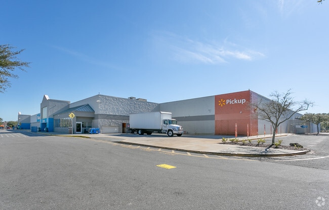
Property Detail
12100 Lem Turner Rd
019995-0100
04-1S-26E 30.64 PT NW1/4 OF NE1/4,NE1/4/ OF NW1/4 RECD O/R 14845-146 BEING PARCELS 1,2,3
Departmentstore
Duval
CCG-1
Florida
B and X Area of moderate flood hazard, usually the area between the limits of the 100-year and 500-year floods.
30.32 AC
2025
Northwest Jacksonville
2026
Jacksonville (Florida)
010503
Jacksonville, FL
240,692 SF
NEARBY LISTINGS FOR SALE OR LEASE
DEMOGRAPHICS near 12100 Lem Turner Rd
1 mile
3 mile
5 mile
2025 Total Population
3,987
37,626
88,497
2030 Population
4,285
40,065
94,549
Pop Growth 2025-2030
+ 7.47%
+ 6.48%
+ 6.84%
Average Age
38
39
39
2025 Total Households
1,416
14,014
33,879
HH Growth 2025-2030
+ 7.77%
+ 6.70%
+ 7.13%
Median Household Inc
$59,099
$63,519
$57,377
Avg Household Size
2.70
2.60
2.60
2025 Avg HH Vehicles
2.00
2.00
2.00
Median Home Value
$311,560
$266,163
$233,080
Median Year Built
2003
1993
1983
Nearby Places
Map Layers
Map Styles
 Street
 Aerial
Layers
 Traffic
 Biking
Places
Listings with unknown addresses are not visible on the map
- Restaurants
- Banks
- Shops
- Fitness
- Groceries
PUBLIC TRANSPORTATION
COMMUTER RAIL
Jacksonville (Silver Meteor - Amtrak, Silver Star - Amtrak)
Drive
Walk
Distance
Jacksonville (Silver Meteor - Amtrak, Silver Star - Amtrak)
14 min
8.5 mi
AIRPORT
Jacksonville International
Drive
Walk
Distance
Jacksonville International
13 min
6.5 mi
Freight Ports
Jacksonville Port
Drive
Walk
Distance
Jacksonville Port
20 min
10.5 mi
Nearby Properties
Address
Land Use
TOTAL SIZE
Lot Size
Zoning
Address
Land Use
TOTAL SIZE
Lot Size
Zoning
877,030 SF
135.59 AC
IBP
Address
Land Use
TOTAL SIZE
Lot Size
Zoning
658,743 SF
36.71 AC
PUD
Address
Land Use
TOTAL SIZE
Lot Size
Zoning
226,596 SF
13.23 AC
PUD
Address
Land Use
TOTAL SIZE
Lot Size
Zoning
556,924 SF
29.11 AC
PUD
Address
Land Use
TOTAL SIZE
Lot Size
Zoning
505,048 SF
41.66 AC
PUD
Address
Land Use
TOTAL SIZE
Lot Size
Zoning
395,655 SF
21.86 AC
PUD
Address
Land Use
TOTAL SIZE
Lot Size
Zoning
284,023 SF
25.30 AC
RMD-C
Address
Land Use
TOTAL SIZE
Lot Size
Zoning
287,410 SF
43.31 AC
RMD-C
Address
Land Use
TOTAL SIZE
Lot Size
Zoning
214,742 SF
20.13 AC
PUD
Address
Land Use
TOTAL SIZE
Lot Size
Zoning
6,300 SF
744.81 AC
PUD
Address
Land Use
TOTAL SIZE
Lot Size
Zoning
254,693 SF
40.76 AC
RMD-D
Address
Land Use
TOTAL SIZE
Lot Size
Zoning
39,251 SF
55.24 AC
PUD
Address
Land Use
TOTAL SIZE
Lot Size
Zoning
225,829 SF
140.47 AC
PBF-1
Address
Land Use
TOTAL SIZE
Lot Size
Zoning
57,495 SF
1.95 AC
CCG-1
Address
Land Use
TOTAL SIZE
Lot Size
Zoning
126,930 SF
20.47 AC
PUD
Address
Land Use
TOTAL SIZE
Lot Size
Zoning
157.33 AC
PUD
Address
Land Use
TOTAL SIZE
Lot Size
Zoning
85,326 SF
26.76 AC
PUD
Address
Land Use
TOTAL SIZE
Lot Size
Zoning
130,885 SF
8.37 AC
RMD-D
Address
Land Use
TOTAL SIZE
Lot Size
Zoning
116,632 SF
10.07 AC
RMD-C
Address
Land Use
TOTAL SIZE
Lot Size
Zoning
102,858 SF
6.93 AC
PUD
Address
Land Use
TOTAL SIZE
Lot Size
Zoning
238,052 SF
30.81 AC
RHD-A
Address
Land Use
TOTAL SIZE
Lot Size
Zoning
82,610 SF
9.46 AC
PBF-2
Address
Land Use
TOTAL SIZE
Lot Size
Zoning
124,680 SF
7.21 AC
CCG-1
Address
Land Use
TOTAL SIZE
Lot Size
Zoning
94,300 SF
7.65 AC
PUD
Address
Land Use
TOTAL SIZE
Lot Size
Zoning
9,238 SF
48.79 AC
ROS
Address
Land Use
TOTAL SIZE
Lot Size
Zoning
37,595 SF
14.09 AC
IL
Address
Land Use
TOTAL SIZE
Lot Size
Zoning
80,905 SF
14.86 AC
PUD
Address
Land Use
TOTAL SIZE
Lot Size
Zoning
141,882 SF
39.93 AC
PBF-1
Address
Land Use
TOTAL SIZE
Lot Size
Zoning
44,280 SF
6 AC
RMD-C
The World's #1 Commercial Real Estate Marketplace
Connect with us
© 2026 CoStar Group
The information above has been obtained from sources believed reliable. While we do not doubt its accuracy we have not verified it and make no guarantee, warranty or representation about it. It is your responsibility to independently confirm its accuracy and completeness. Any projections, opinions, assumptions, or estimates used are for example only and do not represent the current or future performance of the property. The value of this transaction to you depends on tax and other factors which should be evaluated by your tax, financial, and legal advisors. You and your advisors should conduct a careful, independent investigation of the property to determine to your satisfaction the suitability of the property for your needs.