Property Record
12107 Manchester Rd, Saint Louis, MO 63131


NEARBY LISTINGS FOR SALE OR LEASE
Property Detail
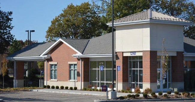
12107 Manchester Rd
St. Louis, MO-IL
Olympic Oaks Village Lots 1 & 2 Bdy Adj
22N-41-1001
OLYMPIC OAKS VILLAGE LOTS 1 & 2 BDY ADJ LOTS 1 & 2 BDY ADJ LOT 2
Regionalshoppingcenterormallwithanchorstore
St. Louis
X
Missouri
29099C0050F
2
2024
1.39 AC
2025
Mid County
217600
St. Louis
47,487 SF
DEMOGRAPHICS near 12107 Manchester Rd
1 Mile
3 Mile
5 Mile
2024 Total Population
7,242
54,508
157,429
2029 Population
7,053
53,209
153,996
Pop Growth 2024-2029
(2.61%)
(2.38%)
(2.18%)
Average Age
42
43
42
2024 Total Households
2,688
21,503
62,742
HH Growth 2024-2029
(2.64%)
(2.40%)
(2.26%)
Median Household Inc
$154,444
$126,138
$113,257
Avg Household Size
2.70
2.50
2.40
2024 Avg HH Vehicles
2.00
2.00
2.00
Median Home Value
$550,056
$491,136
$416,452
Median Year Built
1971
1968
1970
Nearby Places
Map Layers
Map Styles
 Street
 Aerial
- Restaurants
- Banks
- Shops
- Fitness
- Groceries
PUBLIC TRANSPORTATION
COMMUTER RAIL
Kirkwood Amtrak Station (Lincoln Service Missouri River Runner - Amtrak, Missouri River Runner - Amtrak)
DRIVE
WALK
Distance
Kirkwood Amtrak Station (Lincoln Service Missouri River Runner - Amtrak, Missouri River Runner - Amtrak)
6 min
3.0 mi
Richmond Heights (Shrewsbury-Lansdowne I-44 Emerson Park - St. Louis MetroLink (MetroLink))
DRIVE
WALK
Distance
Richmond Heights (Shrewsbury-Lansdowne I-44 Emerson Park - St. Louis MetroLink (MetroLink))
14 min
8.9 mi
AIRPORT
St Louis Lambert International
DRIVE
WALK
Distance
St Louis Lambert International
25 min
17.7 mi
Freight Ports
Tulsa Port of Inola
DRIVE
WALK
Distance
Tulsa Port of Inola
412 min
372.3 mi
SALE & LEASE HISTORY
LISTING DATE
SALE/LEASE

Sep 26, 2016
For Lease
Nearby Properties
Address
Land Use
TOTAL SIZE
Lot Size
Zoning
Address
Land Use
TOTAL SIZE
Lot Size
Zoning
20,852 SF
48.33 AC
82PH
Address
Land Use
TOTAL SIZE
Lot Size
Zoning
389,075 SF
19.85 AC
83H
Address
Land Use
TOTAL SIZE
Lot Size
Zoning
31,582 SF
77.77 AC
32R3
Address
Land Use
TOTAL SIZE
Lot Size
Zoning
43,617 SF
7.04 AC
83O
Address
Land Use
TOTAL SIZE
Lot Size
Zoning
670,149 SF
24.95 AC
17C-2
Address
Land Use
TOTAL SIZE
Lot Size
Zoning
34.35 AC
25R-1
Address
Land Use
TOTAL SIZE
Lot Size
Zoning
434,971 SF
24.80 AC
G
Address
Land Use
TOTAL SIZE
Lot Size
Zoning
442,503 SF
3.52 AC
82PH
Address
Land Use
TOTAL SIZE
Lot Size
Zoning
476,802 SF
20.71 AC
32R3
Address
Land Use
TOTAL SIZE
Lot Size
Zoning
33.71 AC
R3
Address
Land Use
TOTAL SIZE
Lot Size
Zoning
4,150 SF
21.42 AC
83H
Address
Land Use
TOTAL SIZE
Lot Size
Zoning
100,291 SF
569.29 AC
PS
Address
Land Use
TOTAL SIZE
Lot Size
Zoning
31.83 AC
R2
Address
Land Use
TOTAL SIZE
Lot Size
Zoning
314,640 SF
4.70 AC
83H
Address
Land Use
TOTAL SIZE
Lot Size
Zoning
43.43 AC
R3
Address
Land Use
TOTAL SIZE
Lot Size
Zoning
3.52 AC
82PH
Address
Land Use
TOTAL SIZE
Lot Size
Zoning
600,516 SF
4.27 AC
17C-3
Address
Land Use
TOTAL SIZE
Lot Size
Zoning
97,479 SF
21.51 AC
82HE
Address
Land Use
TOTAL SIZE
Lot Size
Zoning
46,849 SF
311.57 AC
NU
Address
Land Use
TOTAL SIZE
Lot Size
Zoning
228,889 SF
43.21 AC
A
Address
Land Use
TOTAL SIZE
Lot Size
Zoning
17,371 SF
25.44 AC
SL1
Address
Land Use
TOTAL SIZE
Lot Size
Zoning
10.57 AC
33C
Address
Land Use
TOTAL SIZE
Lot Size
Zoning
302,449 SF
11.44 AC
NU
Address
Land Use
TOTAL SIZE
Lot Size
Zoning
223,541 SF
6.52 AC
17C-3
Address
Land Use
TOTAL SIZE
Lot Size
Zoning
474,239 SF
34.85 AC
R4
Address
Land Use
TOTAL SIZE
Lot Size
Zoning
415,744 SF
62.46 AC
M3
Address
Land Use
TOTAL SIZE
Lot Size
Zoning
233,381 SF
4.45 AC
C-8
Address
Land Use
TOTAL SIZE
Lot Size
Zoning
9,830 SF
7.72 AC
B
Address
Land Use
TOTAL SIZE
Lot Size
Zoning
10.30 AC
A
Address
Land Use
TOTAL SIZE
Lot Size
Zoning
204,349 SF
19.07 AC
83POP
The World's #1 Commercial Real Estate Marketplace
Connect with us
© 2026 CoStar Group
The information above has been obtained from sources believed reliable. While we do not doubt its accuracy we have not verified it and make no guarantee, warranty or representation about it. It is your responsibility to independently confirm its accuracy and completeness. Any projections, opinions, assumptions, or estimates used are for example only and do not represent the current or future performance of the property. The value of this transaction to you depends on tax and other factors which should be evaluated by your tax, financial, and legal advisors. You and your advisors should conduct a careful, independent investigation of the property to determine to your satisfaction the suitability of the property for your needs.