Property Record
12108 Ne 182Nd Ave, Brush Prairie, WA 98606
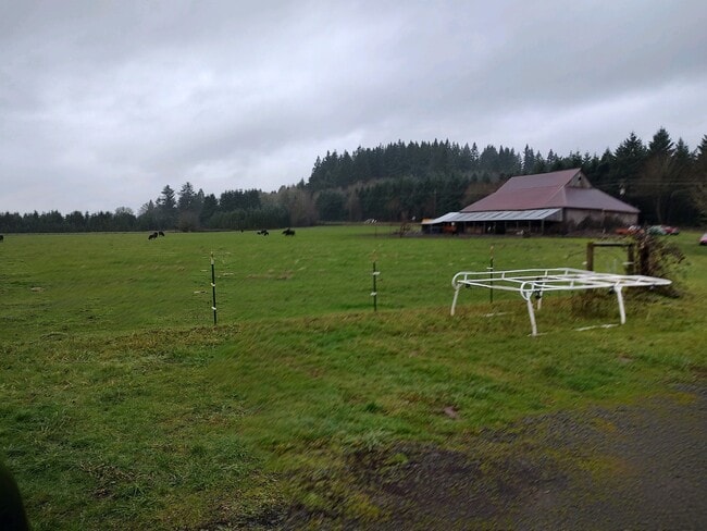


This Property Is For Sale
NEARBY LISTINGS FOR SALE OR LEASE
Property Detail
12108 Ne 182Nd Ave
Portland-Vancouver-Hillsboro, OR-WA
Clark
207362-000
Washington
Sfr
18.74 AC
X
Orchards
53011C0403D
Portland
2,053 SF
DEMOGRAPHICS near 12108 Ne 182Nd Ave
1 Mile
3 Mile
5 Mile
2024 Total Population
865
33,999
101,966
2029 Population
931
36,804
110,227
Pop Growth 2024-2029
+ 7.63%
+ 8.25%
+ 8.10%
Average Age
42
38
39
2024 Total Households
269
11,129
34,109
HH Growth 2024-2029
+ 7.81%
+ 8.29%
+ 8.21%
Median Household Inc
$121,999
$100,869
$93,478
Avg Household Size
3.10
3.00
2.90
2024 Avg HH Vehicles
3.00
2.00
2.00
Median Home Value
$661,242
$474,560
$432,276
Median Year Built
1988
1998
1995
Nearby Places
Map Layers
Map Styles
 Street
 Aerial
- Restaurants
- Banks
- Shops
- Fitness
- Groceries
PUBLIC TRANSPORTATION
AIRPORT
Portland International
DRIVE
WALK
Distance
Portland International
26 min
15.4 mi
Freight Ports
Port of Vancouver
DRIVE
WALK
Distance
Port of Vancouver
25 min
13.8 mi
Nearby Properties
Address
Land Use
TOTAL SIZE
Lot Size
Zoning
Address
Land Use
TOTAL SIZE
Lot Size
Zoning
224,426 SF
8.65 AC
R-30
Address
Land Use
TOTAL SIZE
Lot Size
Zoning
100,476 SF
5.51 AC
R-18
Address
Land Use
TOTAL SIZE
Lot Size
Zoning
157,245 SF
39 AC
R-5
Address
Land Use
TOTAL SIZE
Lot Size
Zoning
310,100 SF
15.42 AC
R-22
Address
Land Use
TOTAL SIZE
Lot Size
Zoning
110,876 SF
4.55 AC
R-30
Address
Land Use
TOTAL SIZE
Lot Size
Zoning
363,734 SF
40.47 AC
R-6
Address
Land Use
TOTAL SIZE
Lot Size
Zoning
162,870 SF
4.97 AC
R-30
Address
Land Use
TOTAL SIZE
Lot Size
Zoning
188,598 SF
10.25 AC
CC
Address
Land Use
TOTAL SIZE
Lot Size
Zoning
140,352 SF
25.52 AC
RC-1
Address
Land Use
TOTAL SIZE
Lot Size
Zoning
116,978 SF
7.44 AC
R-18
Address
Land Use
TOTAL SIZE
Lot Size
Zoning
57,214 SF
10.89 AC
R1-6
Address
Land Use
TOTAL SIZE
Lot Size
Zoning
124,591 SF
1.70 AC
R-30
Address
Land Use
TOTAL SIZE
Lot Size
Zoning
60,162 SF
5 AC
R1-10
Address
Land Use
TOTAL SIZE
Lot Size
Zoning
16,186 SF
4.75 AC
IL
Address
Land Use
TOTAL SIZE
Lot Size
Zoning
27,088 SF
3.47 AC
CC
Address
Land Use
TOTAL SIZE
Lot Size
Zoning
36.01 AC
IL
Address
Land Use
TOTAL SIZE
Lot Size
Zoning
135,000 SF
5.54 AC
IL
Address
Land Use
TOTAL SIZE
Lot Size
Zoning
101,587 SF
24.22 AC
R-5
Address
Land Use
TOTAL SIZE
Lot Size
Zoning
16,200 SF
26 AC
IL
Address
Land Use
TOTAL SIZE
Lot Size
Zoning
25,562 SF
1.96 AC
CC
Address
Land Use
TOTAL SIZE
Lot Size
Zoning
26,024 SF
2.34 AC
CC
Address
Land Use
TOTAL SIZE
Lot Size
Zoning
36,371 SF
8.25 AC
R-5
Address
Land Use
TOTAL SIZE
Lot Size
Zoning
52,335 SF
4.90 AC
CC
Address
Land Use
TOTAL SIZE
Lot Size
Zoning
8,970 SF
1.51 AC
CC
Address
Land Use
TOTAL SIZE
Lot Size
Zoning
9,000 SF
1.45 AC
IL
Address
Land Use
TOTAL SIZE
Lot Size
Zoning
16,476 SF
5 AC
R-6
Address
Land Use
TOTAL SIZE
Lot Size
Zoning
22,950 SF
1.43 AC
IL
Address
Land Use
TOTAL SIZE
Lot Size
Zoning
14,556 SF
5.79 AC
PF
Address
Land Use
TOTAL SIZE
Lot Size
Zoning
6,860 SF
0.83 AC
IL
Address
Land Use
TOTAL SIZE
Lot Size
Zoning
21,408 SF
3.28 AC
R-18
The World's #1 Commercial Real Estate Marketplace
Connect with us
© 2026 CoStar Group
The information above has been obtained from sources believed reliable. While we do not doubt its accuracy we have not verified it and make no guarantee, warranty or representation about it. It is your responsibility to independently confirm its accuracy and completeness. Any projections, opinions, assumptions, or estimates used are for example only and do not represent the current or future performance of the property. The value of this transaction to you depends on tax and other factors which should be evaluated by your tax, financial, and legal advisors. You and your advisors should conduct a careful, independent investigation of the property to determine to your satisfaction the suitability of the property for your needs.