Property Record
12066 Nw Cache Rd, Lawton, OK 73505


This Property Is For Sale
NEARBY LISTINGS FOR SALE OR LEASE
Property Detail
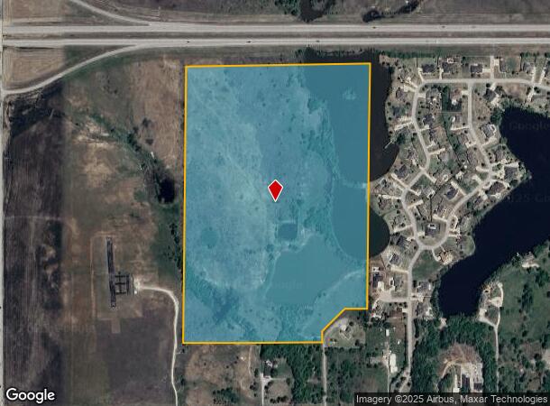
12066 Nw Cache Rd
0039313
Farm 2N-13W
Agriculturalland
23-2N-13W E/2 SW/4 LESS: BEG 436.057' W OF SE/C SW/4 OF SEC 23 THNW 436.057' TO A PT 436.057' E OF SW/C E/2 SW/4;THN N 535.48
A
Comanche
40031C0250E
Oklahoma
2024
59.36 AC
2025
Oklahoma West Area
002301
Other Market Areas
2,826 SF
Lawton, OK
DEMOGRAPHICS near 12066 Nw Cache Rd
1 Mile
3 Mile
5 Mile
2024 Total Population
1,049
5,354
28,874
2029 Population
1,047
5,426
29,500
Pop Growth 2024-2029
(0.19%)
+ 1.34%
+ 2.17%
Average Age
43
42
38
2024 Total Households
382
2,170
11,520
HH Growth 2024-2029
(0.26%)
+ 1.43%
+ 2.20%
Median Household Inc
$118,333
$89,999
$57,193
Avg Household Size
2.70
2.40
2.40
2024 Avg HH Vehicles
3.00
2.00
2.00
Median Home Value
$303,691
$268,172
$181,892
Median Year Built
1996
1989
1981
Nearby Places
Map Layers
Map Styles
 Street
 Aerial
- Restaurants
- Banks
- Shops
- Fitness
- Groceries
PUBLIC TRANSPORTATION
AIRPORT
Lawton-Fort Sill Regional
DRIVE
WALK
Distance
Lawton-Fort Sill Regional
24 min
12.7 mi
Freight Ports
Tulsa Port Of Catoosa
DRIVE
WALK
Distance
Tulsa Port Of Catoosa
236 min
217.6 mi
Nearby Properties
Address
Land Use
TOTAL SIZE
Lot Size
Zoning
Address
Land Use
TOTAL SIZE
Lot Size
Zoning
44,900 SF
484.43 AC
Address
Land Use
TOTAL SIZE
Lot Size
Zoning
9,000 SF
25.35 AC
Address
Land Use
TOTAL SIZE
Lot Size
Zoning
40,284 SF
7.19 AC
Address
Land Use
TOTAL SIZE
Lot Size
Zoning
7,752 SF
6.30 AC
Address
Land Use
TOTAL SIZE
Lot Size
Zoning
8,800 SF
30.05 AC
Address
Land Use
TOTAL SIZE
Lot Size
Zoning
2,330 SF
19.42 AC
Address
Land Use
TOTAL SIZE
Lot Size
Zoning
131,736 SF
10.23 AC
Address
Land Use
TOTAL SIZE
Lot Size
Zoning
39,791 SF
20.50 AC
Address
Land Use
TOTAL SIZE
Lot Size
Zoning
83,945 SF
46.95 AC
Address
Land Use
TOTAL SIZE
Lot Size
Zoning
68,844 SF
10.42 AC
Address
Land Use
TOTAL SIZE
Lot Size
Zoning
3,470 SF
10.11 AC
Address
Land Use
TOTAL SIZE
Lot Size
Zoning
65,320 SF
4.80 AC
Address
Land Use
TOTAL SIZE
Lot Size
Zoning
3,366 SF
5.97 AC
Address
Land Use
TOTAL SIZE
Lot Size
Zoning
22,472 SF
4.52 AC
Address
Land Use
TOTAL SIZE
Lot Size
Zoning
3,034 SF
4 AC
Address
Land Use
TOTAL SIZE
Lot Size
Zoning
19,837 SF
2.44 AC
Address
Land Use
TOTAL SIZE
Lot Size
Zoning
7,582 SF
1.77 AC
Address
Land Use
TOTAL SIZE
Lot Size
Zoning
20,000 SF
6.42 AC
Address
Land Use
TOTAL SIZE
Lot Size
Zoning
1,671 SF
1.14 AC
Address
Land Use
TOTAL SIZE
Lot Size
Zoning
3,366 SF
2 AC
Address
Land Use
TOTAL SIZE
Lot Size
Zoning
55,500 SF
9.99 AC
Address
Land Use
TOTAL SIZE
Lot Size
Zoning
12,496 SF
2.14 AC
Address
Land Use
TOTAL SIZE
Lot Size
Zoning
19,094 SF
2.30 AC
Address
Land Use
TOTAL SIZE
Lot Size
Zoning
4,646 SF
1.33 AC
Address
Land Use
TOTAL SIZE
Lot Size
Zoning
600 SF
1.40 AC
Address
Land Use
TOTAL SIZE
Lot Size
Zoning
7,172 SF
1.37 AC
Address
Land Use
TOTAL SIZE
Lot Size
Zoning
3,366 SF
2.75 AC
Address
Land Use
TOTAL SIZE
Lot Size
Zoning
4,356 SF
1.24 AC
Address
Land Use
TOTAL SIZE
Lot Size
Zoning
33,200 SF
2.54 AC
The World's #1 Commercial Real Estate Marketplace
Connect with us
© 2026 CoStar Group
The information above has been obtained from sources believed reliable. While we do not doubt its accuracy we have not verified it and make no guarantee, warranty or representation about it. It is your responsibility to independently confirm its accuracy and completeness. Any projections, opinions, assumptions, or estimates used are for example only and do not represent the current or future performance of the property. The value of this transaction to you depends on tax and other factors which should be evaluated by your tax, financial, and legal advisors. You and your advisors should conduct a careful, independent investigation of the property to determine to your satisfaction the suitability of the property for your needs.