Property Record
12110 Doc Adams, Laredo, TX 78045
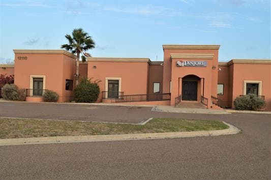


Property Detail
12110 Doc Adams
256702
KILLAM IND PARK UNIT 11, BLOCK 16, LOTS 1 & 2
Commercialnec
Webb
M1
Texas
AE The base floodplain where base flood elevations are provided. AE Zones are now used on new format FIRMs instead of A1-A30 Zones.
1,2
2024
9.61 AC
2025
Texas South Area
001711
Other Market Areas
157,193 SF
Laredo, TX
NEARBY LISTINGS FOR SALE OR LEASE
DEMOGRAPHICS near 12110 Doc Adams
1 mile
3 mile
5 mile
2025 Total Population
22
35,527
81,211
2030 Population
23
36,523
83,175
Pop Growth 2025-2030
+ 4.55%
+ 2.80%
+ 2.42%
Average Age
30
33
35
2025 Total Households
6
10,474
25,091
HH Growth 2025-2030
0.00%
+ 3.07%
+ 2.65%
Median Household Inc
$93,749
$80,104
$83,937
Avg Household Size
3.60
3.30
3.20
2025 Avg HH Vehicles
3.00
2.00
2.00
Median Home Value
$225,000
$234,565
$261,966
Median Year Built
2007
2004
2002
Nearby Places
Map Layers
Map Styles
 Street
 Aerial
Transit
 Traffic
 Biking
Places
Listings with unknown addresses are not visible on the map
- Restaurants
- Banks
- Shops
- Fitness
- Groceries
PUBLIC TRANSPORTATION
AIRPORT
Laredo International
Drive
Walk
Distance
Laredo International
16 min
10.6 mi
Freight Ports
Port of Corpus Christi
Drive
Walk
Distance
Port of Corpus Christi
172 min
149.6 mi
SALE & LEASE HISTORY
LISTING DATE
SALE/LEASE

Jun 14, 2024
For Lease
Jul 15, 2024
For Lease
Nearby Properties
Address
Land Use
TOTAL SIZE
Lot Size
Zoning
Address
Land Use
TOTAL SIZE
Lot Size
Zoning
430,587 SF
30 AC
R1
Address
Land Use
TOTAL SIZE
Lot Size
Zoning
251,512 SF
57.32 AC
B4
Address
Land Use
TOTAL SIZE
Lot Size
Zoning
255,819 SF
50 AC
R1
Address
Land Use
TOTAL SIZE
Lot Size
Zoning
436,814 SF
27.66 AC
Address
Land Use
TOTAL SIZE
Lot Size
Zoning
206,224 SF
20.03 AC
R1
Address
Land Use
TOTAL SIZE
Lot Size
Zoning
649,220 SF
38.29 AC
M1
Address
Land Use
TOTAL SIZE
Lot Size
Zoning
562,944 SF
30 AC
M1
Address
Land Use
TOTAL SIZE
Lot Size
Zoning
370,800 SF
40.09 AC
Address
Land Use
TOTAL SIZE
Lot Size
Zoning
521,026 SF
30 AC
M1
Address
Land Use
TOTAL SIZE
Lot Size
Zoning
286,008 SF
37.30 AC
Address
Land Use
TOTAL SIZE
Lot Size
Zoning
109,695 SF
3.73 AC
M1
Address
Land Use
TOTAL SIZE
Lot Size
Zoning
194,520 SF
11.18 AC
B3
Address
Land Use
TOTAL SIZE
Lot Size
Zoning
115,076 SF
32.87 AC
Address
Land Use
TOTAL SIZE
Lot Size
Zoning
192,203 SF
22.01 AC
B4
Address
Land Use
TOTAL SIZE
Lot Size
Zoning
136,981 SF
10.01 AC
Address
Land Use
TOTAL SIZE
Lot Size
Zoning
170,632 SF
8.03 AC
B3
Address
Land Use
TOTAL SIZE
Lot Size
Zoning
257,516 SF
21.94 AC
Address
Land Use
TOTAL SIZE
Lot Size
Zoning
263,842 SF
22.20 AC
Address
Land Use
TOTAL SIZE
Lot Size
Zoning
243,399 SF
15.50 AC
Address
Land Use
TOTAL SIZE
Lot Size
Zoning
66,232 SF
47.65 AC
Address
Land Use
TOTAL SIZE
Lot Size
Zoning
162,013 SF
9.16 AC
B1
Address
Land Use
TOTAL SIZE
Lot Size
Zoning
246,003 SF
24.32 AC
Address
Land Use
TOTAL SIZE
Lot Size
Zoning
118,124 SF
11.30 AC
R1A
Address
Land Use
TOTAL SIZE
Lot Size
Zoning
228,046 SF
13.58 AC
Address
Land Use
TOTAL SIZE
Lot Size
Zoning
96,665 SF
11.12 AC
R1A
Address
Land Use
TOTAL SIZE
Lot Size
Zoning
253,180 SF
16.56 AC
M1
Address
Land Use
TOTAL SIZE
Lot Size
Zoning
264,984 SF
18.70 AC
Address
Land Use
TOTAL SIZE
Lot Size
Zoning
98,998 SF
10.31 AC
B3
Address
Land Use
TOTAL SIZE
Lot Size
Zoning
200,446 SF
25.68 AC
M1
Address
Land Use
TOTAL SIZE
Lot Size
Zoning
174,928 SF
10 AC
R2
The World's #1 Commercial Real Estate Marketplace
Connect with us
© 2026 CoStar Group
The information above has been obtained from sources believed reliable. While we do not doubt its accuracy we have not verified it and make no guarantee, warranty or representation about it. It is your responsibility to independently confirm its accuracy and completeness. Any projections, opinions, assumptions, or estimates used are for example only and do not represent the current or future performance of the property. The value of this transaction to you depends on tax and other factors which should be evaluated by your tax, financial, and legal advisors. You and your advisors should conduct a careful, independent investigation of the property to determine to your satisfaction the suitability of the property for your needs.