Property Record
12110 N Highway 183, Florence, TX 76527
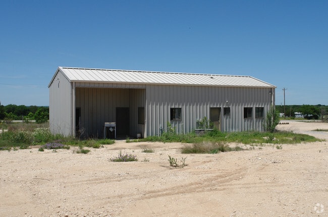

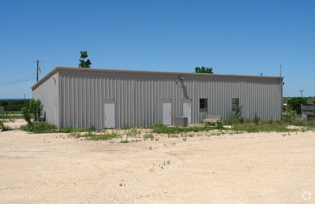
Property Detail
12110 N Highway 183
Austin-Round Rock-San Marcos, TX
S3989 - LEFFS ACRES, LOT 15-16, ACRES 10
R009584
WILLIAMSON
Commercialnec
Texas
B and X Area of moderate flood hazard, usually the area between the limits of the 100-year and 500-year floods.
15-16
2024
10 AC
2025
Georgetown
020206
Austin
7,669 SF
NEARBY LISTINGS FOR SALE OR LEASE
DEMOGRAPHICS near 12110 N Highway 183
1 mile
3 mile
5 mile
2025 Total Population
379
1,157
3,241
2030 Population
420
1,299
3,643
Pop Growth 2025-2030
+ 10.82%
+ 12.27%
+ 12.40%
Average Age
40
41
40
2025 Total Households
126
399
1,101
HH Growth 2025-2030
+ 11.90%
+ 12.53%
+ 12.62%
Median Household Inc
$104,545
$115,798
$108,145
Avg Household Size
2.90
2.80
2.90
2025 Avg HH Vehicles
2.00
3.00
3.00
Median Home Value
$397,726
$437,931
$448,064
Median Year Built
2002
2003
2003
Nearby Places
Map Layers
Map Styles
 Street
 Aerial
Transit
 Traffic
 Biking
Places
Listings with unknown addresses are not visible on the map
- Restaurants
- Banks
- Shops
- Fitness
- Groceries
Nearby Properties
Address
Land Use
TOTAL SIZE
Lot Size
Zoning
Address
Land Use
TOTAL SIZE
Lot Size
Zoning
3,618 SF
11.47 AC
Address
Land Use
TOTAL SIZE
Lot Size
Zoning
13,200 SF
40.04 AC
Address
Land Use
TOTAL SIZE
Lot Size
Zoning
7,500 SF
9.16 AC
Address
Land Use
TOTAL SIZE
Lot Size
Zoning
Address
Land Use
TOTAL SIZE
Lot Size
Zoning
9,744 SF
5 AC
Address
Land Use
TOTAL SIZE
Lot Size
Zoning
10,242 SF
57.72 AC
Address
Land Use
TOTAL SIZE
Lot Size
Zoning
7,500 SF
5 AC
Address
Land Use
TOTAL SIZE
Lot Size
Zoning
3,164 SF
5 AC
Address
Land Use
TOTAL SIZE
Lot Size
Zoning
38.81 AC
Address
Land Use
TOTAL SIZE
Lot Size
Zoning
864 SF
100 AC
Address
Land Use
TOTAL SIZE
Lot Size
Zoning
42.95 AC
Address
Land Use
TOTAL SIZE
Lot Size
Zoning
4,071 SF
1.57 AC
Address
Land Use
TOTAL SIZE
Lot Size
Zoning
6,000 SF
18.82 AC
Address
Land Use
TOTAL SIZE
Lot Size
Zoning
3,740 SF
10.43 AC
Address
Land Use
TOTAL SIZE
Lot Size
Zoning
8,352 SF
4.99 AC
Address
Land Use
TOTAL SIZE
Lot Size
Zoning
4,271 SF
73.49 AC
Address
Land Use
TOTAL SIZE
Lot Size
Zoning
3,420 SF
22.24 AC
Address
Land Use
TOTAL SIZE
Lot Size
Zoning
3,888 SF
2.02 AC
Address
Land Use
TOTAL SIZE
Lot Size
Zoning
2,740 SF
409.43 AC
Address
Land Use
TOTAL SIZE
Lot Size
Zoning
2,852 SF
6.30 AC
Address
Land Use
TOTAL SIZE
Lot Size
Zoning
926 SF
16.67 AC
Address
Land Use
TOTAL SIZE
Lot Size
Zoning
2,996 SF
11.06 AC
Address
Land Use
TOTAL SIZE
Lot Size
Zoning
7.50 AC
Address
Land Use
TOTAL SIZE
Lot Size
Zoning
23.08 AC
Address
Land Use
TOTAL SIZE
Lot Size
Zoning
4,026 SF
5 AC
Address
Land Use
TOTAL SIZE
Lot Size
Zoning
2,414 SF
12.81 AC
Address
Land Use
TOTAL SIZE
Lot Size
Zoning
2,419 SF
194.26 AC
Address
Land Use
TOTAL SIZE
Lot Size
Zoning
53.07 AC
Address
Land Use
TOTAL SIZE
Lot Size
Zoning
2,666 SF
10.78 AC
The World's #1 Commercial Real Estate Marketplace
Connect with us
© 2026 CoStar Group
The information above has been obtained from sources believed reliable. While we do not doubt its accuracy we have not verified it and make no guarantee, warranty or representation about it. It is your responsibility to independently confirm its accuracy and completeness. Any projections, opinions, assumptions, or estimates used are for example only and do not represent the current or future performance of the property. The value of this transaction to you depends on tax and other factors which should be evaluated by your tax, financial, and legal advisors. You and your advisors should conduct a careful, independent investigation of the property to determine to your satisfaction the suitability of the property for your needs.