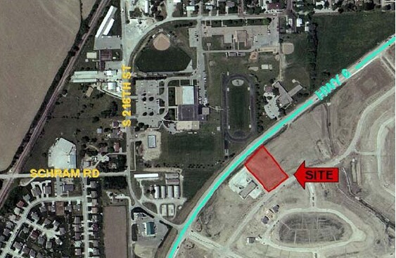
Property Record
12110 Standing Stone Dr, Gretna, NE 68028

Property Detail
12110 Standing Stone Dr
Omaha, NE-IA
LOT 1 STANDING STONE REPLAT 4
011591741
SARPY
Commercialnec
Nebraska
B and X Area of moderate flood hazard, usually the area between the limits of the 100-year and 500-year floods.
1
2024
3.39 AC
2025
Southwest Omaha
010632
Omaha/Council Bluffs
NEARBY LISTINGS FOR SALE OR LEASE
DEMOGRAPHICS near 12110 Standing Stone Dr
1 mile
3 mile
5 mile
2025 Total Population
5,845
15,145
43,990
2030 Population
6,270
16,580
47,824
Pop Growth 2025-2030
+ 7.27%
+ 9.48%
+ 8.72%
Average Age
38
37
36
2025 Total Households
2,039
5,096
14,634
HH Growth 2025-2030
+ 7.36%
+ 9.52%
+ 8.85%
Median Household Inc
$111,072
$126,938
$132,167
Avg Household Size
2.80
2.90
3.00
2025 Avg HH Vehicles
2.00
2.00
2.00
Median Home Value
$369,578
$409,603
$392,071
Median Year Built
2001
2007
2010
Nearby Places
Map Layers
Map Styles
 Street
 Aerial
Layers
 Traffic
 Biking
Places
Listings with unknown addresses are not visible on the map
- Restaurants
- Banks
- Shops
- Fitness
- Groceries
PUBLIC TRANSPORTATION
AIRPORT
Eppley Airfield
Drive
Walk
Distance
Eppley Airfield
39 min
26.6 mi
Freight Ports
Tulsa Port Of Catoosa
Drive
Walk
Distance
Tulsa Port Of Catoosa
476 min
398.8 mi
Nearby Properties
Address
Land Use
TOTAL SIZE
Lot Size
Zoning
Address
Land Use
TOTAL SIZE
Lot Size
Zoning
46,338 SF
25.95 AC
Address
Land Use
TOTAL SIZE
Lot Size
Zoning
12.60 AC
Address
Land Use
TOTAL SIZE
Lot Size
Zoning
30.87 AC
Address
Land Use
TOTAL SIZE
Lot Size
Zoning
13,312 SF
9.27 AC
Address
Land Use
TOTAL SIZE
Lot Size
Zoning
38,154 SF
10.65 AC
Address
Land Use
TOTAL SIZE
Lot Size
Zoning
1,288 SF
157.59 AC
AG
Address
Land Use
TOTAL SIZE
Lot Size
Zoning
15.85 AC
Address
Land Use
TOTAL SIZE
Lot Size
Zoning
36,145 SF
2 AC
Address
Land Use
TOTAL SIZE
Lot Size
Zoning
37,589 SF
6.76 AC
Address
Land Use
TOTAL SIZE
Lot Size
Zoning
13.44 AC
Address
Land Use
TOTAL SIZE
Lot Size
Zoning
6,404 SF
4.61 AC
Address
Land Use
TOTAL SIZE
Lot Size
Zoning
6.78 AC
Address
Land Use
TOTAL SIZE
Lot Size
Zoning
17,250 SF
10.21 AC
Address
Land Use
TOTAL SIZE
Lot Size
Zoning
8,800 SF
0.34 AC
AG
Address
Land Use
TOTAL SIZE
Lot Size
Zoning
67,737 SF
4.01 AC
Address
Land Use
TOTAL SIZE
Lot Size
Zoning
11,666 SF
4.15 AC
Address
Land Use
TOTAL SIZE
Lot Size
Zoning
1.65 AC
I1
Address
Land Use
TOTAL SIZE
Lot Size
Zoning
Address
Land Use
TOTAL SIZE
Lot Size
Zoning
1,344 SF
10.41 AC
Address
Land Use
TOTAL SIZE
Lot Size
Zoning
9,560 SF
2.99 AC
Address
Land Use
TOTAL SIZE
Lot Size
Zoning
44,001 SF
3.93 AC
Address
Land Use
TOTAL SIZE
Lot Size
Zoning
5.33 AC
Address
Land Use
TOTAL SIZE
Lot Size
Zoning
32,763 SF
3 AC
Address
Land Use
TOTAL SIZE
Lot Size
Zoning
21,122 SF
3.68 AC
Address
Land Use
TOTAL SIZE
Lot Size
Zoning
3,500 SF
3.34 AC
Address
Land Use
TOTAL SIZE
Lot Size
Zoning
41,075 SF
1.04 AC
Address
Land Use
TOTAL SIZE
Lot Size
Zoning
5.20 AC
Address
Land Use
TOTAL SIZE
Lot Size
Zoning
3,082 SF
10.70 AC
Address
Land Use
TOTAL SIZE
Lot Size
Zoning
66,758 SF
10.55 AC
I1
Address
Land Use
TOTAL SIZE
Lot Size
Zoning
4,183 SF
2.58 AC
The World's #1 Commercial Real Estate Marketplace
Connect with us
© 2026 CoStar Group
The information above has been obtained from sources believed reliable. While we do not doubt its accuracy we have not verified it and make no guarantee, warranty or representation about it. It is your responsibility to independently confirm its accuracy and completeness. Any projections, opinions, assumptions, or estimates used are for example only and do not represent the current or future performance of the property. The value of this transaction to you depends on tax and other factors which should be evaluated by your tax, financial, and legal advisors. You and your advisors should conduct a careful, independent investigation of the property to determine to your satisfaction the suitability of the property for your needs.