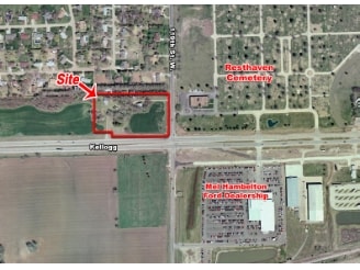
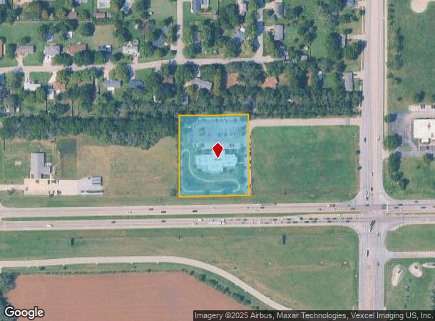
Property Record
12112 W Us Highway 54, Wichita, KS 67235
NEARBY LISTINGS FOR SALE OR LEASE
Property Detail
12112 W Us Highway 54
Wichita, KS
Wheatridge Add
147-25-0-44-01-019.00B
W 63.21 FT LOT 5 & ALL LOTS 6 & 7 & E 303.19 FT HARRY ST ROW ADJOING LOTS 5,6.7 BLOCK 2 WHEATRIDGE
Medicalbuilding
Sedgwick
X
Kansas
20173C0336G
5,6,7
2024
2.44 AC
2025
Goddard/West
009510
Wichita
11,341 SF
DEMOGRAPHICS near 12112 W Us Highway 54
1 Mile
3 Mile
5 Mile
2024 Total Population
5,409
36,032
81,708
2029 Population
5,487
36,258
82,235
Pop Growth 2024-2029
+ 1.44%
+ 0.63%
+ 0.64%
Average Age
38
41
40
2024 Total Households
1,850
13,327
31,431
HH Growth 2024-2029
+ 1.46%
+ 0.56%
+ 0.62%
Median Household Inc
$94,809
$91,581
$78,174
Avg Household Size
2.90
2.60
2.50
2024 Avg HH Vehicles
2.00
2.00
2.00
Median Home Value
$180,193
$212,078
$194,662
Median Year Built
1998
1990
1988
Nearby Places
- Restaurants
- Banks
- Shops
- Fitness
- Groceries
PUBLIC TRANSPORTATION
AIRPORT
Wichita Dwight D Eisenhower Ntl
DRIVE
WALK
Distance
Wichita Dwight D Eisenhower Ntl
8 min
4.6 mi
Freight Ports
Tulsa Port Of Catoosa
DRIVE
WALK
Distance
Tulsa Port Of Catoosa
211 min
198.1 mi
Nearby Properties
Address
Land Use
TOTAL SIZE
Lot Size
Zoning
Address
Land Use
TOTAL SIZE
Lot Size
Zoning
478,786 SF
124.50 AC
SF-5,LC
Address
Land Use
TOTAL SIZE
Lot Size
Zoning
95,466 SF
31.67 AC
SF-5
Address
Land Use
TOTAL SIZE
Lot Size
Zoning
102,794 SF
14.78 AC
SF-5
Address
Land Use
TOTAL SIZE
Lot Size
Zoning
143,704 SF
19.22 AC
SF-5
Address
Land Use
TOTAL SIZE
Lot Size
Zoning
193,680 SF
4.31 AC
LI
Address
Land Use
TOTAL SIZE
Lot Size
Zoning
58,588 SF
11.08 AC
SF-5
Address
Land Use
TOTAL SIZE
Lot Size
Zoning
65,504 SF
6.81 AC
SF-5
Address
Land Use
TOTAL SIZE
Lot Size
Zoning
53,402 SF
26.35 AC
SF-5
Address
Land Use
TOTAL SIZE
Lot Size
Zoning
51,845 SF
5.51 AC
SF-5
Address
Land Use
TOTAL SIZE
Lot Size
Zoning
56,627 SF
14.01 AC
SF-5
Address
Land Use
TOTAL SIZE
Lot Size
Zoning
31,132 SF
4.14 AC
B
Address
Land Use
TOTAL SIZE
Lot Size
Zoning
65,110 SF
3.94 AC
B
Address
Land Use
TOTAL SIZE
Lot Size
Zoning
34,848 SF
8.24 AC
SF-5
Address
Land Use
TOTAL SIZE
Lot Size
Zoning
87.72 AC
SF-5
Address
Land Use
TOTAL SIZE
Lot Size
Zoning
592,009 SF
44.43 AC
LI
Address
Land Use
TOTAL SIZE
Lot Size
Zoning
26,681 SF
9.54 AC
SF-5
Address
Land Use
TOTAL SIZE
Lot Size
Zoning
24,767 SF
8.96 AC
SF-5
Address
Land Use
TOTAL SIZE
Lot Size
Zoning
31,411 SF
3.98 AC
SF-5
Address
Land Use
TOTAL SIZE
Lot Size
Zoning
43,962 SF
4.69 AC
MF-29
Address
Land Use
TOTAL SIZE
Lot Size
Zoning
8,786 SF
4.49 AC
MF-18
Address
Land Use
TOTAL SIZE
Lot Size
Zoning
24,665 SF
2.04 AC
SF-5
Address
Land Use
TOTAL SIZE
Lot Size
Zoning
34,550 SF
9.08 AC
SF-5
Address
Land Use
TOTAL SIZE
Lot Size
Zoning
25,144 SF
3.91 AC
LI
Address
Land Use
TOTAL SIZE
Lot Size
Zoning
38,144 SF
0.46 AC
SF-5
Address
Land Use
TOTAL SIZE
Lot Size
Zoning
16,823 SF
3.22 AC
LC
Address
Land Use
TOTAL SIZE
Lot Size
Zoning
5,396 SF
138.07 AC
SF-5
Address
Land Use
TOTAL SIZE
Lot Size
Zoning
78,920 SF
22.15 AC
LI
Address
Land Use
TOTAL SIZE
Lot Size
Zoning
55,816 SF
13.02 AC
LC
Address
Land Use
TOTAL SIZE
Lot Size
Zoning
127,204 SF
15.72 AC
LC
Address
Land Use
TOTAL SIZE
Lot Size
Zoning
119,826 SF
7.12 AC
LC
The World's #1 Commercial Real Estate Marketplace
Connect with us
© 2025 CoStar Group
The information above has been obtained from sources believed reliable. While we do not doubt its accuracy we have not verified it and make no guarantee, warranty or representation about it. It is your responsibility to independently confirm its accuracy and completeness. Any projections, opinions, assumptions, or estimates used are for example only and do not represent the current or future performance of the property. The value of this transaction to you depends on tax and other factors which should be evaluated by your tax, financial, and legal advisors. You and your advisors should conduct a careful, independent investigation of the property to determine to your satisfaction the suitability of the property for your needs.