Property Record
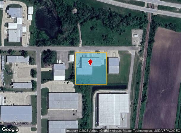
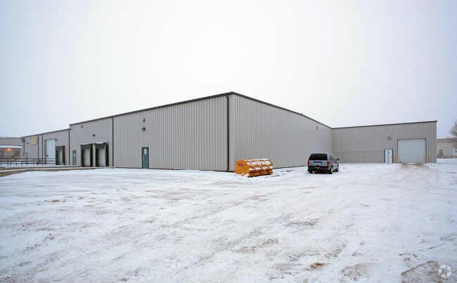
1212 Sykes St, Albert Lea, MN 56007

NEARBY LISTINGS FOR SALE OR LEASE
Property Detail
1212 Sykes St
Albert Lea, MN
Port Authority Plat No 1
34.317.0050
PORT AUTHORITY PLAT NO. 1 LOT-005 BLOCK-001 LOT 5 PORT AUTHORITY PLAT 1
Industrialgeneral
Freeborn
X
Minnesota
27047C0236C
5
2025
2.07 AC
2025
Minnesota South Area
180500
Other Market Areas
26,840 SF
DEMOGRAPHICS near 1212 Sykes St
1 Mile
3 Mile
5 Mile
2024 Total Population
440
11,917
20,441
2029 Population
441
11,844
20,394
Pop Growth 2024-2029
+ 0.23%
(0.61%)
(0.23%)
Average Age
49
44
43
2024 Total Households
196
5,141
8,712
HH Growth 2024-2029
0.00%
(0.66%)
(0.22%)
Median Household Inc
$63,970
$57,075
$54,719
Avg Household Size
2.20
2.20
2.20
2024 Avg HH Vehicles
2.00
2.00
2.00
Median Home Value
$171,428
$145,614
$132,811
Median Year Built
1974
1958
1959
Nearby Places
Map Layers
Map Styles
 Street
 Aerial
- Restaurants
- Banks
- Shops
- Fitness
- Groceries
Nearby Properties
Address
Land Use
TOTAL SIZE
Lot Size
Zoning
Address
Land Use
TOTAL SIZE
Lot Size
Zoning
8.30 AC
PD
Address
Land Use
TOTAL SIZE
Lot Size
Zoning
2.01 AC
B3
Address
Land Use
TOTAL SIZE
Lot Size
Zoning
21.14 AC
Address
Land Use
TOTAL SIZE
Lot Size
Zoning
81.57 AC
I1
Address
Land Use
TOTAL SIZE
Lot Size
Zoning
25.67 AC
Address
Land Use
TOTAL SIZE
Lot Size
Zoning
5.41 AC
PD
Address
Land Use
TOTAL SIZE
Lot Size
Zoning
15.50 AC
Address
Land Use
TOTAL SIZE
Lot Size
Zoning
16.79 AC
B2
Address
Land Use
TOTAL SIZE
Lot Size
Zoning
Address
Land Use
TOTAL SIZE
Lot Size
Zoning
5.68 AC
PD
Address
Land Use
TOTAL SIZE
Lot Size
Zoning
13.94 AC
PD
Address
Land Use
TOTAL SIZE
Lot Size
Zoning
Address
Land Use
TOTAL SIZE
Lot Size
Zoning
Address
Land Use
TOTAL SIZE
Lot Size
Zoning
247,732 SF
13.04 AC
I2
Address
Land Use
TOTAL SIZE
Lot Size
Zoning
11.71 AC
B2
Address
Land Use
TOTAL SIZE
Lot Size
Zoning
4.98 AC
Address
Land Use
TOTAL SIZE
Lot Size
Zoning
4.87 AC
I2
Address
Land Use
TOTAL SIZE
Lot Size
Zoning
12.80 AC
PD
Address
Land Use
TOTAL SIZE
Lot Size
Zoning
19.82 AC
Address
Land Use
TOTAL SIZE
Lot Size
Zoning
0.26 AC
B3
Address
Land Use
TOTAL SIZE
Lot Size
Zoning
1.71 AC
PD
Address
Land Use
TOTAL SIZE
Lot Size
Zoning
2.90 AC
R3
Address
Land Use
TOTAL SIZE
Lot Size
Zoning
0.29 AC
Address
Land Use
TOTAL SIZE
Lot Size
Zoning
14.73 AC
B4
Address
Land Use
TOTAL SIZE
Lot Size
Zoning
70,530 SF
5.68 AC
I2
Address
Land Use
TOTAL SIZE
Lot Size
Zoning
44,604 SF
3.85 AC
Address
Land Use
TOTAL SIZE
Lot Size
Zoning
2.12 AC
Address
Land Use
TOTAL SIZE
Lot Size
Zoning
58.53 AC
R3
Address
Land Use
TOTAL SIZE
Lot Size
Zoning
3.63 AC
Address
Land Use
TOTAL SIZE
Lot Size
Zoning
60,296 SF
4.14 AC
B2
The World's #1 Commercial Real Estate Marketplace
Connect with us
© 2025 CoStar Group
The information above has been obtained from sources believed reliable. While we do not doubt its accuracy we have not verified it and make no guarantee, warranty or representation about it. It is your responsibility to independently confirm its accuracy and completeness. Any projections, opinions, assumptions, or estimates used are for example only and do not represent the current or future performance of the property. The value of this transaction to you depends on tax and other factors which should be evaluated by your tax, financial, and legal advisors. You and your advisors should conduct a careful, independent investigation of the property to determine to your satisfaction the suitability of the property for your needs.