Property Record
12121 W Thunderbird Rd, El Mirage, AZ 85335

This Property Is For Sale
Property Detail
12121 W Thunderbird Rd
Phoenix-Mesa-Chandler, AZ
CAPISTRANO ESTATES LOT 1001-1144 COMM AREA A MCR 291-23
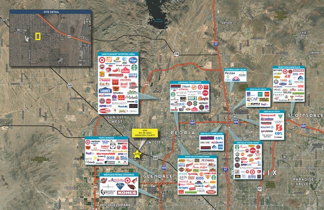
501-36-282G
MARICOPA
Commercialacreage
Arizona
UC
l
C and X Area of minimal flood hazard, usually depicted on FIRMs as above the 500-year flood level.
7.89 AC
2025
Loop 303/Surprise
2025
Phoenix
060902
NEARBY LISTINGS FOR SALE OR LEASE
DEMOGRAPHICS near 12121 W Thunderbird Rd
1 mile
3 mile
5 mile
2025 Total Population
21,832
97,781
246,209
2030 Population
22,493
101,741
256,264
Pop Growth 2025-2030
+ 3.03%
+ 4.05%
+ 4.08%
Average Age
33
45
47
2025 Total Households
6,114
38,740
102,815
HH Growth 2025-2030
+ 3.01%
+ 4.40%
+ 4.30%
Median Household Inc
$76,461
$66,171
$69,575
Avg Household Size
3.50
2.50
2.30
2025 Avg HH Vehicles
2.00
2.00
2.00
Median Home Value
$330,514
$332,545
$359,930
Median Year Built
2002
1994
1992
Nearby Places
Map Layers
Map Styles
 Street
 Aerial
Transit
 Traffic
 Biking
Places
Listings with unknown addresses are not visible on the map
- Restaurants
- Banks
- Shops
- Fitness
- Groceries
PUBLIC TRANSPORTATION
AIRPORT
Phoenix Sky Harbor International
Drive
Walk
Distance
Phoenix Sky Harbor International
42 min
30.8 mi
Nearby Properties
Address
Land Use
TOTAL SIZE
Lot Size
Zoning
Address
Land Use
TOTAL SIZE
Lot Size
Zoning
35.74 AC
Address
Land Use
TOTAL SIZE
Lot Size
Zoning
1,010,365 SF
29.94 AC
C2
Address
Land Use
TOTAL SIZE
Lot Size
Zoning
53.02 AC
Address
Land Use
TOTAL SIZE
Lot Size
Zoning
16,341 SF
174.45 AC
R-43
Address
Land Use
TOTAL SIZE
Lot Size
Zoning
1,113,127 SF
48.24 AC
C2
Address
Land Use
TOTAL SIZE
Lot Size
Zoning
294,360 SF
21.69 AC
EI
Address
Land Use
TOTAL SIZE
Lot Size
Zoning
225,457 SF
70.07 AC
PAD
Address
Land Use
TOTAL SIZE
Lot Size
Zoning
20,948 SF
2.39 AC
R-6
Address
Land Use
TOTAL SIZE
Lot Size
Zoning
67,417 SF
12.16 AC
PAD
Address
Land Use
TOTAL SIZE
Lot Size
Zoning
418,305 SF
24.06 AC
PAD
Address
Land Use
TOTAL SIZE
Lot Size
Zoning
333,066 SF
16.33 AC
PAD
Address
Land Use
TOTAL SIZE
Lot Size
Zoning
38,400 SF
4.97 AC
I-2
Address
Land Use
TOTAL SIZE
Lot Size
Zoning
247,178 SF
33.92 AC
PAD
Address
Land Use
TOTAL SIZE
Lot Size
Zoning
106,356 SF
14.16 AC
PAD
Address
Land Use
TOTAL SIZE
Lot Size
Zoning
77,400 SF
20.34 AC
PAD
Address
Land Use
TOTAL SIZE
Lot Size
Zoning
145,491 SF
37.61 AC
PAD
Address
Land Use
TOTAL SIZE
Lot Size
Zoning
707,380 SF
46.26 AC
I-2
Address
Land Use
TOTAL SIZE
Lot Size
Zoning
67,932 SF
14.90 AC
PAD
Address
Land Use
TOTAL SIZE
Lot Size
Zoning
199,390 SF
24.59 AC
C-C
Address
Land Use
TOTAL SIZE
Lot Size
Zoning
65,749 SF
14.58 AC
PAD
Address
Land Use
TOTAL SIZE
Lot Size
Zoning
270,000 SF
16.26 AC
PAD
Address
Land Use
TOTAL SIZE
Lot Size
Zoning
65,711 SF
8.62 AC
PAD
Address
Land Use
TOTAL SIZE
Lot Size
Zoning
153,525 SF
14.48 AC
PAD
Address
Land Use
TOTAL SIZE
Lot Size
Zoning
112,957 SF
17.40 AC
PAD
Address
Land Use
TOTAL SIZE
Lot Size
Zoning
151,598 SF
9.89 AC
PAD
Address
Land Use
TOTAL SIZE
Lot Size
Zoning
123,820 SF
4.53 AC
C-C
Address
Land Use
TOTAL SIZE
Lot Size
Zoning
19,858 SF
0.64 AC
C-2
Address
Land Use
TOTAL SIZE
Lot Size
Zoning
296,540 SF
11 AC
Address
Land Use
TOTAL SIZE
Lot Size
Zoning
97,910 SF
26.16 AC
PAD
Address
Land Use
TOTAL SIZE
Lot Size
Zoning
94,438 SF
12 AC
PAD
The World's #1 Commercial Real Estate Marketplace
Connect with us
© 2026 CoStar Group
The information above has been obtained from sources believed reliable. While we do not doubt its accuracy we have not verified it and make no guarantee, warranty or representation about it. It is your responsibility to independently confirm its accuracy and completeness. Any projections, opinions, assumptions, or estimates used are for example only and do not represent the current or future performance of the property. The value of this transaction to you depends on tax and other factors which should be evaluated by your tax, financial, and legal advisors. You and your advisors should conduct a careful, independent investigation of the property to determine to your satisfaction the suitability of the property for your needs.