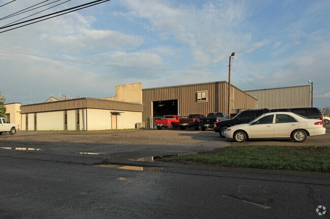
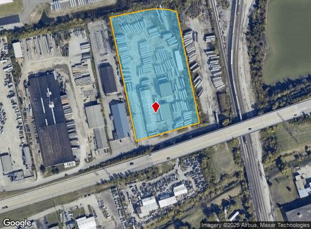
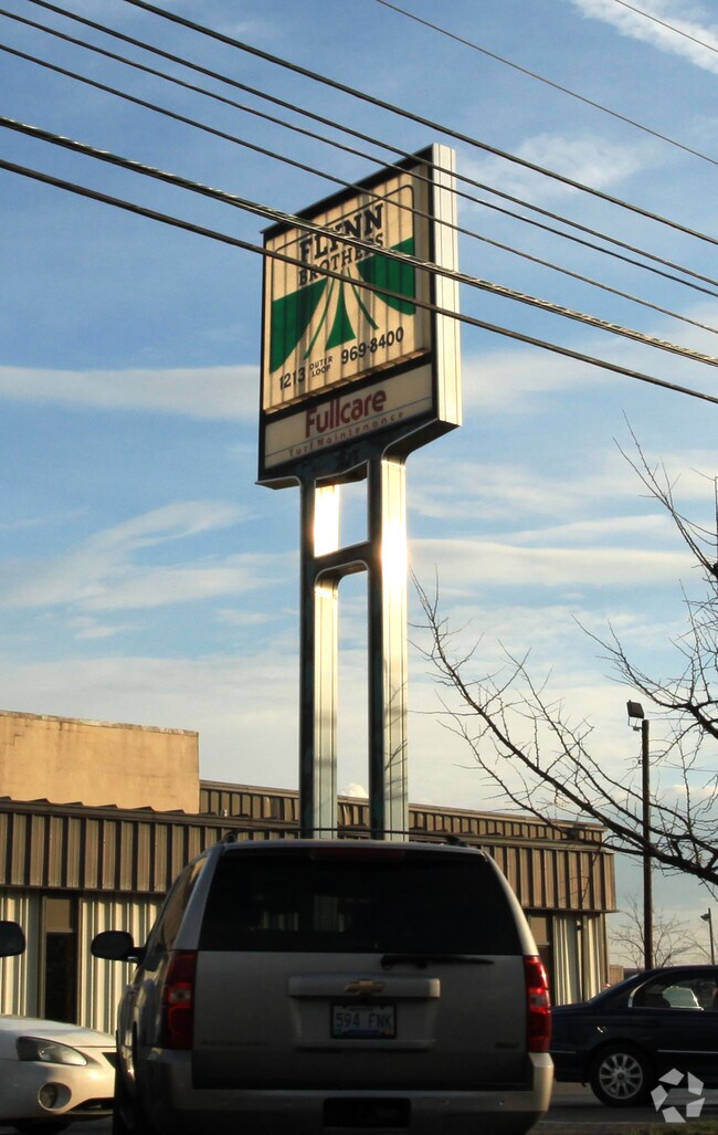
Property Record
1213 Outer Loop, Louisville, KY 40219
NEARBY LISTINGS FOR SALE OR LEASE
Property Detail
1213 Outer Loop
104600210001
6.794 ACRES
Warehouse
Jefferson
AE
Kentucky
21111C0092E
6.79 AC
2025
South Central
2025
Louisville
009103
Louisville/Jefferson County, KY-IN
27,314 SF
DEMOGRAPHICS near 1213 Outer Loop
1 Mile
3 Mile
5 Mile
2024 Total Population
3,423
42,329
142,492
2029 Population
3,383
41,715
141,372
Pop Growth 2024-2029
(1.17%)
(1.45%)
(0.79%)
Average Age
37
38
38
2024 Total Households
1,271
16,411
56,780
HH Growth 2024-2029
(1.34%)
(1.52%)
(0.86%)
Median Household Inc
$44,021
$49,711
$50,630
Avg Household Size
2.60
2.50
2.40
2024 Avg HH Vehicles
2.00
2.00
2.00
Median Home Value
$121,276
$149,514
$157,544
Median Year Built
1977
1969
1967
Nearby Places
Map Layers
Map Styles
 Street
 Aerial
- Restaurants
- Banks
- Shops
- Fitness
- Groceries
PUBLIC TRANSPORTATION
AIRPORT
Louisville Muhammad Ali International
DRIVE
WALK
Distance
Louisville Muhammad Ali International
12 min
4.5 mi
SALE & LEASE HISTORY
LISTING DATE
SALE/LEASE

Feb 02, 2018
For Lease
Nearby Properties
Address
Land Use
TOTAL SIZE
Lot Size
Zoning
Address
Land Use
TOTAL SIZE
Lot Size
Zoning
226,400 SF
150.18 AC
EZ1-ENTERP
Address
Land Use
TOTAL SIZE
Lot Size
Zoning
377,041 SF
469.53 AC
Address
Land Use
TOTAL SIZE
Lot Size
Zoning
257,385 SF
176.30 AC
Address
Land Use
TOTAL SIZE
Lot Size
Zoning
109.84 AC
R5-RESIDEN
Address
Land Use
TOTAL SIZE
Lot Size
Zoning
221,115 SF
97.92 AC
EZ1-ENTERP
Address
Land Use
TOTAL SIZE
Lot Size
Zoning
61.37 AC
C2-COMMERC
Address
Land Use
TOTAL SIZE
Lot Size
Zoning
822,500 SF
44.75 AC
EZ1-ENTERP
Address
Land Use
TOTAL SIZE
Lot Size
Zoning
Address
Land Use
TOTAL SIZE
Lot Size
Zoning
34.73 AC
Address
Land Use
TOTAL SIZE
Lot Size
Zoning
39.61 AC
Address
Land Use
TOTAL SIZE
Lot Size
Zoning
35 AC
C2-COMMERC
Address
Land Use
TOTAL SIZE
Lot Size
Zoning
30.47 AC
R7-RESIDEN
Address
Land Use
TOTAL SIZE
Lot Size
Zoning
517,000 SF
31.95 AC
EZ1-ENTERP
Address
Land Use
TOTAL SIZE
Lot Size
Zoning
679,250 SF
35.34 AC
Address
Land Use
TOTAL SIZE
Lot Size
Zoning
1,484 SF
17.11 AC
R4-RESIDEN
Address
Land Use
TOTAL SIZE
Lot Size
Zoning
22.14 AC
EZ1-ENTERP
Address
Land Use
TOTAL SIZE
Lot Size
Zoning
102,600 SF
173.89 AC
EZ1-ENTERP
Address
Land Use
TOTAL SIZE
Lot Size
Zoning
12,972 SF
28.36 AC
R6-RESIDEN
Address
Land Use
TOTAL SIZE
Lot Size
Zoning
1,800 SF
31.91 AC
Address
Land Use
TOTAL SIZE
Lot Size
Zoning
636,716 SF
33.71 AC
Address
Land Use
TOTAL SIZE
Lot Size
Zoning
28.70 AC
C1-COMMERC
Address
Land Use
TOTAL SIZE
Lot Size
Zoning
273,585 SF
42.27 AC
Address
Land Use
TOTAL SIZE
Lot Size
Zoning
18.37 AC
Address
Land Use
TOTAL SIZE
Lot Size
Zoning
2,043 SF
60.14 AC
Address
Land Use
TOTAL SIZE
Lot Size
Zoning
31.15 AC
EZ1-ENTERP
Address
Land Use
TOTAL SIZE
Lot Size
Zoning
23.20 AC
EZ1-ENTERP
Address
Land Use
TOTAL SIZE
Lot Size
Zoning
2,507 SF
77.40 AC
R5-RESIDEN
Address
Land Use
TOTAL SIZE
Lot Size
Zoning
25,326 SF
11.36 AC
R7-RESIDEN
Address
Land Use
TOTAL SIZE
Lot Size
Zoning
20,496 SF
18.38 AC
R6-RESIDEN
Address
Land Use
TOTAL SIZE
Lot Size
Zoning
22.40 AC
The World's #1 Commercial Real Estate Marketplace
Connect with us
© 2026 CoStar Group
The information above has been obtained from sources believed reliable. While we do not doubt its accuracy we have not verified it and make no guarantee, warranty or representation about it. It is your responsibility to independently confirm its accuracy and completeness. Any projections, opinions, assumptions, or estimates used are for example only and do not represent the current or future performance of the property. The value of this transaction to you depends on tax and other factors which should be evaluated by your tax, financial, and legal advisors. You and your advisors should conduct a careful, independent investigation of the property to determine to your satisfaction the suitability of the property for your needs.