Property Record
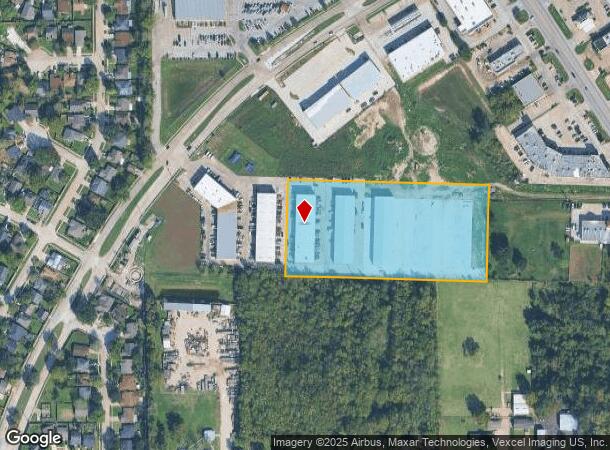
12130 Antoine Dr, Houston, TX 77066
NEARBY LISTINGS FOR SALE OR LEASE
Property Detail
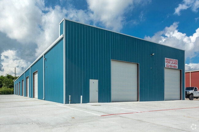
12130 Antoine Dr
1162560020014
Starline
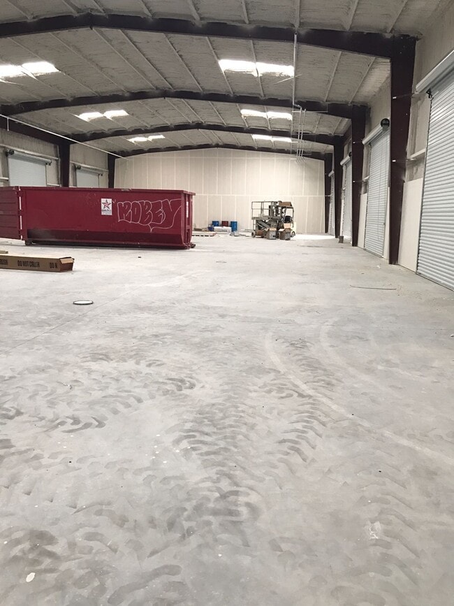
Warehouse
RES B4-A BLK 2 STARLINE
X
Harris
48201C0455L
Texas
2024
5.12 AC
2025
North Fwy/Tomball Pky
550800
Houston
74,750 SF
Houston-The Woodlands-Sugar Land, TX
DEMOGRAPHICS near 12130 Antoine Dr
1 Mile
3 Mile
5 Mile
2024 Total Population
18,098
123,935
301,153
2029 Population
18,238
125,504
305,628
Pop Growth 2024-2029
+ 0.77%
+ 1.27%
+ 1.49%
Average Age
35
35
35
2024 Total Households
5,249
39,322
100,599
HH Growth 2024-2029
+ 0.80%
+ 1.32%
+ 1.57%
Median Household Inc
$53,887
$55,358
$52,360
Avg Household Size
3.30
3.10
2.90
2024 Avg HH Vehicles
2.00
2.00
2.00
Median Home Value
$154,956
$177,673
$192,873
Median Year Built
1986
1987
1988
Nearby Places
Map Layers
Map Styles
 Street
 Aerial
- Restaurants
- Banks
- Shops
- Fitness
- Groceries
PUBLIC TRANSPORTATION
AIRPORT
George Bush Intcntl/Houston
DRIVE
WALK
Distance
George Bush Intcntl/Houston
19 min
13.1 mi
William P Hobby
DRIVE
WALK
Distance
William P Hobby
47 min
28.7 mi
Freight Ports
Port of Houston
DRIVE
WALK
Distance
Port of Houston
39 min
24.2 mi
SALE & LEASE HISTORY
LISTING DATE
SALE/LEASE

Oct 19, 2020
For Lease
Nearby Properties
Address
Land Use
TOTAL SIZE
Lot Size
Zoning
Address
Land Use
TOTAL SIZE
Lot Size
Zoning
552,757 SF
32.95 AC
Address
Land Use
TOTAL SIZE
Lot Size
Zoning
180,249 SF
13.35 AC
Address
Land Use
TOTAL SIZE
Lot Size
Zoning
402,504 SF
31.93 AC
Address
Land Use
TOTAL SIZE
Lot Size
Zoning
339,477 SF
13.54 AC
Address
Land Use
TOTAL SIZE
Lot Size
Zoning
424,122 SF
21.06 AC
Address
Land Use
TOTAL SIZE
Lot Size
Zoning
423,472 SF
28.91 AC
Address
Land Use
TOTAL SIZE
Lot Size
Zoning
351,235 SF
20.73 AC
Address
Land Use
TOTAL SIZE
Lot Size
Zoning
335,106 SF
13.27 AC
Address
Land Use
TOTAL SIZE
Lot Size
Zoning
215,968 SF
17.23 AC
Address
Land Use
TOTAL SIZE
Lot Size
Zoning
356,656 SF
23.54 AC
Address
Land Use
TOTAL SIZE
Lot Size
Zoning
304,518 SF
15 AC
Address
Land Use
TOTAL SIZE
Lot Size
Zoning
292,112 SF
4.41 AC
Address
Land Use
TOTAL SIZE
Lot Size
Zoning
200,123 SF
14.94 AC
Address
Land Use
TOTAL SIZE
Lot Size
Zoning
293,280 SF
16.24 AC
Address
Land Use
TOTAL SIZE
Lot Size
Zoning
614,712 SF
7.93 AC
Address
Land Use
TOTAL SIZE
Lot Size
Zoning
240,905 SF
19.98 AC
Address
Land Use
TOTAL SIZE
Lot Size
Zoning
130,470 SF
9.22 AC
Address
Land Use
TOTAL SIZE
Lot Size
Zoning
241,946 SF
14.02 AC
Address
Land Use
TOTAL SIZE
Lot Size
Zoning
404,248 SF
16.31 AC
Address
Land Use
TOTAL SIZE
Lot Size
Zoning
253,369 SF
16.81 AC
Address
Land Use
TOTAL SIZE
Lot Size
Zoning
237,292 SF
11.91 AC
Address
Land Use
TOTAL SIZE
Lot Size
Zoning
247,670 SF
13.38 AC
Address
Land Use
TOTAL SIZE
Lot Size
Zoning
319,231 SF
14.97 AC
Address
Land Use
TOTAL SIZE
Lot Size
Zoning
209,825 SF
11.97 AC
Address
Land Use
TOTAL SIZE
Lot Size
Zoning
213,200 SF
18.72 AC
Address
Land Use
TOTAL SIZE
Lot Size
Zoning
523,507 SF
38.28 AC
Address
Land Use
TOTAL SIZE
Lot Size
Zoning
348,857 SF
20.06 AC
Address
Land Use
TOTAL SIZE
Lot Size
Zoning
188,236 SF
9.67 AC
Address
Land Use
TOTAL SIZE
Lot Size
Zoning
211,200 SF
8.10 AC
Address
Land Use
TOTAL SIZE
Lot Size
Zoning
221,352 SF
17.35 AC
The World's #1 Commercial Real Estate Marketplace
Connect with us
© 2025 CoStar Group
The information above has been obtained from sources believed reliable. While we do not doubt its accuracy we have not verified it and make no guarantee, warranty or representation about it. It is your responsibility to independently confirm its accuracy and completeness. Any projections, opinions, assumptions, or estimates used are for example only and do not represent the current or future performance of the property. The value of this transaction to you depends on tax and other factors which should be evaluated by your tax, financial, and legal advisors. You and your advisors should conduct a careful, independent investigation of the property to determine to your satisfaction the suitability of the property for your needs.