Property Record
12131 Brighton Rd, Henderson, CO 80640

Save to a Folder
{{folder.Name}}
{{folder.ListingIds.length}} Properties
{{folder.ListingIds.length}} Property
Create a New Folder
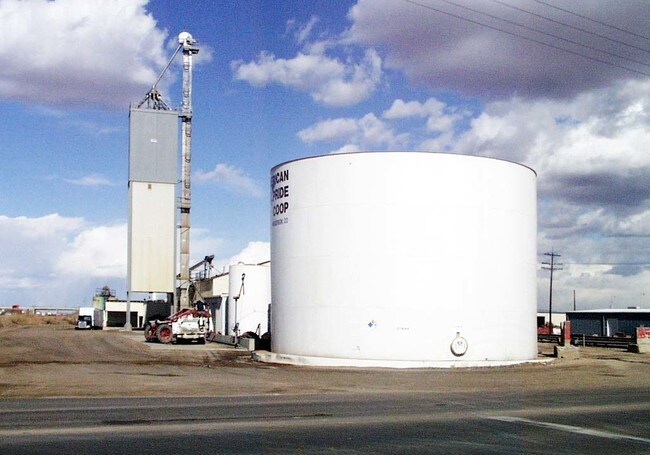
Property Detail
12131 Brighton Rd
1571-34-0-00-037
SECT,TWN,RNG:34-1-67 DESC: COM AT SE COR SEC TH W 80 RODS TH N 15 RODS 3 AND 1/2 FT TO POB TH N 71 AND 1/2 RODS TH S 62D 30M E 39 RODS TO CEN OF CO RD TH S 31D 30M W 61 AND 1/2 RODS TO POB AND EXC RD (2010000090166) 6/8602A
Vacantlandnec
ADAMS
A3
Colorado
AE The base floodplain where base flood elevations are provided. AE Zones are now used on new format FIRMs instead of A1-A30 Zones.
6.86 AC
2024
DIA
2025
Denver
008535
Denver-Aurora-Centennial, CO
NEARBY LISTINGS FOR SALE OR LEASE
DEMOGRAPHICS near 12131 Brighton Rd
1 mile
3 mile
5 mile
2025 Total Population
1,697
38,288
145,256
2030 Population
1,746
39,914
151,390
Pop Growth 2025-2030
+ 2.89%
+ 4.25%
+ 4.22%
Average Age
35
36
37
2025 Total Households
521
12,067
48,538
HH Growth 2025-2030
+ 3.26%
+ 4.49%
+ 4.56%
Median Household Inc
$121,428
$132,233
$121,276
Avg Household Size
3.30
3.20
3.00
2025 Avg HH Vehicles
2.00
2.00
2.00
Median Home Value
$506,944
$619,340
$588,147
Median Year Built
2004
2005
2002
Nearby Places
Map Layers
Map Styles
 Street
 Aerial
Layers
 Traffic
 Biking
Places
Listings with unknown addresses are not visible on the map
- Restaurants
- Banks
- Shops
- Fitness
- Groceries
PUBLIC TRANSPORTATION
COMMUTER RAIL
Drive
Walk
Distance
10 min
5.4 mi
Drive
Walk
Distance
10 min
5.7 mi
AIRPORT
Denver International
Drive
Walk
Distance
Denver International
24 min
18.3 mi
Nearby Properties
Address
Land Use
TOTAL SIZE
Lot Size
Zoning
Address
Land Use
TOTAL SIZE
Lot Size
Zoning
8,556 SF
382.73 AC
A3
Address
Land Use
TOTAL SIZE
Lot Size
Zoning
358,386 SF
76.08 AC
Address
Land Use
TOTAL SIZE
Lot Size
Zoning
276,395 SF
26.43 AC
A3
Address
Land Use
TOTAL SIZE
Lot Size
Zoning
330,176 SF
17.12 AC
Address
Land Use
TOTAL SIZE
Lot Size
Zoning
153,301 SF
26.75 AC
Address
Land Use
TOTAL SIZE
Lot Size
Zoning
298,200 SF
17.67 AC
Address
Land Use
TOTAL SIZE
Lot Size
Zoning
272,800 SF
16.44 AC
Address
Land Use
TOTAL SIZE
Lot Size
Zoning
109,685 SF
11.51 AC
Address
Land Use
TOTAL SIZE
Lot Size
Zoning
64,750 SF
11.91 AC
Address
Land Use
TOTAL SIZE
Lot Size
Zoning
86,977 SF
4.14 AC
Address
Land Use
TOTAL SIZE
Lot Size
Zoning
158,001 SF
20.40 AC
Address
Land Use
TOTAL SIZE
Lot Size
Zoning
96,628 SF
4.35 AC
Address
Land Use
TOTAL SIZE
Lot Size
Zoning
174.45 AC
Address
Land Use
TOTAL SIZE
Lot Size
Zoning
207,453 SF
26.66 AC
Address
Land Use
TOTAL SIZE
Lot Size
Zoning
64,501 SF
29.37 AC
Address
Land Use
TOTAL SIZE
Lot Size
Zoning
121,275 SF
6.56 AC
Address
Land Use
TOTAL SIZE
Lot Size
Zoning
48,359 SF
278.79 AC
A3
Address
Land Use
TOTAL SIZE
Lot Size
Zoning
64,715 SF
10.38 AC
Address
Land Use
TOTAL SIZE
Lot Size
Zoning
106,530 SF
7.04 AC
Address
Land Use
TOTAL SIZE
Lot Size
Zoning
70,573 SF
6.42 AC
Address
Land Use
TOTAL SIZE
Lot Size
Zoning
33,989 SF
24.98 AC
Address
Land Use
TOTAL SIZE
Lot Size
Zoning
63,602 SF
10.09 AC
Address
Land Use
TOTAL SIZE
Lot Size
Zoning
63,989 SF
12.74 AC
Address
Land Use
TOTAL SIZE
Lot Size
Zoning
89,219 SF
11.79 AC
Address
Land Use
TOTAL SIZE
Lot Size
Zoning
56,697 SF
9.97 AC
PUD
Address
Land Use
TOTAL SIZE
Lot Size
Zoning
44,090 SF
20.72 AC
Address
Land Use
TOTAL SIZE
Lot Size
Zoning
55,810 SF
14.52 AC
Address
Land Use
TOTAL SIZE
Lot Size
Zoning
82,239 SF
7.02 AC
Address
Land Use
TOTAL SIZE
Lot Size
Zoning
79,121 SF
6.39 AC
Address
Land Use
TOTAL SIZE
Lot Size
Zoning
75,398 SF
8.82 AC
I2
The World's #1 Commercial Real Estate Marketplace
Connect with us
© 2026 CoStar Group
The information above has been obtained from sources believed reliable. While we do not doubt its accuracy we have not verified it and make no guarantee, warranty or representation about it. It is your responsibility to independently confirm its accuracy and completeness. Any projections, opinions, assumptions, or estimates used are for example only and do not represent the current or future performance of the property. The value of this transaction to you depends on tax and other factors which should be evaluated by your tax, financial, and legal advisors. You and your advisors should conduct a careful, independent investigation of the property to determine to your satisfaction the suitability of the property for your needs.