Property Record
12134 State Road 54, Odessa, FL 33556

NEARBY LISTINGS FOR SALE OR LEASE
-
-
-
-
-
No Photo
-
-
View all Odessa listings for sale on LoopNet.com
Property Detail
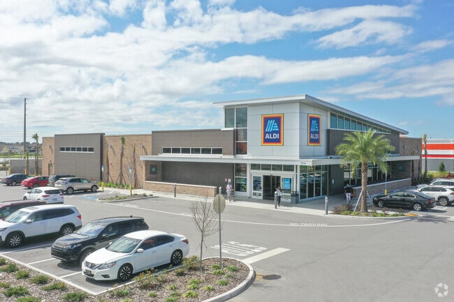
12134 State Road 54
Tampa-St. Petersburg-Clearwater, FL
Trinity Lakes Crossings
28-26-17-0120-00000-0010
Pasco
Supermarket
Florida
X
2.27 AC
12101C0380F
Pasco County
20,346 SF
Tampa/St Petersburg
DEMOGRAPHICS near 12134 State Road 54
1 Mile
3 Mile
5 Mile
2024 Total Population
4,629
31,436
79,044
2029 Population
5,619
38,118
94,905
Pop Growth 2024-2029
+ 21.39%
+ 21.26%
+ 20.07%
Average Age
43
42
43
2024 Total Households
1,846
11,874
31,180
HH Growth 2024-2029
+ 21.24%
+ 21.26%
+ 20.03%
Median Household Inc
$104,074
$103,065
$87,332
Avg Household Size
2.50
2.60
2.50
2024 Avg HH Vehicles
2.00
2.00
2.00
Median Home Value
$360,061
$381,232
$341,496
Median Year Built
2010
2007
2000
Nearby Places
Map Layers
Map Styles
 Street
 Aerial
- Restaurants
- Banks
- Shops
- Fitness
- Groceries
PUBLIC TRANSPORTATION
AIRPORT
Tampa International
DRIVE
WALK
Distance
Tampa International
36 min
24.7 mi
St Pete-Clearwater International
DRIVE
WALK
Distance
St Pete-Clearwater International
50 min
28.2 mi
Freight Ports
Port of Tampa Bay
DRIVE
WALK
Distance
Port of Tampa Bay
48 min
30.2 mi
SALE & LEASE HISTORY
LISTING DATE
SALE/LEASE

May 18, 2020
For Sale
Nearby Properties
Address
Land Use
TOTAL SIZE
Lot Size
Zoning
Address
Land Use
TOTAL SIZE
Lot Size
Zoning
420,063 SF
42.64 AC
C2
Address
Land Use
TOTAL SIZE
Lot Size
Zoning
430,820 SF
19.14 AC
MPUD
Address
Land Use
TOTAL SIZE
Lot Size
Zoning
417,700 SF
28.91 AC
MPUD
Address
Land Use
TOTAL SIZE
Lot Size
Zoning
347,170 SF
15.50 AC
MPUD
Address
Land Use
TOTAL SIZE
Lot Size
Zoning
339,446 SF
16.29 AC
MPUD
Address
Land Use
TOTAL SIZE
Lot Size
Zoning
290,535 SF
14.91 AC
MPUD
Address
Land Use
TOTAL SIZE
Lot Size
Zoning
231,952 SF
19.51 AC
MPUD
Address
Land Use
TOTAL SIZE
Lot Size
Zoning
190,854 SF
14.90 AC
MPUD
Address
Land Use
TOTAL SIZE
Lot Size
Zoning
152,300 SF
2.82 AC
MF3
Address
Land Use
TOTAL SIZE
Lot Size
Zoning
1,017 AC
AR
Address
Land Use
TOTAL SIZE
Lot Size
Zoning
654.52 AC
AR
Address
Land Use
TOTAL SIZE
Lot Size
Zoning
59,874 SF
7.73 AC
MPUD
Address
Land Use
TOTAL SIZE
Lot Size
Zoning
83,958 SF
18.56 AC
MPUD
Address
Land Use
TOTAL SIZE
Lot Size
Zoning
80,957 SF
17.71 AC
MPUD
Address
Land Use
TOTAL SIZE
Lot Size
Zoning
100,984 SF
8.84 AC
MPUD
Address
Land Use
TOTAL SIZE
Lot Size
Zoning
53,744 SF
10.64 AC
MPUD
Address
Land Use
TOTAL SIZE
Lot Size
Zoning
61,760 SF
11.47 AC
MPUD
Address
Land Use
TOTAL SIZE
Lot Size
Zoning
85,547 SF
16.13 AC
MPUD
Address
Land Use
TOTAL SIZE
Lot Size
Zoning
109,894 SF
7.95 AC
C2
Address
Land Use
TOTAL SIZE
Lot Size
Zoning
106,039 SF
3.03 AC
MPUD
Address
Land Use
TOTAL SIZE
Lot Size
Zoning
74,679 SF
5.93 AC
MPUD
Address
Land Use
TOTAL SIZE
Lot Size
Zoning
89,308 SF
0.58 AC
C2
Address
Land Use
TOTAL SIZE
Lot Size
Zoning
83,628 SF
4.09 AC
MPUD
Address
Land Use
TOTAL SIZE
Lot Size
Zoning
106,266 SF
6.98 AC
MPUD
Address
Land Use
TOTAL SIZE
Lot Size
Zoning
13.43 AC
MPUD
Address
Land Use
TOTAL SIZE
Lot Size
Zoning
20,433 SF
4.41 AC
MPUD
Address
Land Use
TOTAL SIZE
Lot Size
Zoning
104,200 SF
4.24 AC
C2
Address
Land Use
TOTAL SIZE
Lot Size
Zoning
52,696 SF
5.64 AC
C2
Address
Land Use
TOTAL SIZE
Lot Size
Zoning
59,352 SF
2.51 AC
MPUD
The World's #1 Commercial Real Estate Marketplace
Connect with us
© 2026 CoStar Group
The information above has been obtained from sources believed reliable. While we do not doubt its accuracy we have not verified it and make no guarantee, warranty or representation about it. It is your responsibility to independently confirm its accuracy and completeness. Any projections, opinions, assumptions, or estimates used are for example only and do not represent the current or future performance of the property. The value of this transaction to you depends on tax and other factors which should be evaluated by your tax, financial, and legal advisors. You and your advisors should conduct a careful, independent investigation of the property to determine to your satisfaction the suitability of the property for your needs.