Property Record
12137 2Nd St, Yucaipa, CA 92399


Save to a Folder
{{folder.Name}}
{{folder.ListingIds.length}} Properties
{{folder.ListingIds.length}} Property
Create a New Folder
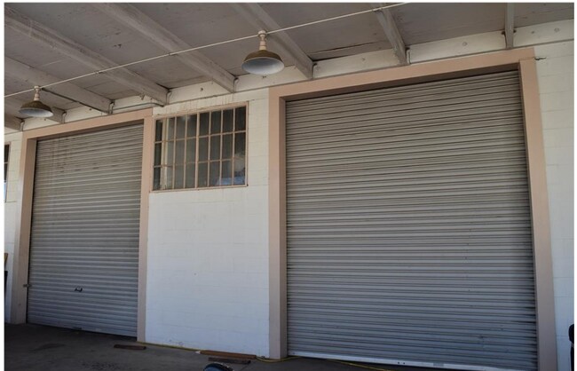
Property Detail
12137 2Nd St
Riverside-San Bernardino-Ontario, CA
REVISED MAP OF YUCAIPA CITY W 39.3 FT LOT 26 BLK 78 AND ALL LOTS 27 28 29 AND 30 BLK 78
0319-051-36
San Bernardino
Warehouse
California
B and X Area of moderate flood hazard, usually the area between the limits of the 100-year and 500-year floods.
27,28
2025
0.66 AC
2026
Redlands/Loma Linda
008800
Inland Empire (California)
6,240 SF
NEARBY LISTINGS FOR SALE OR LEASE
DEMOGRAPHICS near 12137 2Nd St
1 mile
3 mile
5 mile
2025 Total Population
17,390
58,150
75,849
2030 Population
17,798
59,177
77,395
Pop Growth 2025-2030
+ 2.35%
+ 1.77%
+ 2.04%
Average Age
39
40
41
2025 Total Households
6,409
20,871
27,198
HH Growth 2025-2030
+ 2.36%
+ 1.75%
+ 1.98%
Median Household Inc
$79,928
$93,418
$95,310
Avg Household Size
2.70
2.70
2.80
2025 Avg HH Vehicles
2.00
2.00
2.00
Median Home Value
$471,720
$533,996
$555,814
Median Year Built
1969
1977
1980
Nearby Places
Map Layers
Map Styles
 Street
 Aerial
Layers
 Traffic
 Biking
Places
Listings with unknown addresses are not visible on the map
- Restaurants
- Banks
- Shops
- Fitness
- Groceries
PUBLIC TRANSPORTATION
COMMUTER RAIL
Drive
Walk
Distance
15 min
9.1 mi
AIRPORT
Ontario International
Drive
Walk
Distance
Ontario International
47 min
35.5 mi
Palm Springs International
Drive
Walk
Distance
Palm Springs International
52 min
42.8 mi
SALE & LEASE HISTORY
LISTING DATE
SALE/LEASE

Jan 06, 2021
For Sale
Nearby Properties
Address
Land Use
TOTAL SIZE
Lot Size
Zoning
Address
Land Use
TOTAL SIZE
Lot Size
Zoning
369,838 SF
19.32 AC
Address
Land Use
TOTAL SIZE
Lot Size
Zoning
102,506 SF
4.47 AC
Address
Land Use
TOTAL SIZE
Lot Size
Zoning
82,694 SF
3.41 AC
Address
Land Use
TOTAL SIZE
Lot Size
Zoning
5.47 AC
Address
Land Use
TOTAL SIZE
Lot Size
Zoning
147,775 SF
6.27 AC
Address
Land Use
TOTAL SIZE
Lot Size
Zoning
79,299 SF
5.04 AC
Address
Land Use
TOTAL SIZE
Lot Size
Zoning
67,686 SF
4.16 AC
Address
Land Use
TOTAL SIZE
Lot Size
Zoning
56,491 SF
7.50 AC
Address
Land Use
TOTAL SIZE
Lot Size
Zoning
22,308 SF
1.87 AC
Address
Land Use
TOTAL SIZE
Lot Size
Zoning
24,510 SF
6.88 AC
Address
Land Use
TOTAL SIZE
Lot Size
Zoning
56,491 SF
3.39 AC
Address
Land Use
TOTAL SIZE
Lot Size
Zoning
49,952 SF
4.34 AC
Address
Land Use
TOTAL SIZE
Lot Size
Zoning
29,387 SF
3.21 AC
Address
Land Use
TOTAL SIZE
Lot Size
Zoning
27,627 SF
5.07 AC
Address
Land Use
TOTAL SIZE
Lot Size
Zoning
42,634 SF
1.91 AC
Address
Land Use
TOTAL SIZE
Lot Size
Zoning
111,182 SF
3.11 AC
Address
Land Use
TOTAL SIZE
Lot Size
Zoning
15,980 SF
1.56 AC
Address
Land Use
TOTAL SIZE
Lot Size
Zoning
44,046 SF
3.77 AC
Address
Land Use
TOTAL SIZE
Lot Size
Zoning
33,000 SF
2.96 AC
Address
Land Use
TOTAL SIZE
Lot Size
Zoning
78,309 SF
7.09 AC
Address
Land Use
TOTAL SIZE
Lot Size
Zoning
41,005 SF
3.27 AC
MIX
Address
Land Use
TOTAL SIZE
Lot Size
Zoning
29,996 SF
1.86 AC
Address
Land Use
TOTAL SIZE
Lot Size
Zoning
73,670 SF
4.49 AC
Address
Land Use
TOTAL SIZE
Lot Size
Zoning
9.71 AC
Address
Land Use
TOTAL SIZE
Lot Size
Zoning
23,227 SF
1.81 AC
Address
Land Use
TOTAL SIZE
Lot Size
Zoning
18,800 SF
4.07 AC
CC
Address
Land Use
TOTAL SIZE
Lot Size
Zoning
45,862 SF
4.51 AC
Address
Land Use
TOTAL SIZE
Lot Size
Zoning
44,864 SF
5.34 AC
Address
Land Use
TOTAL SIZE
Lot Size
Zoning
17,326 SF
2.24 AC
Address
Land Use
TOTAL SIZE
Lot Size
Zoning
14,738 SF
1.49 AC
C1
The World's #1 Commercial Real Estate Marketplace
Connect with us
© 2026 CoStar Group
The information above has been obtained from sources believed reliable. While we do not doubt its accuracy we have not verified it and make no guarantee, warranty or representation about it. It is your responsibility to independently confirm its accuracy and completeness. Any projections, opinions, assumptions, or estimates used are for example only and do not represent the current or future performance of the property. The value of this transaction to you depends on tax and other factors which should be evaluated by your tax, financial, and legal advisors. You and your advisors should conduct a careful, independent investigation of the property to determine to your satisfaction the suitability of the property for your needs.