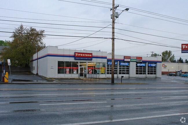
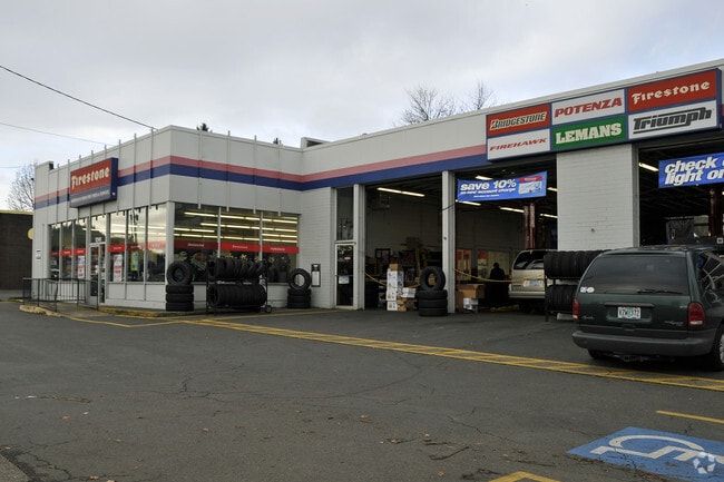
Property Record
12141 Se Division St, Portland, OR 97266


Property Detail
12141 Se Division St
R145724
D & O LITTLE HMS SUB 1, LOT 1 TL 7500
Commercialnec
Multnomah
CM2
Oregon
B and X Area of moderate flood hazard, usually the area between the limits of the 100-year and 500-year floods.
1
2025
0.41 AC
2025
Mall 205
008204
Portland
7,832 SF
Portland-Vancouver-Hillsboro, OR-WA
NEARBY LISTINGS FOR SALE OR LEASE
DEMOGRAPHICS near 12141 Se Division St
1 mile
3 mile
5 mile
2025 Total Population
26,688
175,874
411,573
2030 Population
26,274
172,898
405,792
Pop Growth 2025-2030
(1.55%)
(1.69%)
(1.40%)
Average Age
39
40
40
2025 Total Households
9,052
63,431
157,346
HH Growth 2025-2030
(1.80%)
(2.02%)
(1.70%)
Median Household Inc
$61,119
$69,827
$81,623
Avg Household Size
2.80
2.60
2.50
2025 Avg HH Vehicles
2.00
2.00
2.00
Median Home Value
$421,369
$442,670
$491,171
Median Year Built
1974
1970
1970
Nearby Places
Map Layers
Map Styles
 Street
 Aerial
Transit
 Traffic
 Biking
Places
Listings with unknown addresses are not visible on the map
- Restaurants
- Banks
- Shops
- Fitness
- Groceries
PUBLIC TRANSPORTATION
AIRPORT
Portland International
Drive
Walk
Distance
Portland International
17 min
9.0 mi
Freight Ports
Port of Portland
Drive
Walk
Distance
Port of Portland
22 min
12.3 mi
Nearby Properties
Address
Land Use
TOTAL SIZE
Lot Size
Zoning
Address
Land Use
TOTAL SIZE
Lot Size
Zoning
1,024 SF
15.92 AC
OS
Address
Land Use
TOTAL SIZE
Lot Size
Zoning
361,549 SF
39.26 AC
IR
Address
Land Use
TOTAL SIZE
Lot Size
Zoning
250,280 SF
23.86 AC
IR
Address
Land Use
TOTAL SIZE
Lot Size
Zoning
31,878 SF
15.95 AC
IG2
Address
Land Use
TOTAL SIZE
Lot Size
Zoning
54,676 SF
190.32 AC
OS
Address
Land Use
TOTAL SIZE
Lot Size
Zoning
42,839,055 SF
19.25 AC
CI1
Address
Land Use
TOTAL SIZE
Lot Size
Zoning
317,656 SF
21.94 AC
CX
Address
Land Use
TOTAL SIZE
Lot Size
Zoning
100,217 SF
1.99 AC
R5
Address
Land Use
TOTAL SIZE
Lot Size
Zoning
181,493 SF
3.70 AC
CM1
Address
Land Use
TOTAL SIZE
Lot Size
Zoning
123,716 SF
20.03 AC
LDR-5
Address
Land Use
TOTAL SIZE
Lot Size
Zoning
369,835 SF
6.67 AC
IRD
Address
Land Use
TOTAL SIZE
Lot Size
Zoning
99,100 SF
1.31 AC
CS
Address
Land Use
TOTAL SIZE
Lot Size
Zoning
129,462 SF
15.90 AC
R7
Address
Land Use
TOTAL SIZE
Lot Size
Zoning
21,200 SF
16.03 AC
OS
Address
Land Use
TOTAL SIZE
Lot Size
Zoning
64,658 SF
7.79 AC
R5
Address
Land Use
TOTAL SIZE
Lot Size
Zoning
53,774 SF
3 AC
Address
Land Use
TOTAL SIZE
Lot Size
Zoning
86,138 SF
5.93 AC
R7
Address
Land Use
TOTAL SIZE
Lot Size
Zoning
105,961 SF
8.76 AC
RM1
Address
Land Use
TOTAL SIZE
Lot Size
Zoning
126,776 SF
5.07 AC
RH
Address
Land Use
TOTAL SIZE
Lot Size
Zoning
46,879 SF
5.63 AC
CI1
Address
Land Use
TOTAL SIZE
Lot Size
Zoning
82,335 SF
11.34 AC
R5
Address
Land Use
TOTAL SIZE
Lot Size
Zoning
153,648 SF
12.31 AC
CX
Address
Land Use
TOTAL SIZE
Lot Size
Zoning
122,558 SF
9.85 AC
CM2
Address
Land Use
TOTAL SIZE
Lot Size
Zoning
91,064 SF
0.90 AC
RXD
Address
Land Use
TOTAL SIZE
Lot Size
Zoning
121,144 SF
2.30 AC
RM3
Address
Land Use
TOTAL SIZE
Lot Size
Zoning
121,966 SF
1.97 AC
CM
Address
Land Use
TOTAL SIZE
Lot Size
Zoning
154,347 SF
12.35 AC
CE
Address
Land Use
TOTAL SIZE
Lot Size
Zoning
190,598 SF
5.22 AC
RM2
Address
Land Use
TOTAL SIZE
Lot Size
Zoning
62,592 SF
1.47 AC
RM3
Address
Land Use
TOTAL SIZE
Lot Size
Zoning
142,946 SF
The World's #1 Commercial Real Estate Marketplace
Connect with us
© 2026 CoStar Group
The information above has been obtained from sources believed reliable. While we do not doubt its accuracy we have not verified it and make no guarantee, warranty or representation about it. It is your responsibility to independently confirm its accuracy and completeness. Any projections, opinions, assumptions, or estimates used are for example only and do not represent the current or future performance of the property. The value of this transaction to you depends on tax and other factors which should be evaluated by your tax, financial, and legal advisors. You and your advisors should conduct a careful, independent investigation of the property to determine to your satisfaction the suitability of the property for your needs.