Property Record
12148 Bellaire Blvd, Houston, TX 77072
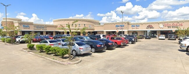


Property Detail
12148 Bellaire Blvd
1156430000005
RES A3-1 ALIEF FOREST SEC3
Stripcommercialcenter
HARRIS
B and X Area of moderate flood hazard, usually the area between the limits of the 100-year and 500-year floods.
Texas
2024
2.32 AC
2025
Sugar Land
452501
Houston
26,627 SF
Houston-Pasadena-The Woodlands, TX
NEARBY LISTINGS FOR SALE OR LEASE
DEMOGRAPHICS near 12148 Bellaire Blvd
1 mile
3 mile
5 mile
2025 Total Population
22,424
231,082
552,994
2030 Population
23,751
245,014
592,891
Pop Growth 2025-2030
+ 5.92%
+ 6.03%
+ 7.21%
Average Age
37
37
37
2025 Total Households
6,960
83,310
205,864
HH Growth 2025-2030
+ 6.14%
+ 6.25%
+ 7.37%
Median Household Inc
$49,221
$51,724
$58,232
Avg Household Size
3.10
2.70
2.60
2025 Avg HH Vehicles
2.00
2.00
2.00
Median Home Value
$198,961
$230,953
$271,617
Median Year Built
1978
1984
1984
Nearby Places
Map Layers
Map Styles
 Street
 Aerial
Layers
 Traffic
 Biking
Places
Listings with unknown addresses are not visible on the map
- Restaurants
- Banks
- Shops
- Fitness
- Groceries
PUBLIC TRANSPORTATION
AIRPORT
William P Hobby
Drive
Walk
Distance
William P Hobby
41 min
26.7 mi
George Bush Intcntl/Houston
Drive
Walk
Distance
George Bush Intcntl/Houston
44 min
34.8 mi
Freight Ports
Port of Houston
Drive
Walk
Distance
Port of Houston
39 min
25.8 mi
Nearby Properties
Address
Land Use
TOTAL SIZE
Lot Size
Zoning
Address
Land Use
TOTAL SIZE
Lot Size
Zoning
1,020,766 SF
3.08 AC
Address
Land Use
TOTAL SIZE
Lot Size
Zoning
430,096 SF
18.99 AC
Address
Land Use
TOTAL SIZE
Lot Size
Zoning
526,410 SF
20.43 AC
Address
Land Use
TOTAL SIZE
Lot Size
Zoning
367,309 SF
14.72 AC
Address
Land Use
TOTAL SIZE
Lot Size
Zoning
497,267 SF
24.69 AC
Address
Land Use
TOTAL SIZE
Lot Size
Zoning
380,423 SF
15.14 AC
Address
Land Use
TOTAL SIZE
Lot Size
Zoning
771,720 SF
19.28 AC
Address
Land Use
TOTAL SIZE
Lot Size
Zoning
489,192 SF
23.11 AC
Address
Land Use
TOTAL SIZE
Lot Size
Zoning
344,088 SF
13.77 AC
Address
Land Use
TOTAL SIZE
Lot Size
Zoning
362,473 SF
15.65 AC
Address
Land Use
TOTAL SIZE
Lot Size
Zoning
126,308 SF
16.95 AC
Address
Land Use
TOTAL SIZE
Lot Size
Zoning
997,813 SF
5.25 AC
Address
Land Use
TOTAL SIZE
Lot Size
Zoning
351,042 SF
5 AC
Address
Land Use
TOTAL SIZE
Lot Size
Zoning
309,704 SF
8.84 AC
Address
Land Use
TOTAL SIZE
Lot Size
Zoning
526,945 SF
23.05 AC
Address
Land Use
TOTAL SIZE
Lot Size
Zoning
325,312 SF
13.66 AC
Address
Land Use
TOTAL SIZE
Lot Size
Zoning
666,184 SF
22.45 AC
Address
Land Use
TOTAL SIZE
Lot Size
Zoning
700,828 SF
3.82 AC
Address
Land Use
TOTAL SIZE
Lot Size
Zoning
379,078 SF
14.83 AC
Address
Land Use
TOTAL SIZE
Lot Size
Zoning
283,782 SF
11.57 AC
Address
Land Use
TOTAL SIZE
Lot Size
Zoning
323,438 SF
8.24 AC
Address
Land Use
TOTAL SIZE
Lot Size
Zoning
697,180 SF
2.90 AC
Address
Land Use
TOTAL SIZE
Lot Size
Zoning
665,550 SF
3.58 AC
Address
Land Use
TOTAL SIZE
Lot Size
Zoning
340,944 SF
12.88 AC
Address
Land Use
TOTAL SIZE
Lot Size
Zoning
690,119 SF
23 AC
Address
Land Use
TOTAL SIZE
Lot Size
Zoning
143,028 SF
14.95 AC
Address
Land Use
TOTAL SIZE
Lot Size
Zoning
425,887 SF
26.70 AC
Address
Land Use
TOTAL SIZE
Lot Size
Zoning
425,069 SF
25.14 AC
Address
Land Use
TOTAL SIZE
Lot Size
Zoning
286,285 SF
11.78 AC
Address
Land Use
TOTAL SIZE
Lot Size
Zoning
322,894 SF
17.51 AC
The World's #1 Commercial Real Estate Marketplace
Connect with us
© 2026 CoStar Group
The information above has been obtained from sources believed reliable. While we do not doubt its accuracy we have not verified it and make no guarantee, warranty or representation about it. It is your responsibility to independently confirm its accuracy and completeness. Any projections, opinions, assumptions, or estimates used are for example only and do not represent the current or future performance of the property. The value of this transaction to you depends on tax and other factors which should be evaluated by your tax, financial, and legal advisors. You and your advisors should conduct a careful, independent investigation of the property to determine to your satisfaction the suitability of the property for your needs.