Property Record
1215 E Mt Gilead Rd, Bolivar, MO 65613

Save to a Folder
{{folder.Name}}
{{folder.ListingIds.length}} Properties
{{folder.ListingIds.length}} Property
Create a New Folder
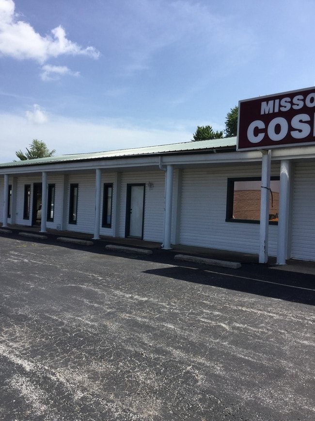
Property Detail
1215 E Mt Gilead Rd
8911061300000002903
BOLIVAR 1992 ADD- PT SE COR SW NE- BEG 1464.81' W OF SE COR NE1/4
Publicstorage
Polk
B and X Area of moderate flood hazard, usually the area between the limits of the 100-year and 500-year floods.
Missouri
2025
1.27 AC
2025
Polk County
960302
Springfield
5,200 SF
Springfield, MO
NEARBY LISTINGS FOR SALE OR LEASE
DEMOGRAPHICS near 1215 E Mt Gilead Rd
1 mile
3 mile
5 mile
2025 Total Population
1,741
12,441
15,473
2030 Population
1,802
12,831
15,981
Pop Growth 2025-2030
+ 3.50%
+ 3.13%
+ 3.28%
Average Age
37
38
39
2025 Total Households
650
4,799
5,940
HH Growth 2025-2030
+ 3.69%
+ 3.25%
+ 3.38%
Median Household Inc
$50,978
$49,912
$52,862
Avg Household Size
2.30
2.40
2.40
2025 Avg HH Vehicles
2.00
2.00
2.00
Median Home Value
$265,048
$217,503
$223,645
Median Year Built
1991
1984
1985
Nearby Places
Map Layers
Map Styles
 Street
 Aerial
Layers
 Traffic
 Biking
Places
Listings with unknown addresses are not visible on the map
- Restaurants
- Banks
- Shops
- Fitness
- Groceries
PUBLIC TRANSPORTATION
AIRPORT
Springfield-Branson Ntl
Drive
Walk
Distance
Springfield-Branson Ntl
45 min
33.0 mi
Freight Ports
Tulsa Port of Inola
Drive
Walk
Distance
Tulsa Port of Inola
218 min
195.4 mi
SALE & LEASE HISTORY
LISTING DATE
SALE/LEASE

Mar 22, 2017
For Lease
Nearby Properties
Address
Land Use
TOTAL SIZE
Lot Size
Zoning
Address
Land Use
TOTAL SIZE
Lot Size
Zoning
51,549 SF
11.02 AC
Address
Land Use
TOTAL SIZE
Lot Size
Zoning
217,679 SF
10.88 AC
Address
Land Use
TOTAL SIZE
Lot Size
Zoning
127,417 SF
34.74 AC
Address
Land Use
TOTAL SIZE
Lot Size
Zoning
8,255 SF
6.80 AC
Address
Land Use
TOTAL SIZE
Lot Size
Zoning
96,160 SF
10.88 AC
Address
Land Use
TOTAL SIZE
Lot Size
Zoning
6,000 SF
4.25 AC
Address
Land Use
TOTAL SIZE
Lot Size
Zoning
14,216 SF
2.79 AC
Address
Land Use
TOTAL SIZE
Lot Size
Zoning
999,999 SF
1.42 AC
Address
Land Use
TOTAL SIZE
Lot Size
Zoning
20,523 SF
4.44 AC
Address
Land Use
TOTAL SIZE
Lot Size
Zoning
101,850 SF
7.38 AC
Address
Land Use
TOTAL SIZE
Lot Size
Zoning
20,233 SF
2.10 AC
Address
Land Use
TOTAL SIZE
Lot Size
Zoning
10,848 SF
1.77 AC
Address
Land Use
TOTAL SIZE
Lot Size
Zoning
12,651 SF
3.13 AC
Address
Land Use
TOTAL SIZE
Lot Size
Zoning
12,116 SF
3.50 AC
Address
Land Use
TOTAL SIZE
Lot Size
Zoning
29,190 SF
14.21 AC
Address
Land Use
TOTAL SIZE
Lot Size
Zoning
7,523 SF
1.14 AC
Address
Land Use
TOTAL SIZE
Lot Size
Zoning
12,380 SF
1.86 AC
Address
Land Use
TOTAL SIZE
Lot Size
Zoning
6,893 SF
3.15 AC
Address
Land Use
TOTAL SIZE
Lot Size
Zoning
12,960 SF
1.39 AC
Address
Land Use
TOTAL SIZE
Lot Size
Zoning
5,760 SF
4.10 AC
Address
Land Use
TOTAL SIZE
Lot Size
Zoning
18,210 SF
1.86 AC
Address
Land Use
TOTAL SIZE
Lot Size
Zoning
20,944 SF
3.19 AC
Address
Land Use
TOTAL SIZE
Lot Size
Zoning
11,100 SF
5.01 AC
Address
Land Use
TOTAL SIZE
Lot Size
Zoning
8,045 SF
1.54 AC
Address
Land Use
TOTAL SIZE
Lot Size
Zoning
41,700 SF
4.41 AC
Address
Land Use
TOTAL SIZE
Lot Size
Zoning
17,003 SF
0.83 AC
Address
Land Use
TOTAL SIZE
Lot Size
Zoning
10,130 SF
1.24 AC
Address
Land Use
TOTAL SIZE
Lot Size
Zoning
7,862 SF
2.26 AC
The World's #1 Commercial Real Estate Marketplace
Connect with us
© 2026 CoStar Group
The information above has been obtained from sources believed reliable. While we do not doubt its accuracy we have not verified it and make no guarantee, warranty or representation about it. It is your responsibility to independently confirm its accuracy and completeness. Any projections, opinions, assumptions, or estimates used are for example only and do not represent the current or future performance of the property. The value of this transaction to you depends on tax and other factors which should be evaluated by your tax, financial, and legal advisors. You and your advisors should conduct a careful, independent investigation of the property to determine to your satisfaction the suitability of the property for your needs.