Property Record
1215 Highway 19 N, Thomaston, GA 30286
NEARBY LISTINGS FOR SALE OR LEASE
-
-
View all Thomaston listings for sale on LoopNet.com
Property Detail
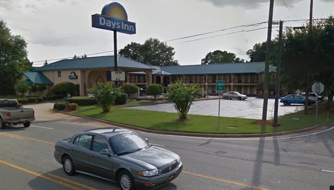
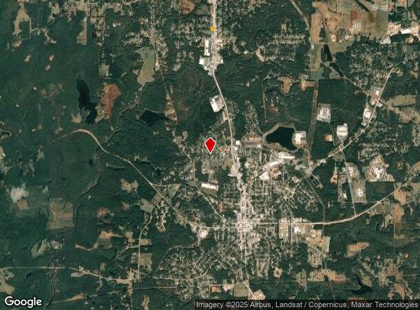
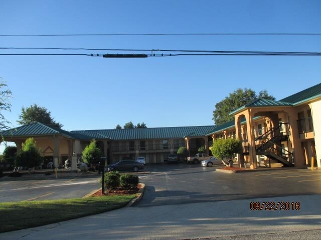
1215 Highway 19 N
Thomaston, GA
North Thomaston Commercial
043B-111 01
DAYS INN LOTS 3,4 BLOCK C PB 20/4
Motel
Upson
X
Georgia
13171C0150C
3,4
2024
0.86 AC
2025
Georgia South Area
010402
Other Market Areas
17,946 SF
DEMOGRAPHICS near 1215 Highway 19 N
1 Mile
3 Mile
5 Mile
2024 Total Population
2,238
12,181
21,128
2029 Population
2,270
12,556
21,830
Pop Growth 2024-2029
+ 1.43%
+ 3.08%
+ 3.32%
Average Age
40
41
41
2024 Total Households
899
5,002
8,566
HH Growth 2024-2029
+ 1.45%
+ 2.94%
+ 3.18%
Median Household Inc
$46,666
$43,172
$42,588
Avg Household Size
2.40
2.40
2.40
2024 Avg HH Vehicles
2.00
2.00
2.00
Median Home Value
$117,605
$108,240
$131,788
Median Year Built
1971
1970
1970
Nearby Places
Map Layers
Map Styles
 Street
 Aerial
- Restaurants
- Banks
- Shops
- Fitness
- Groceries
Nearby Properties
Address
Land Use
TOTAL SIZE
Lot Size
Zoning
Address
Land Use
TOTAL SIZE
Lot Size
Zoning
3,000 SF
73.70 AC
AR
Address
Land Use
TOTAL SIZE
Lot Size
Zoning
90,546 SF
87.05 AC
AR
Address
Land Use
TOTAL SIZE
Lot Size
Zoning
6,768 SF
39.20 AC
MR
Address
Land Use
TOTAL SIZE
Lot Size
Zoning
61,594 SF
31.44 AC
M1
Address
Land Use
TOTAL SIZE
Lot Size
Zoning
58,908 SF
104.55 AC
M1
Address
Land Use
TOTAL SIZE
Lot Size
Zoning
9,588 SF
12.17 AC
PI
Address
Land Use
TOTAL SIZE
Lot Size
Zoning
174,343 SF
18.48 AC
C2
Address
Land Use
TOTAL SIZE
Lot Size
Zoning
57,512 SF
29.28 AC
006
Address
Land Use
TOTAL SIZE
Lot Size
Zoning
46,987 SF
24.32 AC
C2
Address
Land Use
TOTAL SIZE
Lot Size
Zoning
121,950 SF
12.57 AC
PI
Address
Land Use
TOTAL SIZE
Lot Size
Zoning
103,020 SF
11.06 AC
C2
Address
Land Use
TOTAL SIZE
Lot Size
Zoning
26,248 SF
4 AC
PI
Address
Land Use
TOTAL SIZE
Lot Size
Zoning
48,476 SF
17.80 AC
ES2
Address
Land Use
TOTAL SIZE
Lot Size
Zoning
140,288 SF
31.67 AC
M2
Address
Land Use
TOTAL SIZE
Lot Size
Zoning
322,698 SF
72.25 AC
M2
Address
Land Use
TOTAL SIZE
Lot Size
Zoning
27,502 SF
7 AC
PI
Address
Land Use
TOTAL SIZE
Lot Size
Zoning
34,436 SF
3.52 AC
MR
Address
Land Use
TOTAL SIZE
Lot Size
Zoning
31,412 SF
3.69 AC
DT
Address
Land Use
TOTAL SIZE
Lot Size
Zoning
125,647 SF
15.67 AC
C2
Address
Land Use
TOTAL SIZE
Lot Size
Zoning
34,537 SF
6.65 AC
C2
Address
Land Use
TOTAL SIZE
Lot Size
Zoning
24,662 SF
1.09 AC
DT
Address
Land Use
TOTAL SIZE
Lot Size
Zoning
28,266 SF
2.44 AC
PD
Address
Land Use
TOTAL SIZE
Lot Size
Zoning
488 SF
11.97 AC
MR
Address
Land Use
TOTAL SIZE
Lot Size
Zoning
13,765 SF
7.92 AC
PD
Address
Land Use
TOTAL SIZE
Lot Size
Zoning
4,472 SF
11.57 AC
MR
Address
Land Use
TOTAL SIZE
Lot Size
Zoning
61,916 SF
8.93 AC
C2
Address
Land Use
TOTAL SIZE
Lot Size
Zoning
247,227 SF
18.54 AC
M2
Address
Land Use
TOTAL SIZE
Lot Size
Zoning
17,664 SF
37.80 AC
AR
Address
Land Use
TOTAL SIZE
Lot Size
Zoning
4,704 SF
172.30 AC
M2
Address
Land Use
TOTAL SIZE
Lot Size
Zoning
30,719 SF
22.90 AC
PI
The World's #1 Commercial Real Estate Marketplace
Connect with us
© 2025 CoStar Group
The information above has been obtained from sources believed reliable. While we do not doubt its accuracy we have not verified it and make no guarantee, warranty or representation about it. It is your responsibility to independently confirm its accuracy and completeness. Any projections, opinions, assumptions, or estimates used are for example only and do not represent the current or future performance of the property. The value of this transaction to you depends on tax and other factors which should be evaluated by your tax, financial, and legal advisors. You and your advisors should conduct a careful, independent investigation of the property to determine to your satisfaction the suitability of the property for your needs.