Property Record
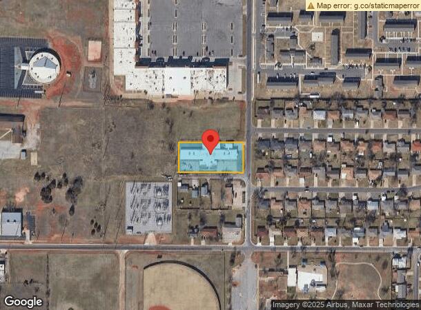
1215 Ne 34Th St, Oklahoma City, OK 73111
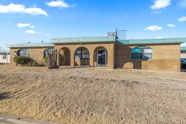
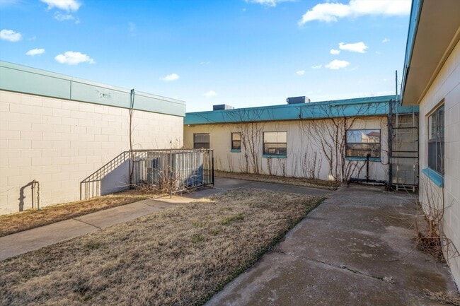
This Property Is For Sale
Current Lease Availabilities
NEARBY LISTINGS FOR SALE OR LEASE
Property Detail
1215 Ne 34Th St
035234205
Alvira Heights Add
Hospitalprivate
ALVIRA HEIGHTS ADD 000 000 S 1/2 OF BLK 1
X
Oklahoma
40109C0190H
Oklahoma
2023
0.91 AC
2024
North
100400
Oklahoma City
15,184 SF
Oklahoma City, OK
DEMOGRAPHICS near 1215 Ne 34Th St
1 Mile
3 Mile
5 Mile
2024 Total Population
7,151
54,818
138,166
2029 Population
7,521
57,066
142,805
Pop Growth 2024-2029
+ 5.17%
+ 4.10%
+ 3.36%
Average Age
40
38
38
2024 Total Households
3,170
26,710
61,435
HH Growth 2024-2029
+ 5.30%
+ 4.16%
+ 3.44%
Median Household Inc
$32,432
$44,287
$48,278
Avg Household Size
2.10
1.90
2.10
2024 Avg HH Vehicles
1.00
2.00
2.00
Median Home Value
$66,597
$183,359
$171,406
Median Year Built
1957
1955
1957
Nearby Places
- Restaurants
- Banks
- Shops
- Fitness
- Groceries
PUBLIC TRANSPORTATION
COMMUTER RAIL
Oklahoma City (Heartland Flyer - Amtrak)
DRIVE
WALK
Distance
Oklahoma City (Heartland Flyer - Amtrak)
9 min
4.2 mi
AIRPORT
Will Rogers World
DRIVE
WALK
Distance
Will Rogers World
27 min
14.8 mi
Freight Ports
Tulsa Port Of Catoosa
DRIVE
WALK
Distance
Tulsa Port Of Catoosa
131 min
120.4 mi
Nearby Properties
Address
Land Use
TOTAL SIZE
Lot Size
Zoning
Address
Land Use
TOTAL SIZE
Lot Size
Zoning
187,346 SF
13.75 AC
PUD
Address
Land Use
TOTAL SIZE
Lot Size
Zoning
324,688 SF
1.36 AC
DBD
Address
Land Use
TOTAL SIZE
Lot Size
Zoning
101,216 SF
1.23 AC
Address
Land Use
TOTAL SIZE
Lot Size
Zoning
951,493 SF
2.24 AC
DBD
Address
Land Use
TOTAL SIZE
Lot Size
Zoning
628,486 SF
0.53 AC
DBD
Address
Land Use
TOTAL SIZE
Lot Size
Zoning
442,553 SF
58.86 AC
PUD
Address
Land Use
TOTAL SIZE
Lot Size
Zoning
511,817 SF
3.85 AC
DBD
Address
Land Use
TOTAL SIZE
Lot Size
Zoning
40,914 SF
0.50 AC
DTD-1
Address
Land Use
TOTAL SIZE
Lot Size
Zoning
417,965 SF
3.48 AC
DTD-1
Address
Land Use
TOTAL SIZE
Lot Size
Zoning
413,783 SF
6.25 AC
DBD
Address
Land Use
TOTAL SIZE
Lot Size
Zoning
194,762 SF
3 AC
DTD-1
Address
Land Use
TOTAL SIZE
Lot Size
Zoning
91,352 SF
0.68 AC
DBD
Address
Land Use
TOTAL SIZE
Lot Size
Zoning
303,589 SF
7.17 AC
PUD
Address
Land Use
TOTAL SIZE
Lot Size
Zoning
58,071 SF
4.15 AC
PUD
Address
Land Use
TOTAL SIZE
Lot Size
Zoning
382,618 SF
5.13 AC
BC
Address
Land Use
TOTAL SIZE
Lot Size
Zoning
327,248 SF
14.22 AC
R-4
Address
Land Use
TOTAL SIZE
Lot Size
Zoning
164,861 SF
0.32 AC
Address
Land Use
TOTAL SIZE
Lot Size
Zoning
2.59 AC
DBD
Address
Land Use
TOTAL SIZE
Lot Size
Zoning
93,244 SF
7.54 AC
PUD
Address
Land Use
TOTAL SIZE
Lot Size
Zoning
38,866 SF
2.89 AC
DBD
Address
Land Use
TOTAL SIZE
Lot Size
Zoning
307,772 SF
1.32 AC
DBD
Address
Land Use
TOTAL SIZE
Lot Size
Zoning
281,052 SF
1.89 AC
DBD
Address
Land Use
TOTAL SIZE
Lot Size
Zoning
42,450 SF
0.32 AC
BC
Address
Land Use
TOTAL SIZE
Lot Size
Zoning
302,236 SF
2.62 AC
SPUD
Address
Land Use
TOTAL SIZE
Lot Size
Zoning
485,764 SF
6.05 AC
C-3
Address
Land Use
TOTAL SIZE
Lot Size
Zoning
279,464 SF
1.49 AC
DBD
Address
Land Use
TOTAL SIZE
Lot Size
Zoning
377,880 SF
24.34 AC
PUD
Address
Land Use
TOTAL SIZE
Lot Size
Zoning
258,381 SF
2.54 AC
PUD
Address
Land Use
TOTAL SIZE
Lot Size
Zoning
188,121 SF
0.83 AC
BC
Address
Land Use
TOTAL SIZE
Lot Size
Zoning
254,126 SF
2.11 AC
SPUD
The World's #1 Commercial Real Estate Marketplace
Connect with us
© 2025 CoStar Group
The information above has been obtained from sources believed reliable. While we do not doubt its accuracy we have not verified it and make no guarantee, warranty or representation about it. It is your responsibility to independently confirm its accuracy and completeness. Any projections, opinions, assumptions, or estimates used are for example only and do not represent the current or future performance of the property. The value of this transaction to you depends on tax and other factors which should be evaluated by your tax, financial, and legal advisors. You and your advisors should conduct a careful, independent investigation of the property to determine to your satisfaction the suitability of the property for your needs.