Property Record
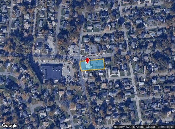
1217 Route 25A, Smithtown, NY 11787
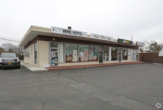
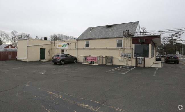
This Property Is For Sale
Current Lease Availabilities
NEARBY LISTINGS FOR SALE OR LEASE
Property Detail
1217 Route 25A
Nassau County-Suffolk County, NY
32.-4-38 *117 LOTS 1-5 & 42-48 RAPALLO PARK BLK 16
0800-032-00-04-00-038-000
Suffolk
Kennel
New York
X
38
36103C0363H
0.75 AC
2024
Western Suffolk
2024
Long Island (New York)
134902
DEMOGRAPHICS near 1217 Route 25A
1 Mile
3 Mile
5 Mile
2024 Total Population
10,134
46,247
128,059
2029 Population
9,955
45,577
126,380
Pop Growth 2024-2029
(1.77%)
(1.45%)
(1.31%)
Average Age
43
43
43
2024 Total Households
3,466
15,591
43,288
HH Growth 2024-2029
(2.14%)
(1.84%)
(1.63%)
Median Household Inc
$136,006
$146,234
$147,922
Avg Household Size
2.80
2.80
2.80
2024 Avg HH Vehicles
2.00
2.00
2.00
Median Home Value
$522,832
$644,703
$656,940
Median Year Built
1966
1966
1966
Nearby Places
- Restaurants
- Banks
- Shops
- Fitness
- Groceries
PUBLIC TRANSPORTATION
COMMUTER RAIL
Kings Park Station (Port Jefferson Branch - Long Island Rail Road)
DRIVE
WALK
Distance
Kings Park Station (Port Jefferson Branch - Long Island Rail Road)
3 min
1.9 mi
Smithtown Station (Port Jefferson Branch - Long Island Rail Road)
DRIVE
WALK
Distance
Smithtown Station (Port Jefferson Branch - Long Island Rail Road)
4 min
2.7 mi
AIRPORT
Long Island MacArthur
DRIVE
WALK
Distance
Long Island MacArthur
22 min
13.0 mi
Freight Ports
Port of New Haven
DRIVE
WALK
Distance
Port of New Haven
129 min
51.9 mi
Nearby Properties
Address
Land Use
TOTAL SIZE
Lot Size
Zoning
Address
Land Use
TOTAL SIZE
Lot Size
Zoning
853.98 AC
Address
Land Use
TOTAL SIZE
Lot Size
Zoning
3,060 SF
0.10 AC
VILLA
Address
Land Use
TOTAL SIZE
Lot Size
Zoning
5,792 SF
0.36 AC
VILLA
Address
Land Use
TOTAL SIZE
Lot Size
Zoning
9,000 SF
0.18 AC
VILLA
Address
Land Use
TOTAL SIZE
Lot Size
Zoning
0.28 AC
VILLA
Address
Land Use
TOTAL SIZE
Lot Size
Zoning
1,648 SF
0.02 AC
VILLA
Address
Land Use
TOTAL SIZE
Lot Size
Zoning
14.50 AC
Address
Land Use
TOTAL SIZE
Lot Size
Zoning
368.36 AC
Address
Land Use
TOTAL SIZE
Lot Size
Zoning
159.25 AC
Address
Land Use
TOTAL SIZE
Lot Size
Zoning
0.23 AC
R10
Address
Land Use
TOTAL SIZE
Lot Size
Zoning
251.38 AC
Address
Land Use
TOTAL SIZE
Lot Size
Zoning
Address
Land Use
TOTAL SIZE
Lot Size
Zoning
Address
Land Use
TOTAL SIZE
Lot Size
Zoning
Address
Land Use
TOTAL SIZE
Lot Size
Zoning
15.74 AC
Address
Land Use
TOTAL SIZE
Lot Size
Zoning
18.82 AC
Address
Land Use
TOTAL SIZE
Lot Size
Zoning
267.48 AC
Address
Land Use
TOTAL SIZE
Lot Size
Zoning
9.30 AC
Address
Land Use
TOTAL SIZE
Lot Size
Zoning
Address
Land Use
TOTAL SIZE
Lot Size
Zoning
0.01 AC
B1
Address
Land Use
TOTAL SIZE
Lot Size
Zoning
23.95 AC
Address
Land Use
TOTAL SIZE
Lot Size
Zoning
1,295 SF
12.40 AC
Address
Land Use
TOTAL SIZE
Lot Size
Zoning
229.06 AC
Address
Land Use
TOTAL SIZE
Lot Size
Zoning
0.92 AC
Address
Land Use
TOTAL SIZE
Lot Size
Zoning
5.80 AC
Address
Land Use
TOTAL SIZE
Lot Size
Zoning
0.52 AC
Address
Land Use
TOTAL SIZE
Lot Size
Zoning
19.77 AC
Address
Land Use
TOTAL SIZE
Lot Size
Zoning
Address
Land Use
TOTAL SIZE
Lot Size
Zoning
3.50 AC
The World's #1 Commercial Real Estate Marketplace
Connect with us
© 2025 CoStar Group
The information above has been obtained from sources believed reliable. While we do not doubt its accuracy we have not verified it and make no guarantee, warranty or representation about it. It is your responsibility to independently confirm its accuracy and completeness. Any projections, opinions, assumptions, or estimates used are for example only and do not represent the current or future performance of the property. The value of this transaction to you depends on tax and other factors which should be evaluated by your tax, financial, and legal advisors. You and your advisors should conduct a careful, independent investigation of the property to determine to your satisfaction the suitability of the property for your needs.