Property Record
1215 Trapper Cir Nw, Roanoke, VA 24012


Property Detail
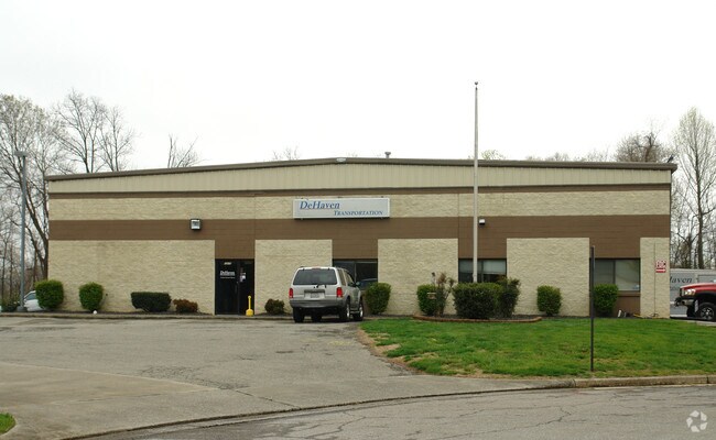
1215 Trapper Cir Nw
6620105
NEW LOT 3 AIRPORT COMMERCE PARK
Multipleuses
Roanoke City
AD
Virginia
B and X Area of moderate flood hazard, usually the area between the limits of the 100-year and 500-year floods.
3
2026
2.32 AC
2026
Northeast Roanoke
000300
Roanoke
9,760 SF
Roanoke, VA
NEARBY LISTINGS FOR SALE OR LEASE
DEMOGRAPHICS near 1215 Trapper Cir Nw
1 mile
3 mile
5 mile
2025 Total Population
6,156
45,754
108,017
2030 Population
6,218
45,644
107,983
Pop Growth 2025-2030
+ 1.01%
(0.24%)
(0.03%)
Average Age
42
41
40
2025 Total Households
2,647
18,898
45,858
HH Growth 2025-2030
+ 1.02%
(0.28%)
(0.05%)
Median Household Inc
$64,418
$60,411
$56,474
Avg Household Size
2.20
2.30
2.20
2025 Avg HH Vehicles
2.00
2.00
2.00
Median Home Value
$213,576
$220,772
$225,152
Median Year Built
1967
1969
1966
Nearby Places
Map Layers
Map Styles
 Street
 Aerial
Layers
 Traffic
 Biking
Places
Listings with unknown addresses are not visible on the map
- Restaurants
- Banks
- Shops
- Fitness
- Groceries
PUBLIC TRANSPORTATION
AIRPORT
Roanoke/Blacksburg Regional (Woodrum Field)
Drive
Walk
Distance
Roanoke/Blacksburg Regional (Woodrum Field)
6 min
1.0 mi
SALE & LEASE HISTORY
LISTING DATE
SALE/LEASE

Aug 04, 2017
For Lease
Nearby Properties
Address
Land Use
TOTAL SIZE
Lot Size
Zoning
Address
Land Use
TOTAL SIZE
Lot Size
Zoning
8,930 SF
604.76 AC
AD
Address
Land Use
TOTAL SIZE
Lot Size
Zoning
3,850 SF
60.20 AC
INPUD
Address
Land Use
TOTAL SIZE
Lot Size
Zoning
437,578 SF
14.74 AC
CLS
Address
Land Use
TOTAL SIZE
Lot Size
Zoning
39,455 SF
12.01 AC
CLS
Address
Land Use
TOTAL SIZE
Lot Size
Zoning
49,887 SF
2.28 AC
C1
Address
Land Use
TOTAL SIZE
Lot Size
Zoning
67,903 SF
11.96 AC
I2
Address
Land Use
TOTAL SIZE
Lot Size
Zoning
609,211 SF
41.01 AC
I1C
Address
Land Use
TOTAL SIZE
Lot Size
Zoning
206,978 SF
19.45 AC
CLS
Address
Land Use
TOTAL SIZE
Lot Size
Zoning
15,312 SF
182.27 AC
AG3
Address
Land Use
TOTAL SIZE
Lot Size
Zoning
10,878 SF
10.34 AC
RMF
Address
Land Use
TOTAL SIZE
Lot Size
Zoning
207,812 SF
22.62 AC
CLS
Address
Land Use
TOTAL SIZE
Lot Size
Zoning
123,651 SF
29.38 AC
R2S
Address
Land Use
TOTAL SIZE
Lot Size
Zoning
71,238 SF
3.62 AC
CLS
Address
Land Use
TOTAL SIZE
Lot Size
Zoning
71,590 SF
2.49 AC
CLS
Address
Land Use
TOTAL SIZE
Lot Size
Zoning
124,725 SF
6.53 AC
I1
Address
Land Use
TOTAL SIZE
Lot Size
Zoning
7,590 SF
14.18 AC
RMF
Address
Land Use
TOTAL SIZE
Lot Size
Zoning
48,935 SF
9.15 AC
RMF
Address
Land Use
TOTAL SIZE
Lot Size
Zoning
32,080 SF
16 AC
INPUD
Address
Land Use
TOTAL SIZE
Lot Size
Zoning
12,159 SF
8.77 AC
RMF
Address
Land Use
TOTAL SIZE
Lot Size
Zoning
139,654 SF
4.77 AC
C2S
Address
Land Use
TOTAL SIZE
Lot Size
Zoning
1.86 AC
CLS
Address
Land Use
TOTAL SIZE
Lot Size
Zoning
22,950 SF
9.50 AC
R3
Address
Land Use
TOTAL SIZE
Lot Size
Zoning
198,089 SF
46.65 AC
AD
Address
Land Use
TOTAL SIZE
Lot Size
Zoning
12,018 SF
8.78 AC
RMF
Address
Land Use
TOTAL SIZE
Lot Size
Zoning
162,236 SF
13.71 AC
CLS
Address
Land Use
TOTAL SIZE
Lot Size
Zoning
106,884 SF
16.20 AC
R1S
Address
Land Use
TOTAL SIZE
Lot Size
Zoning
90,571 SF
10.34 AC
INPUD
Address
Land Use
TOTAL SIZE
Lot Size
Zoning
120,395 SF
9.71 AC
CLS
Address
Land Use
TOTAL SIZE
Lot Size
Zoning
90,000 SF
9.42 AC
INPUD
Address
Land Use
TOTAL SIZE
Lot Size
Zoning
130,957 SF
15.12 AC
CLS
The World's #1 Commercial Real Estate Marketplace
Connect with us
© 2026 CoStar Group
The information above has been obtained from sources believed reliable. While we do not doubt its accuracy we have not verified it and make no guarantee, warranty or representation about it. It is your responsibility to independently confirm its accuracy and completeness. Any projections, opinions, assumptions, or estimates used are for example only and do not represent the current or future performance of the property. The value of this transaction to you depends on tax and other factors which should be evaluated by your tax, financial, and legal advisors. You and your advisors should conduct a careful, independent investigation of the property to determine to your satisfaction the suitability of the property for your needs.