Property Record
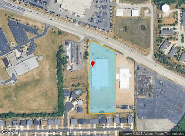
1215 W Lake St, Bartlett, IL 60103

NEARBY LISTINGS FOR SALE OR LEASE
Property Detail
1215 W Lake St
Commercialnec
Cook
X
Illinois
17031C0164J
3.82 AC
2023
Far Northwest
2024
Chicago
804513
Chicago-Naperville-Elgin, IL-IN-WI
15,438 SF
06-28-102-015-0000
DEMOGRAPHICS near 1215 W Lake St
1 Mile
3 Mile
5 Mile
2024 Total Population
8,388
76,837
214,830
2029 Population
8,056
74,405
209,838
Pop Growth 2024-2029
(3.96%)
(3.17%)
(2.32%)
Average Age
41
39
39
2024 Total Households
3,020
25,205
72,334
HH Growth 2024-2029
(4.37%)
(3.49%)
(2.57%)
Median Household Inc
$130,288
$90,355
$85,762
Avg Household Size
2.70
2.90
2.90
2024 Avg HH Vehicles
2.00
2.00
2.00
Median Home Value
$290,684
$255,104
$249,594
Median Year Built
1995
1983
1978
Nearby Places
Map Layers
Map Styles
 Street
 Aerial
- Restaurants
- Banks
- Shops
- Fitness
- Groceries
PUBLIC TRANSPORTATION
COMMUTER RAIL
Bartlett Station (Milwaukee District West Line - Northeast Illinois Regional Commuter Railroad (Metra))
DRIVE
WALK
Distance
Bartlett Station (Milwaukee District West Line - Northeast Illinois Regional Commuter Railroad (Metra))
6 min
2.6 mi
National Street Station (Milwaukee District West Line - Northeast Illinois Regional Commuter Railroad (Metra))
DRIVE
WALK
Distance
National Street Station (Milwaukee District West Line - Northeast Illinois Regional Commuter Railroad (Metra))
9 min
4.7 mi
AIRPORT
Chicago O'Hare International
DRIVE
WALK
Distance
Chicago O'Hare International
34 min
25.6 mi
Chicago Midway International
DRIVE
WALK
Distance
Chicago Midway International
49 min
34.7 mi
Freight Ports
Port Milwaukee
DRIVE
WALK
Distance
Port Milwaukee
112 min
81.8 mi
Nearby Properties
Address
Land Use
TOTAL SIZE
Lot Size
Zoning
Address
Land Use
TOTAL SIZE
Lot Size
Zoning
51,091 SF
3.52 AC
Address
Land Use
TOTAL SIZE
Lot Size
Zoning
421,722 SF
34.61 AC
Address
Land Use
TOTAL SIZE
Lot Size
Zoning
400,000 SF
31.67 AC
I
Address
Land Use
TOTAL SIZE
Lot Size
Zoning
328,208 SF
5.62 AC
Address
Land Use
TOTAL SIZE
Lot Size
Zoning
Address
Land Use
TOTAL SIZE
Lot Size
Zoning
300,000 SF
16.56 AC
I
Address
Land Use
TOTAL SIZE
Lot Size
Zoning
271,200 SF
14.23 AC
Address
Land Use
TOTAL SIZE
Lot Size
Zoning
272,606 SF
15.92 AC
I
Address
Land Use
TOTAL SIZE
Lot Size
Zoning
261,725 SF
15.88 AC
I
Address
Land Use
TOTAL SIZE
Lot Size
Zoning
30,000 SF
1.04 AC
Address
Land Use
TOTAL SIZE
Lot Size
Zoning
94,497 SF
9.43 AC
C
Address
Land Use
TOTAL SIZE
Lot Size
Zoning
207,000 SF
11.72 AC
Address
Land Use
TOTAL SIZE
Lot Size
Zoning
207,000 SF
11.80 AC
Address
Land Use
TOTAL SIZE
Lot Size
Zoning
209,628 SF
11.44 AC
Address
Land Use
TOTAL SIZE
Lot Size
Zoning
186,000 SF
10.50 AC
Address
Land Use
TOTAL SIZE
Lot Size
Zoning
11,132 SF
2 AC
Address
Land Use
TOTAL SIZE
Lot Size
Zoning
3,205 SF
2.35 AC
Address
Land Use
TOTAL SIZE
Lot Size
Zoning
167,449 SF
11.15 AC
Address
Land Use
TOTAL SIZE
Lot Size
Zoning
105,493 SF
16.26 AC
I
Address
Land Use
TOTAL SIZE
Lot Size
Zoning
123,484 SF
7.92 AC
Address
Land Use
TOTAL SIZE
Lot Size
Zoning
86,781 SF
8.80 AC
C
Address
Land Use
TOTAL SIZE
Lot Size
Zoning
154,730 SF
8.76 AC
Address
Land Use
TOTAL SIZE
Lot Size
Zoning
167,166 SF
12.85 AC
Address
Land Use
TOTAL SIZE
Lot Size
Zoning
401,250 SF
73.98 AC
Address
Land Use
TOTAL SIZE
Lot Size
Zoning
Address
Land Use
TOTAL SIZE
Lot Size
Zoning
6.47 AC
Address
Land Use
TOTAL SIZE
Lot Size
Zoning
423,726 SF
35.97 AC
Address
Land Use
TOTAL SIZE
Lot Size
Zoning
Address
Land Use
TOTAL SIZE
Lot Size
Zoning
436,500 SF
Address
Land Use
TOTAL SIZE
Lot Size
Zoning
9.39 AC
The World's #1 Commercial Real Estate Marketplace
Connect with us
© 2025 CoStar Group
The information above has been obtained from sources believed reliable. While we do not doubt its accuracy we have not verified it and make no guarantee, warranty or representation about it. It is your responsibility to independently confirm its accuracy and completeness. Any projections, opinions, assumptions, or estimates used are for example only and do not represent the current or future performance of the property. The value of this transaction to you depends on tax and other factors which should be evaluated by your tax, financial, and legal advisors. You and your advisors should conduct a careful, independent investigation of the property to determine to your satisfaction the suitability of the property for your needs.